


![]()
You are here
Alaudin lakes.
Tours to Alaudin lakes.
“When we leave, leave, fly away,
When we saddle our cars -
What empty paths will become here,
How lonely the peaks will be without us.
What empty paths will become here,
How lonely the peaks will be without us"
Yuri Vizbor. "Fan Mountains".
Photo tour to Alaudin lakes.
Video-film Alaudin lakes in Gissar Range.
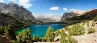
The flowing Alaudin lakes are located at an altitude of 2,782 meters above sea level, they are located in the Fany Mountains, in the northern part of the Kaznok valley, 1.4 kilometers south-west of the Vertical alpine camp, the Chapdara River flows out of the lakes in the Ayni district of the Sughd region.
The lakes are considered one of the most beautiful lakes in the Fany Mountains and belong to the basin of the Pasruddarya River. There are four Alaudin lakes in total: the Big one, which lies in the center of the water complex, then an elongated lake - Vostochnoye, which has an underground runoff, and two more small lakes.
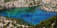
The lakes are always blue or blue. The depth of the lakes reaches 16 meters in depth, a five-kilometer underground stone filter reliably protects the purity of the lake. The hiking trail runs along the western shore of the Big Alaudin Lake.
Here, in the southwestern part, there is a green meadow, where it is convenient to put up tents. On the other side of the lake, a peninsula juts out into the lake with a curved stone hook. The Chapdara River flows out of the Big Alaudinsky Lake and further divides.
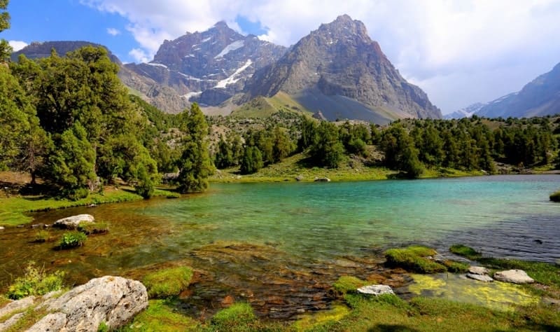
One branch flows into the Middle Alaudin Lake, the other disappears into the moraine heaps and appears over the Lower Alaudin Lake. There are no fish in the Alaudin lakes. The gorge of the Alaudin lakes is facing north, from the south they are surrounded by a snowy ridge, and all around are the highest peaks with many glaciers.
Several popular tourist routes pass through the Alaudin Lakes. From the western side, through the Laudan passes, 3630 meters above sea level and Alaudin, 3860 meters above sea level, trails from the Kulikalon lakes lead to the Alaudin lakes.
On the east side there is an interesting route from the Bodkhona canyon through the simple Chapdara pass, 3430 meters above sea level, and to the south, up the gorge, there is a path that ascends to Mutnye lakes.
From the Alaudin lakes, climbers begin their ascents to the Chapdar peaks, 5050 meters above sea level, the Castle 5070 meters above sea level, Energy, 5120 meters above sea level, Chimtarga, 5489 meters above sea level, etc.
There is another small ancient moraine overgrown with forest above the Big Alaudin Lake. Above it, the trail goes among rare juniper and grassy meadows, which were once the bottom of dried up lakes. The walls of the western spur of Chapdara rise above the right side of the gorge.
Geographic coordinates of Alaudin Lakes: N39 ° 14'12.79 "E68 ° 15'34.66"


Authority:
Books: "Fan Mountains", authors A.S. Mukhin, V.F. Gusev. "Nature of Tajikistan" publishing house "Mysl", 1982. Pavel Luknitsky. "Travels in the Pamirs", Young Guard, 1955. "Pamir", publishing house "Planeta" 1987, edited by Corresponding Member of the USSR Academy of Sciences M.S. Asimova.
"Stone miracle of Tajikistan", V.P. Novikov, RB Baratov, publishing house "Irfon", 1988.
www.skitalets.ru
Photos by
Alexander Petrov.