


![]()
You are here
Ancient settlement Ayakkamyr.
Tours on the ancient monuments of Ulytau.
"In the second half of the 2nd millennium BC, Central Kazakhstan became one of the important centers of metallurgy on the Eurasian continent."
A.Kh. Margulan.
Historical Monuments of Ulytau.
Ayakkamyr (Kutluk-Temira) Mausoleum is located at an altitude of 455 meters above sea level, in central part of ancient cemetery, 126 meters from right (western) bank of Zhezdy River, on southern side of Karabulak valley, 635 meters from mouth of Karabulak stream, 7.2 kilometers northwest of village of Zhezdy, 337 meters northeast of Ayakkamyr ancient settlement and 63.6 kilometers northwest of town of Zhezkazgan, 11.6 kilometers south and slightly west of village of Taldysay in Ulytau district of region of same name.
History of study of Ayakkamyr mausoleum.
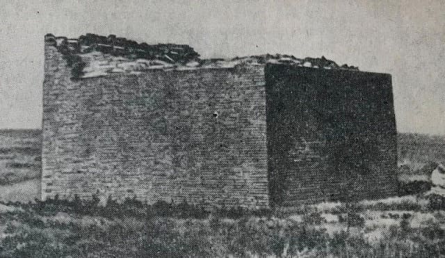
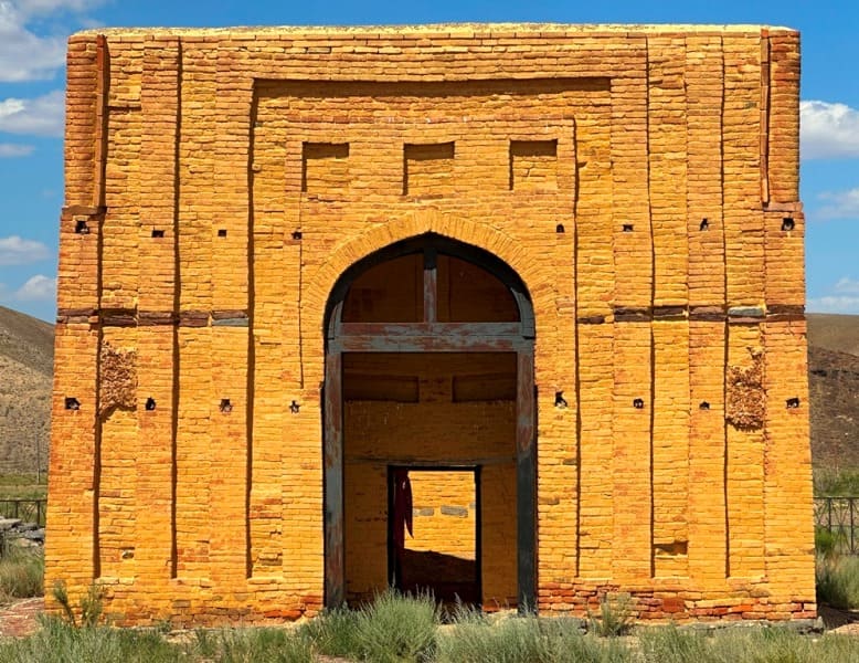
The mausoleum was first described in the mid-19th century by Ch. Ch. Valikhanov and academician A. I. Shrenk. According to this description, the mausoleum was presumably named after Khan Kamyr, but this name is unknown in history. The mausoleum was heavily damaged; by the end of the 20th century, only the entrance gate and four walls with half-erased crescent-shaped patterns remained.
Description of Ayakkamyr mausoleum.
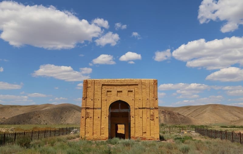
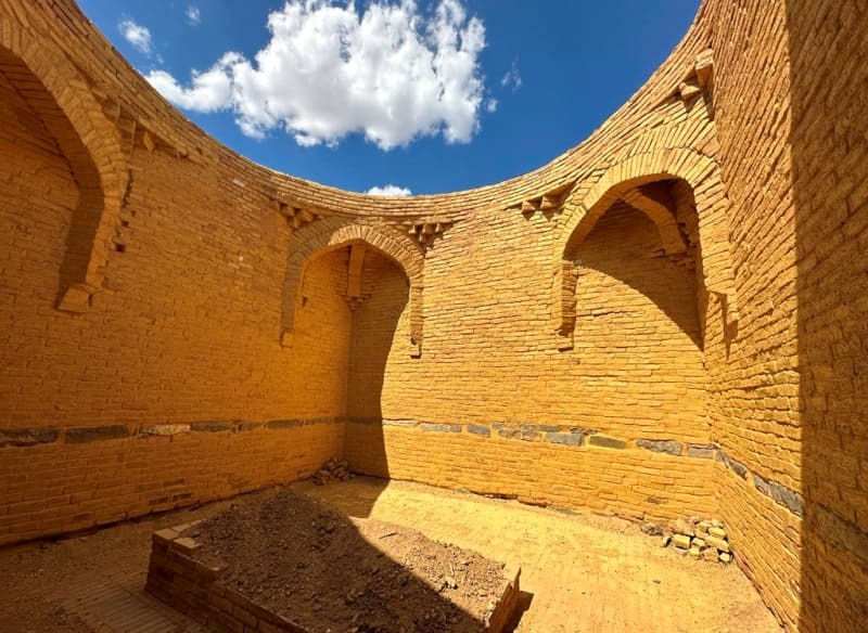
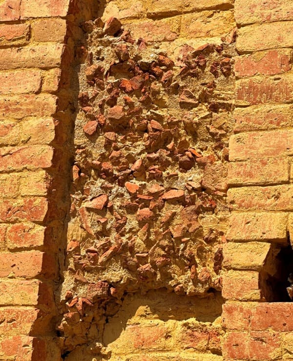
An architectural monument of the Oguz-Kipchak period (11th - 14th centuries). The monument is made of fired brick. According to A. Kh. Margulan, the mausoleum was built as a tomb for the Chingizid Kutlug-Temir. The mausoleum is square in shape, with sides 50 meters long, surrounded by an earthen rampart 1 meter high. The mausoleum is surrounded by a late medieval necropolis.
The mausoleum belongs to the portal-dome type of tomb structures. The overall size is 8.10 × 9.84 meters, the height of the stone foundation is 1 meter.
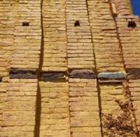
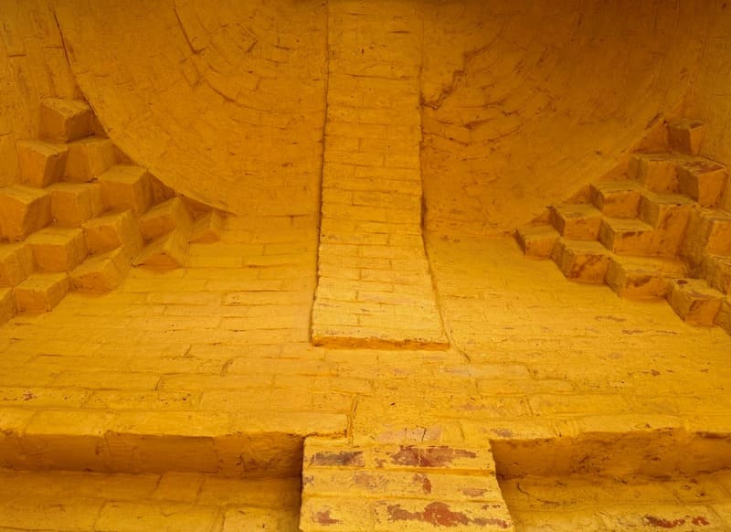
In the construction of the mausoleum, baked bricks measuring 26 × 26 × 5 cm and 28 × 28 × 5 cm were used.
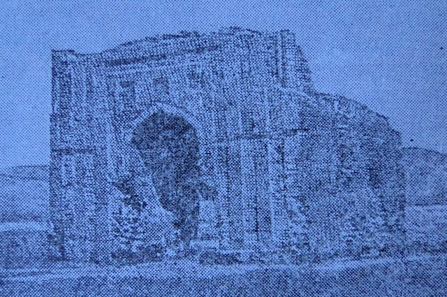
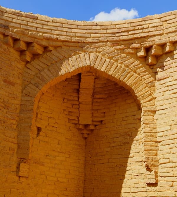
In the center of the main facade, processed as a monumental portal, there is a deep niche covered by a slender wedge-pointed arch, framed by a slightly recessed U-shaped strip.
Behind the arch there is a rectangular door measuring 1.9 × 1.15 meters. The facade of the mausoleum is decorated with slightly protruding columns and ornamentation typical of the style of that time. The side sections of the portal wall adjacent to the niche frame are vertically divided by blades and recessed strips intended for the installation of ornamented terracotta slabs, fragments of which were found in the rubble near the mausoleum
In 1982, the Ayakkhamyr mausoleum was included in the list of historical and cultural monuments of the Kazakh SSR of republican significance and taken under state protection.
Geographical coordinates of Ayakkhamyr mausoleum (Kutluk-Temira): N48°06'49 E66°59'22
Authority:
"Archaeological map of Kazakhstan." Alma-Ata, 1960. No. 937, table III, 16.21. Akishev K.A. "Antiquities of Northern Kazakhstan." "Monuments of archeology of Western Sarah Arches." "Medieval hillforts and settlements." Zhezkazgan, 1996.111 s.
https://ulytaureserve.kz/745-ajaamyr.html