You are here
Ancient settlement Kalaly gyr II.

Tours across antique ancient settlements of ancient Khorezm.
“The eighth section of this belt is made up of the nomads of the Goz-Turks, on the south-western side of it lies the Khorezm Lake, into which the Zhaikhun River flows. The circumference of this lake is three hundred miles; many more rivers flow there from the Goz land. Lake Argun lies on its northeastern side. Its circumference is four hundred miles; the water in it is fresh. To the west of this section is Mount Muzgar, which means Snow Mountain, because the snow does not melt there; it extends to the end of the department"
Ibn Khaldun.
Automobile routes of tours on Kunya-Urgench.
The ancient settlement Kalaly gyr II (Zhokhsakar) is located on the left bank of the ancient channel of Daudan, located in the northeastern part of the Karakum desert, 10.7 kilometers west of the ancient settlement Kalaly gyr I, 39.5 kilometers southwest of the Akdepe village, 75 kilometers south-west of the city of Dashoguz, 48.4 kilometers to the west and slightly south of the village of Gurbansoltan-Eje in the territory of the Gurbansoltan-Eje etrap of the Dashoguz velayat.
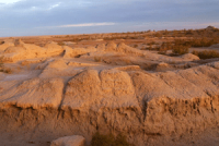
Kalaly gyr II, represents almost correct isosceles triangle (length of side walls of 195 m). With the arc-shaped basis going on edge of a height which from North side the rectangular entrance complex in the plan which is going down on a slope adjoins.
Fortifications remained on this the site to a mark 4,5 - 5 meters, in them - a shooting corridor. The most monumental construction in fortress - the so-called round temple with a diameter of 24 m built, as well as external fortification, on a two-meter artificial platform.
Walls of the temple had loopholes, from the North it is adjoined by a massive entrance tower, oval in the plan. This cult center was thrown after the total defeat of fortress which was followed by heavy fire which traces are noticeable not only on walls, but also on all archaeological stock.
The monument is dated the middle the IV beginning of the II and centuries BC.
Geographic coordinates of the ancient settlement Kalaly gyr II: N41 ° 48'12.65 "E59 ° 03'10.76"
Authority:
On materials of information department of the State committee of Turkmenistan on tourism and sport. "Religious and spiritual monuments to Central Asia". Author M. Hashimov. Saga publishing house, 2001.


