


![]()
You are here
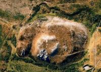
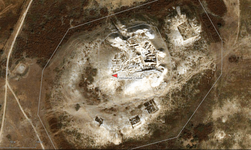
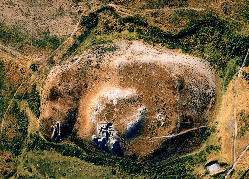
Ancient settlements of Sidak.
Tourist trip to Turkestan.
"World history is the sum of everything that could have been avoided"
Bertrand Russell.
Familiarization walks in Turkestan.
Ancient settlement of Sidak is located on the mound of same name, 224 m. a. s. l., on the right (eastern) side of Ashasai ravine, 3.3 kilometers south and slightly west of village of Kosmezgil, 18.4 kilometers north-west of city of Turkestan, 14.7 kilometers northeast of village of Nurtas, subordinate to city administration of Turkestan, Turkestan region.
The city was founded in the 1st century BC. e. in the form of a fortress (outpost) along the Great Silk Road and in the IV century BC. e., became one of the largest cities of the Kangyui state. The people of the Kangyui state professed the religion of Zorastrianism, because of this, the city became one of the largest religious centers in this region, where many temples were built in the VIII century.
During the Arab invasion, which took place in the second half (775-777), the city suffered a great fire and was abandoned by the population. The inhabitants of the city migrated to the settlement of Kosmezgil and to the foothills of Karatau.
The size of the town: north-west side 260 meters, north-east side 120 meters, west side 100 meters, east side 130 meters, south-west side 180 meters and south-east side 260 meters.
Citadel and a two-level hill with a square in the southern part. In addition, the rabad on the northern surface is separated by a deep ravine. The total area of the settlement with the Northern rabad is 7.7 hectares, the shahristan is 6.2 hectares, the citadel is 1.4 hectares.
The entrance to the citadel is removed from the southern surface. The research was carried out by the South Kazakhstan archaeological expedition (A.N.Bernshtam) in 1946 - 1951. Summing up the results of the study, A. N. Bernshtam noted that the city dates from the end of the Ist millennium BC. e. before the beginning of the 1st millennium BC.
In 1966 the city was surveyed by the Khorezm expedition led by S.P. Tolstov and dated it to the Ist - Vth centuries. On the "map of archeology of Kazakhstan" in 1960, the settlement was called "Sadyk ata" and was dated by the interval of the Ist - IXth centuries.
The Turkestan archaeological expedition (E. Smagulov, M. Tuyakbaev, A. Zhigitova) in the period from 2002 to 2004 resumed research and convincingly proved the existence of the city between the I-VIII centuries.
Geographic coordinates of settlement of Sidak: N43°21'41 E68°02'59
Authority:
http://azretsultan.kz/rus/gorodishhe-sidak-ata-i-viii-vv/