You are here
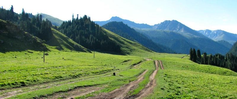
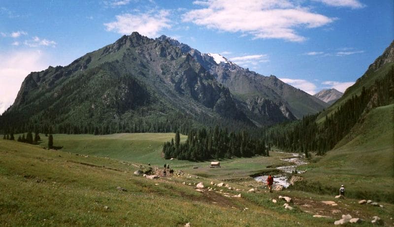
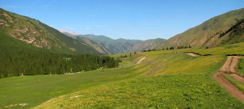
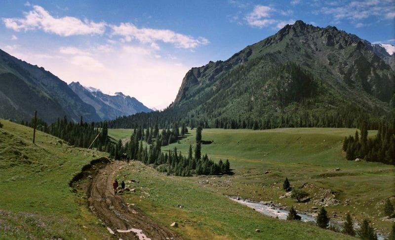
Bayankol gorge.
Horse-riding tourism in Kazakhstan.
“Nature does nothing in vain”
Aristotle.
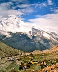
Bayankol gorge is located on the northern slope of the Sarydzhaz ridge, on the eastern slopes of the Terskey Alatau ridge and the western slopes of the Meridional ridge in the Narynkol district of the Almaty region.
The general geographical position of the Bayankol gorge covers the northern slope of the Central Tien Shan mountains. Almost the entire southeastern appendicitis of the territory of the Republic of Kazakhstan, which is located on the northern slope of the Terskey Alatau ridge from the peak of Ashutor Novy with a height of 4427.6 meters above sea level, deepens to the south and southeast, approximately to the peak Bayankol at a height of 5761 meters above sea level by 33 kilometers.
The sources of the Banyakol River begin from the northern slopes of the Sarydzhaz ridge, which is located on the territory of the Republic of Kazakhstan for 12 kilometers from east to west (distance from Semenov peak, 5816 meters above sea level, to Plato peak, 6146 meters above sea level).
The eastern sources of the Bayankol River are located on the northeastern slopes of the Katta-Ashutor ridge. The western sources of the river are located on the western and northwestern slopes of the Meridional Ridge.
The length of the gorge from the northern tongue of the Bayankol Central glacier to the southern end of the village of Karatogan is 49 kilometers. From the village of Karatogan, the gorge spreads to the south, then at the mouth of the Akkol River turns to the southeast and thus reaches the upper reaches of the river of the same name.
In the upper reaches, the Sarykoinou River receives power from the Central, Eastern and Western Bayankol glaciers. In the upper reaches, the Karasai River, which is a left tributary of the Sarykoinou River, receives water from the Karasai and Ashutor glaciers located on the northern slopes of the Katta-Ashutor ridge.
The Sauruksay River, is the right tributary of the Keskentasa River in its upper reaches, it receives power from the powerful Saurksay glacier lying on the western slope of the Meridional Range. The sources of the Ashutor River receive water from two branches of the glacier tongues - Ashutor West and Ashutor Vostochny.
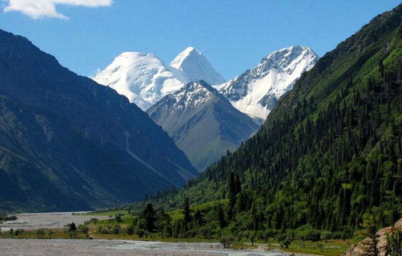
In the upper reaches of the Bayankol gorge, there are many peaks that exceed heights of more than 5000 meters above sea level: Kazakhstan peak 5761 meters above sea level, Bayankol peak 5791 meters above sea level, Semenov peak 5816 meters above sea level.
Peaks more than 6,000 meters above sea level: Peak Plateau, 6146 meters above sea level, Peak Marble Wall, 6,140 meters above sea level, peak of the 100th anniversary of the Russian Geographical Society, 6276 meters above sea level, Shater Vostochny peak, 6637 meters above sea level, Zapadny peak, 6,511 meters above sea level, Saladin peak, 6201 meters above sea level, Khan Tengri peak, 6995.2 meters above sea level, Petka peak, 6,120 meters above sea level, Chapaev peak, 6371 meters above sea level.
The Bayankol River has five left large tributaries: Bugunisay, Izbushka, Akkol, Chugunsay, Charynbai. The right nine tributaries of the Bayankol River: Bodobeksay, Asylbek, Bayteli, Shirokiy, Tungushpay, Baymensay, Aktas, Akbulak, Narynkol.
In the upper reaches of the Akkol River, there are two moraine flowing lakes: Lake Akkol, located at an altitude of 3069 meters above sea level, and a moraine lake under the northern end of the Akkol glacier, located at an altitude of 3568 meters above sea level.
There are three lakes in the upper reaches of the Izbushka River: Lake Zapadnoye Izbushka, located at an altitude of 3583 meters above sea level, Lake Izbushka Vostochnoye, 3556 meters above sea level, and Lake Nizhnee Izbushka, 3446 meters above sea level.
In the upper reaches of the Alaaygyr River, the right tributary of the Bayankol River, there is a moraine lake of the same name at an altitude of 3681 meters above sea level. In the upper reaches of the Narynkol River, which is the right tributary of Bayankol, there are five large and small moraine lakes, two of them are large: the Upper Narynkol lake located at an altitude of 3548 meters above sea level and the Lower Narynkol lake located at an altitude of 3412 meters above sea level.
In the Zharkulak tract at the mouth of the Karasai River, on the right bank of the Keskentas River, at an altitude of 2901 meters above sea level, there is a mothballed mine where gold was previously mined. In the vicinity of the Keskentas tract on the northern slope of the small ridge Sauruksay there is an ancient talus that reached the channel of the Keskentas river.
The water found its way among the stones from the mark of 2687 meters above sea level, the river goes into the underground labyrinths of the moraine and only after 100 meters it appears on the surface. Further, the surface water of the river flows among huge stones, and the bulk of the water is in underground streams.
After 550 meters, the waters of the river at the mouth of the Alaigyr River break out to the surface. In the Bayankol gorge, at an altitude of 2857 meters above sea level, on the right side of the Keskentas river, the last spruces grow in a small island, higher up the gorge, trees are no longer found.
Starting from the mouth of the Bayateli River, the left tributary of the Bayankol, the gorge widens and the river flows through a wide, gentle and very picturesque valley. In the area of the confluence of Bayankol with the Ashutor river and in the Keskentas tract, in good weather, you can observe the Khan-Tengri peak rising in the Meridional ridge.
The Bayankol frontier post is located 400 meters southwest of the mouth of the Akkol River. Below the outpost, the gorge widens even more and smoothly passes into the Tekes River valley. There is a hunting farm in the Bayankol gorge at the mouth of the Ashutor river.
Starting from the Bayankol outpost, three bridges have been built across the Bayankol River. The road, 30 kilometers long, starts from the border outpost, crosses the Bayankol River three times and ends at the Zharkulak mine.
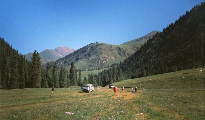
1.4 kilometers south of the border outpost, at the beginning of the Akkol gorge, on the left side of the river, at an altitude of 2295 meters above sea level, there is a camp site. There are numerous agricultural farms in the Bayankol gorge and in its side gorges, with dirt roads leading to them.
Due to the proximity of the state border to visit the Bayankol gorge, it is necessary to issue a border pass. The fauna of the gorge is represented by a wide variety of wild animals, among the ungulates you can see: red deer (maral), Tien Shan argali, Siberian ibex, Siberian roe deer (local name spruce), wild boar.
Predators in the gorge are represented by: snow leopards, Tien Shan bear, wolves, lynx, foxes. There is a badger in the gorge. In the upper part of the gorge, in the alpine zone, you can meet a snowcock. The flora of the gorge is represented by: Shrenk spruce, willow, juniper grows along the slopes of the gorge, along the barberry river. In the alpine meadows you can find: sushitseriya susseriya, chamomile, edelweiss, sickle gentian.
Geographic coordinates of Bayankol gorge: N42 ° 33'40.32 "E80 ° 04'23.04"
Authority:
Alexander Petrov.
Photos by
Sergei Mikhalkov, Almaty city.


