


![]()
You are here
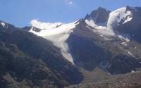
Bogdanovich Glacier.

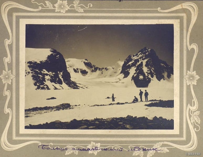
Walk to glaciers in Small Almaty gorge.
"Golden rays rush down from a height,
Filling your ridges with radiance, Alatau,
Age-old glaciers bathe in sunlight
You smile joyfully at the blue skies..."
Saken Seifullin. "In the mountains of the Kyrgyz Alatau". November, 1936.
Trip to Bogdanovich Glacier.
Bogdanovich glacier is located at the junction of the Maloalmatinsky and Komsomolsky spurs, on the northern slope of the Zaili Altau ridge, to the south of the Big Talgar Pass at a height of 3163 meters above sea level in the Medeusky district of Almaty.
The beginning of the glacier is located on the western slope of the Komsomol pass 4000 meters above sea level, located in the eastern branch of the Maloalmatinsky spur between the Komsomol peaks 4376 meters above sea level and the Karlytau peak 4170 meters above sea level.
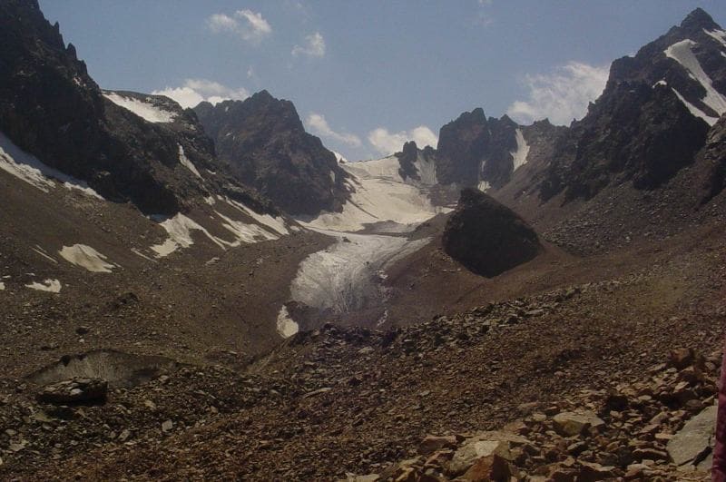
The tongue of the glacier is located at an altitude of 3374 meters above sea level. he Bogdanovich glacier belongs to the valley type and has a length of the open part of 2.7 kilometers. The glacier occupies the northern exposure of the ridge connecting the peaks of Amangeldy in the west and Karlytau in the east.
The glacier consists of three branches. The main one starts from the northern and northwestern slopes of the ice domed Karlytau peak and from the western slopes of the Komsomol peak. In this chamber of the glacier there are passes: Komsomol (2A) 4000 meters above sea level, Panfilov Heroes 3950 meters above sea level, Uchitel 4045 meters above sea level.
The left, Western branch of the glacier flows out from the northeastern slopes of the Amangeldy peak at a height of 4000 meters above sea level from the northwestern slopes of Yoshkar Ola peak at a height of 3950 meters above sea level and closes with the Pioneer Pass (1B) at a height of 3840 meters above sea level.
On the glacier, only its middle branch has many transverse cracks. Right, the Eastern branch of the Bogdanovich glacier, 950 meters long, flows down from the northern slopes of the Komsomol peak and at an altitude of 3737 meters above sea level, it connects with the main branch of the Bogdanovich glacier.
In the middle part of the course, both branches of the glacier join and give the source of the Sauruksay stream, 3.9 kilometers long, which is the left tributary of the Left Talgar River. The glacier was named by glaciologist S.E. Dmitriev in 1911, in honor of the Polish-Russian professor-geologist Karl Ivanovich Bogdanovich (1864 - 1947), the researcher of the Vernensky earthquake of 1910.
After the Verny earthquake of 1910 (according to the new style - in 1911), Bogdanovich came to Verny to conduct research. The result of his stay here was the work that contributed to seismology and outlined the tectonic scheme of this region. Also, together with I. Kark and D. Mushketov, in 1910 he compiled the “Plan of the City of Verny”.
Geographical coordinates of Bogdanovich Glacier: N43°05'14.57" E77°06'24.76"

Authority:
Alexander Petrov.
Defeated Peaks. 1949 M.E. Grudzinsky. "Zailiysky Alatau". Books "Nature of the Zailiysky Alatau", M.Zh. Zhandaev, ed. Kazakhstan, Alma-Ata.
Photos by
Alexander Petrov.