You are here
Bukhtarma research.


Buchtarma River Journey.
"July 15. I spent the morning instrumental shooting ... This shooting I connected the sources of Kanas, Alakha, Ukok and Bukhtarma and determined the elevation of the peaks of this part of the ridge, which turned out to be from 3300 to 3600 meters. The main snowy peaks at the head of Bukhtarma were obscured by the advanced mountains, and their height was uncertain. I could not be near the glaciers themselves, therefore, only their position and approximately the total extent were determined. In any case, there is still much material left for a detailed study of glaciers”
V. Sapozhnikov. 1905.
Bukhtarma River Hike.
The birth of a river is always a mystery. Especially such as Bukhtarma. This is a mighty mountain river, sometimes pacified, and gently carrying its brightened waters in September-October, then turbulent and muddy, crowded to the brim in April-May (and sometimes in June, and even in autumn, drunk with heavy rain), milky white in August, when glaciers melt violently in the upper reaches.
Its origins are hidden behind distant lands, near the borders with Mongolia and China. This is a river that was previously mastered by Russian migrants, long before the scientists gave their names mixed with the former Kalmyk (Dzungarian).
The first researcher to visit Bukhtarm was the doctor and mine surveyor of the Kolyvano-Voskresensky plants Peter Shangin. Twice in 1786 and 1796, with a detachment crossing the Kholzunsky ridge, he went to the Bukhtarma valley and mapped all its main tributaries, mainly according to interrogative information.
To the village of Fykalka and to Bukhtarma at the level of Chingistaya in 1826, the botanist K. Ledebur passed. Barnaul doctor, who became a scientific geographer, F. Gebler in 1833 - 1835 visited the sources of Katun and Berel.
But much earlier, the local population knew about all these rivers, including Russian fugitive masons who settled along gorges along Bukhtarma. The first scientifically reliable information about Bukhtarma itself and its origins was given by an officer of the General Staff of Russia, topographer Miroshnichenko and mining engineer Malevsky.
In 1869, they accompanied the border commission led by P. Babkov, conducting reconnaissance of the border with China under the Chuguchak Treaty. In May - June, the commission passed along the Bukhtarma valley, gradually rising to the upper reaches.
Along the way, they determined the coordinates and heights of geodetic points, gave a geographical and geological description of the area. At the same time, they plotted the position of Bukhtarma and its tributaries on a schematic map.
The last settlement on their way was the village of Chernovaya, founded by immigrants - peasants of the Perm province in 1866. Next stretched a deserted area, although it kept the traces of the long stay of people. The Kazakhs of the Samai and Karatai tribes roaming here went to summer pastures in the upper Berel.
Travelers themselves moved along the horse trail, laid here since ancient times by trade caravans, and loudly called the Ukok tract. Throughout the valley, mounds of old mounds blackened by time were visible. As travelers were convinced, in the tract of Chindagatuy, Bukhtarma was formed from the confluence of three tributaries: the northernmost, flowing through Lake Black, which local Russian residents called Bukhtarminsky, the Chindagatuy river and Bukhtarma itself, called Belaya Bukhtarma here.
From Chindagatuy, the road along the right bank of Belaya Bukhtarma steeply went up. The left bank was covered with larch-cedar forest, which stretched for about 8 kilometers, after which the travelers entered a strip of stone marshes, which made it extremely difficult to advance heavily loaded horses.
The forest ended, giving way to alpine vegetation. A vast plateau stretched before them, cut by streams with blocks of still un-melted snow along the logs. According to the measurement of Miroshnichenko, the height of the plateau turned out to be equal to 2200 meters.
Behind the Ukok, a whole group of snow-capped peaks rose, called Mongolian Tabyn-Bogdo-Ola, with heights clearly above 4000 meters. Right from the road, right along the course were visible silver ribbons of streams and white spots of glaciers giving rise to Bukhtarma.
Horns of argali lay everywhere, huge fragments of granite-syenite rocks sticking out here and there. Travelers spent a whole week here from May 30 to June 6, and every night the temperature fell below zero, it was snowing, it would melt by noon. The only fuel was dwarf birch and argal growing here (dry manure).
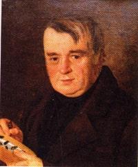
The next researcher to visit the upper reaches of Bukhtarma was the then famous traveler and scientist, professor of Tomsk University V.V. Sapozhnikov, who studied the glaciers of Altai from 1895 to 1909. In the summer of 1905, Sapozhnikov, accompanied by three of his companions - students, went from Kosh-Agach (in Russian Altai) to the south with the goal of exploring the glaciers of the Mongolian Altai near the Russian border.
He was interested in the Tabyn-Bogdo-Ola mountain node in the Ukok plateau, where the main ranges of Altai meet (the borders of the states also converge here: Russia, China, Mongolia, and now Kazakhstan). Having examined the sources of the rivers Kalguta, Alakha, and Kanas, on the way to Uryl he observed glaciers in the upper reaches of Bukhtarma, subsequently writing in the book “Mongolian Altai at the Source of Irtysh and Kobdo”:
"July 15. I spent the morning instrumental shooting ... This shooting I connected the sources of Kanas, Alakha, Ukok and Bukhtarma and determined the elevation of the peaks of this part of the ridge, which turned out to be from 3300 to 3600 meters.
The main snowy peaks at the head of Bukhtarma were obscured by the advanced mountains, and their height was uncertain. I could not be near the glaciers themselves, therefore, only their position and approximately the total extent were determined. In any case, there is still much material left for a detailed study of glaciers”
In the evening of the same day he continued the description: “... It is interesting to note that the peak dividing Alahu and Ukok (rivers on the Ukok plateau - A.L.) is very similar to the other dividing Ukok and Bukhtarma.
Both peaks have at the top a wide depression in the form of a hollow or, rather, a trench filled with snow, which forms here and here along a small glacier. ... in the morning I could have a good look at the glaciers at the head of Bukhtarma. Two glaciers lie in the deepening of the ridge, one next to the other.
A large glacier, curved like the letter S, lies on the east side. It starts from the rear snowy peak and goes around the rocky barrier with its upper course, giving rise to the second smaller glacier.” Here, Sapozhnikov observed a rather significant earthquake, the shocks of which were felt throughout the valley of the upper Bukhtarma.
Going down to the valley of Bukhtarma, he visited the Rakhmanovskiye Klyuchi, and then from the village of Sogorny he rafted on the raft, along Bukhtarma, and then sailed along the Irtysh to the Shulba village. Sapozhnikov reconnoitered the Bukhtarma glaciers, finding out that they are located, although close to Tabyn-Bogdo-Ola, but not in this mountain junction itself, but in the eastern part of the Southern Altai ridge, called the Agayryk mountains.
The next significant explorers of the Altai glaciers were brothers Mikhail and Boris Tronov. Like Sapozhnikov, they were indefatigable and courageous walkers along mountain trails and not only made instrumental and other scientific observations, but also made difficult ascents, having first conquered Belukha, and ascended to the main peak of the Tabyn-Bogdo-Ola group, Kyytyn peak (Cold ) higher than Belukha.
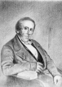
The brothers became scientists and travelers not by chance. Their father, Vladimir Dmitrievich, a doctor by training, was a passionate local historian who traveled a lot in Altai. He also visited the origins of Bukhtarma, moreover, in the same years as Sapozhnikov (1895, 1896), and was twice awarded silver medals of the Russian Geographical Society for researching the glaciers of the Southern Altai and the description of the Rakhmanov keys.
We can say that the study of Altai glaciers for the Tronov brothers has become their family tradition. In 1915, examining the glaciers of Central Altai, they could not pass by the Bukhtarma glaciers. On June 28, specially, in order to examine firn fields as best as possible and to make bussolny notches, they climbed a 3650-meter-high peak opposite it, calling it Krugozornaya.
From here the sources of Bukhtarma were in full view of them. The weather was favorable, and only mosquitoes annoyed even on the glacier, which was surprising, because they were in the zone of eternal snows. The next day they passed through the entire glacier, and then climbed to the summit ridge of the Agayryk ridge, from where the glacier flowed.
It was found that Belaya Bukhtarma begins from two glaciers, one of which is 3 km long, the other 1 km, and the nearest left tributary Akulgen flows from a group of completely insignificant glaciers. They themselves describe their tour of the glacier:
“The day of June 29 was devoted to two excursions - to the Bukhtarma glacier and to the Krugozornaya mountain glacier. Having reached the ledge in the middle of the general Bukhtarminsky circus by moraines, we have Bolshoi and Maly Bukhtarminsky glaciers on both sides, which, as it turned out, are currently not connected.
The large glacier begins with two main streams and carries a mild moraine. The left moraine, which used to be the middle one, stretches from our point and, connecting with the terminal moraine, forms long longitudinal shafts that hide significant masses of ice. This dying part of the glacier stretches for four versts...
The left Bukhtarminsky glacier is insignificant and, apparently, is on the way to extinction. The stream from it flows first between the shafts, and then goes under the moraines. Bukhtarma flows out in two completely muddy streams and, half a mile from the glacier, also takes on the right a muddy key from the glacier of Mount Krugozornaya.
This last one starts from the snows near the very top and falls into the gorge formed by the ridge mentioned above with steep ice walls. The height of the end of the glacier is 2850 m. Below is a pile of moraines (rock-clastic material carried by the glacier - A.L.). ”
Like Belaya Berel, Bukhtarma endures white turbidity, a product of rock destruction and is therefore called Bukhtarma. In the moraines of the Bukhtarma glacier, the Tronovs found a lead shine (galena - ore per lead), and at the peak of Krugozornaya - a copper green, but in very small quantities.
Having marked with a heap of stones the lower end of the glacier, the scientists on this completed their work at the head of Bukhtarma and continued their route along the glaciers of the Mongolian Altai.
Authority:
Naturalist writer, photo artist, local historian Alexander Lukhtanov.


