


![]()
You are here
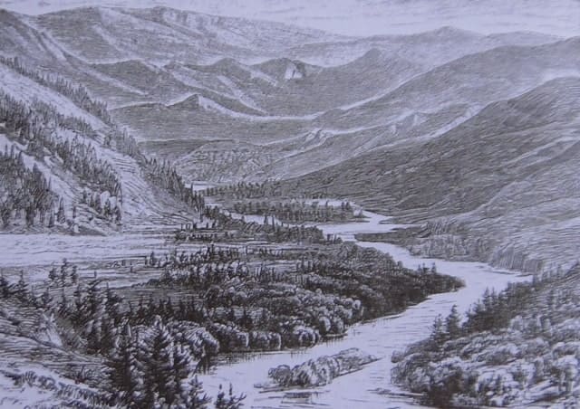
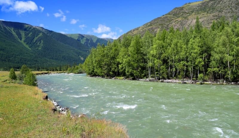
Bukhtarma river.

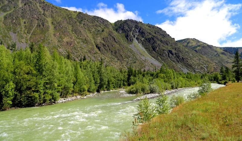
Rafting on Bukhtarma river.
The Bukhtarma River is a right tributary of the Irtysh River. It is formed by three sources: the left tributary flows from the southwest, originating on the Chinese border from a snowy ridge. The other two flow from the northwest, beginning on the Argutsky Ridge. One of these tributaries is called Chindagatuya. In the second part of its course, the Bukhtarma flows along a longitudinal valley, ranging from one and a half to five miles wide, between the parallel ridges of the Altai mountain system. This valley has a majestic mountain character and is distinguished by its rich vegetation. The mountain slopes are covered with magnificent forests, dominated by larch; in places, the forests descend to the foothills, which are a continuous meadow with the richest and most diverse flora. Its climate is incomparably warmer than one might expect from its geographical location, so that grain fields reach an altitude of over a thousand meters. Uryl settlement."
"Picturesque Russia." 1884. (Volume XI "Western Siberia"). L.K. Poltoratskaya, "Southern Slopes of Altai and Tarbagatai Region."
Water tourism on rivers of Katon-Karagay district.
Bukhtarma River is located at an altitude of 390.5 m (its mouth at confluence with northern part of Bukhtarma Reservoir) to 3297 m (its source on the southeastern slope of Southern Altai Range) m. a. s. l., it flows through Katon-Karagay and Altai districts of East Kazakhstan region.
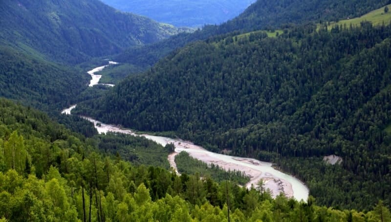
Bukhtarma is one of the largest rivers in the Altai, a tributary of the Irtysh. Originating on the southeastern slope of the Southern Altai Range, it rolls noisily and triumphantly through rocky gorges, past wooded banks, until it emerges into a wide valley.
This ancient river is used for rafting timber, and is a popular leisure activity for boaters. The Bukhtarma River is nominally a right tributary of the Irtysh, as it flows into the Bukhtarma Reservoir through which the Irtysh River flows. The Bukhtarma is 364 kilometers long, with a drainage area of 12,660 square kilometers.
Its main tributaries are the Belaya Berel, Sarymsakty, Turgusun, and others. The terrain adjacent to the river valley is mountainous. The valley is 5-6 kilometers wide (0.3-0.4 kilometers at narrow points). Its water supply is mixed: 50-55% snow, 25-35% rain, and 15% groundwater.
The average annual water flow is 207 m3/s. The Bukhtarma basin is prone to mudflows. The lower reaches of the river are home to energy industry facilities, and the river and its tributaries are used for irrigation and water supply to populated areas.
Near Lake Rakhmanovskoye are the Rakhmanovskie Klyuchi mineral springs, where a sanatorium has been built in the Bukhtarma basin. The river is accessible to small boats. Monuments to Civil War heroes have been erected in settlements along the banks of the Bukhtarma: Altay (formerly Zyryanovsk), Katon-Karagay, Uryl, and several others.
One of the Bukhtarma's main tributaries, the Belaya Berel River, originates from the Berel Glacier, located on the southern slopes of the Katunsky Range. The highest point in its basin is at an altitude of 4,506 m above sea level, with the mouth of the Bukhtarma River located 4 km below. Initially, the Bukhtarma flows westward, but the spurs of the Tarbagatai Range force it to take a sharp northward turn.
Confined by cliffs, the river thunders over the rocks, forming numerous cascades, whirlpools, and rapids. After the confluence of its right tributary, the Berel, the Bukhtarma flows south, and from the village of Uryl, southwestward. The Bukhtarma flows through a widening mountain basin.
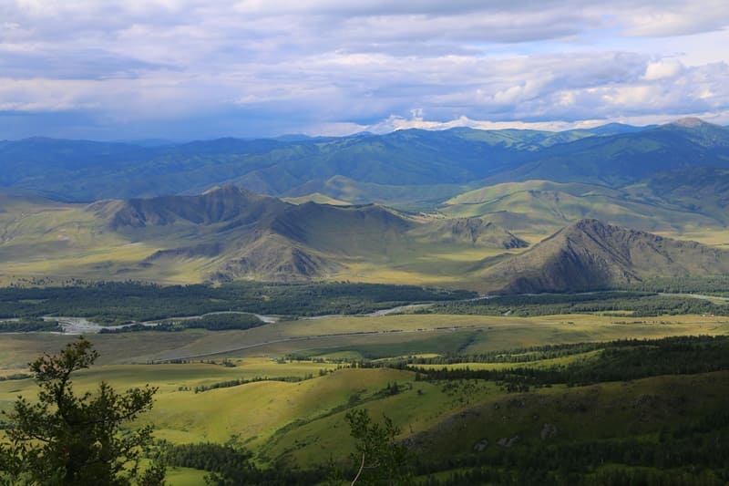
Gentle ridges rise on all sides, covered with dense deciduous and coniferous forests, beyond which low snow-capped peaks can be seen. Here, the river flows through the Bukhtarma Depression - an intermontane depression between the ridges of the Southern Altai (to the south) and the mountain ranges of the right bank (to the north and east).
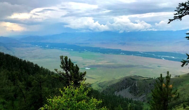
The valley of the depression is approximately 120 km long. It consists of a system of small basins (Katon-Karagayskaya, Urylskaya) with steppe and meadow vegetation and the mountain passes separating them, covered with deciduous and pine forests.
After the confluence of the Chernovaya and Kilmes rivers (the upper reaches of the latter are known as the Sarymsakty), the Bukhtarma turns northwest, receiving the Belaya tributary and several others along the way from the right. Here, the Bukhtarma is a typical mountain river, rushing with a deafening roar and speed of 2-3 m/sec through a narrow gorge littered with boulders and overgrown with forest, forming an almost continuous cascade of rapids that are inaccessible to passage.
Only as the valley widens does the river become a calmer and clearer ribbon up to 30-The 70-meter river meanders between the approaching slopes. After Kilmes, the terrain takes on a steppe character. From the confluence of the Khamir River (on the right side), the Bukhtarma turns southwest and near the village.
The Turgusun River is a right tributary of the Bukhtarma, 4.9 kilometers before its confluence with the Bukhtarma Reservoir. Extreme caution is required in the upper reaches of the river. Particularly dangerous here are the narrow, winding channels, which in places are completely or almost completely blocked by fallen trees.
Geographical coordinates of Bukhtarma River: N49°15'06 E85°21'28
Geographical coordinates of Bukhtarma River's source: N49°08'27 E87°12'19
Geographical coordinates of Bukhtarma River's mouth: N49°45'11 E83°59'24
Authority:
The book "Geography of East Kazakhstan", 2005. Ust-Kamenogorsk.
Photos by:
Alexander Petrov.