


![]()
You are here
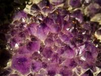
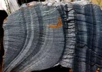
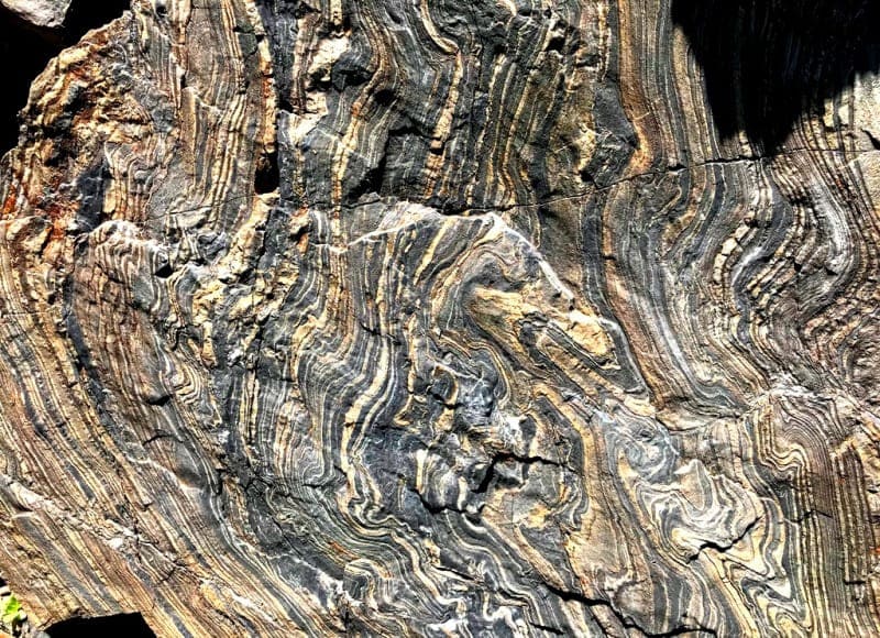
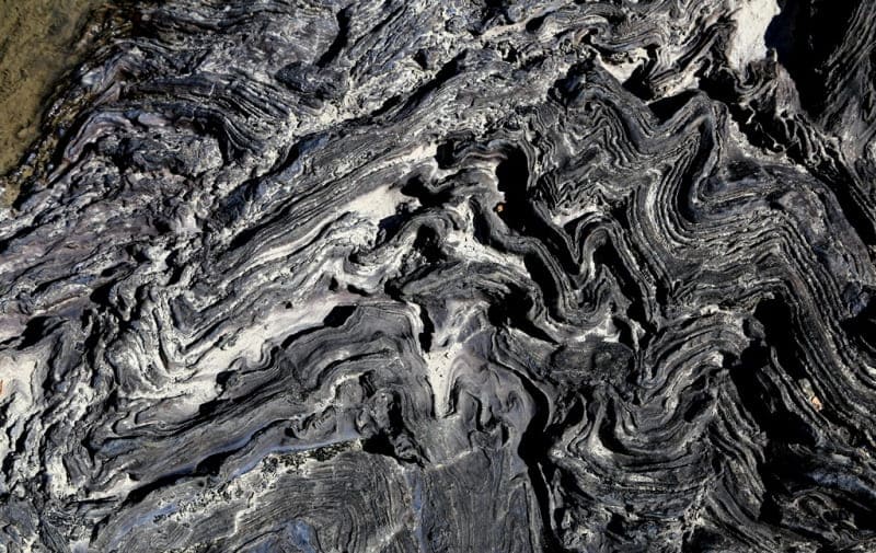
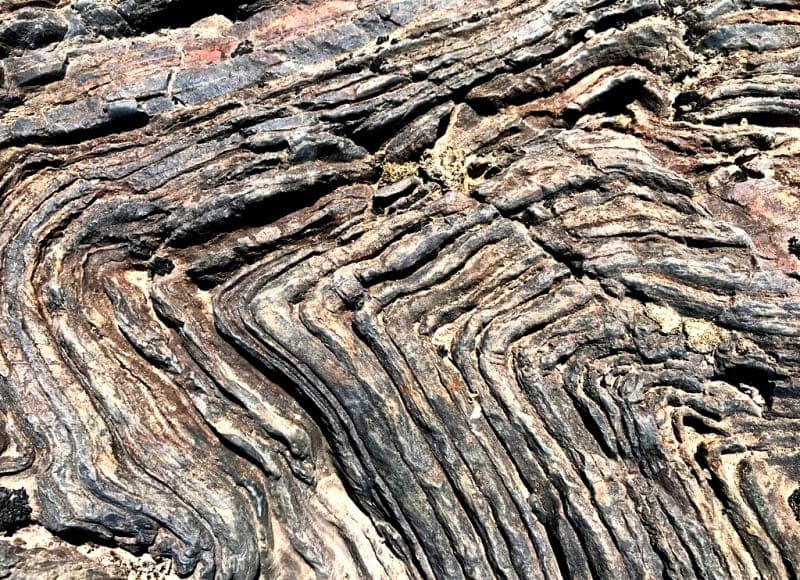
Geology of Dzhungar Alatau.
Tectonics of Kazakhstan.
“Nature does not age; instead of faded works, it gives birth to new ones.”
Nikolai Chernyshevsky.
Rafting on rivers of the Dzhungar Alatau.
In structural and tectonic terms, the Dzungarian (Zhetysu) Alatau is a complex folded and blocky structure, formed during a long history of geological development. Tectonic movements were mainly of a plicative nature, but disjunctive faults are widespread here.
The largest structural line here is the regional Zhongar fault. Recent movements mainly developed along the strike of ancient structures with the formation of folds and brachyfolds of the base. According to the peculiarities of the geological structure, the territory belongs to areas of intense manifestation of folds and faults.
The structures consist of a series of alternating anticlinor and synclinor structures, delimited by tectonic fault zones. All of them have a latitudinal or similar strike, and each of them is internally complicated by folds of the second and third order and small tectonic faults.
Zhetysu Alatau is composed mainly of rocks of Precambrian and Paleozoic age (gneisses, crystalline schists, quartzites, marbles, limestones). In the interfluves, granites come to the surface. Predominant development is used by Paleozoic volcanic and sedimentary complexes, represented by marine terrigenous and continental effusive-sedimentary and sedimentary rocks, which are crushed into fold systems, dissected by faults and crushed by numerous cracks and in many places broken through by intrusions.
Meso-Cenozoic deposits have a limited distribution and are found in intermountain depressions and foothills, represented by a sequence of Paleogene, Neogene and Quaternary sediments. The oldest geological formations on the territory of the Zhetysu Range are Precambrian intrusive formations, which compose large massifs of complex shape, and are represented by porphyritic granites, gneiss granites, and granosyenites.
Small gabbro bodies and gabbrodiabases belong to the same age level. In the upper reaches of the Kishi and Ulken Baskan rivers there is a massif composed of the Baskan complex of gneissed granites. Several smaller massifs are located in the Zheldykaragai ridge and along the Terekty River.
The granites of the Bascan massif occur among quartzites, phyllitic schists and carbonate rocks and are represented mainly by large and coarse-grained varieties, passing to fine and medium-grained in the marginal facies.
The Upper Silurian is represented by green and red sandy-clayey and gray sandstones with interlayers of limestone. Devonian deposits are distributed throughout the territory. In the upper reaches of the Lepsi River, Devonian deposits are represented by sandstones and calcareous siltstones.
The Middle Devonian is represented by sandstones and shales of the northern main ridge, and limestones in the eastern part of the ridge. Upper Devonian deposits are developed in the western part of the territory, in the Zheldykaragai mountains, and are represented by conglomerates, sandstones with interlayers of limestone, siltstone, etc.
Lower Carboniferous deposits are developed in the Tastau Mountains and are represented by effusive sedimentary rocks: conglomerates, sandstones, gravelites. In the upper reaches of the Ulken and Kishi Baskan rivers, volcanomictic sandstones, siltstones, and limestones of the Aksu formation with plant remains are common.
In the watershed part of the Zhetysu Alatau, the Lower Carboniferous layers are represented by black mudstones, siltstones with interlayers and packs of gravelstones. In the upper reaches of the river. Aksu is dominated by calcareous and polymictic sandstones.
The foothills and intermountain depressions are composed of strata of Paleogene, Neogene and Quaternary sediments - clays, sandstones, conglomerates. Neogene deposits are common in all foothill and intermountain depressions and are represented by reddish-brown or brown, often sandy clays.
In the depressions they lie on Paleogene and Cretaceous deposits, in the foothills - directly on the Paleozoic. Toward the foothills, the clays are replaced by brown, rhythmically repeating packs of conglomerates, sands, and clays.
Quaternary deposits within the territory vary in age, genesis and lithological composition. Within the mountainous part, they are represented mainly by moraine and fluvioglacial deposits - boulders and pebbles and pebbles, 40 - 60 meters thick, alternating with boulders and pebbles with sandy and clayey filler, lenses of sands and sandy loams, overlain by loess-like loams.
At the foot of the mountains, as well as at a short distance from them, fluvioglacial deposits give way to proluvial deposits, which are represented by boulders and pebbles with overlying loess-like loams, giving way to proluvial and alluvial and proluvial pebbles and gravel and sand accumulations.
In the mountains and foothills, alluvial and proluvial deposits make up alluvial fans and foothill trails, composed of gravel and pebble of varying degrees of roundness with lenses and interlayers of sand and gravel and clay and sandy material.
The deposits of each cycle begin with gravel and pebble with sandy and clayey filler and end with sandy and thin sandy loams (40 - 120 meters). Alluvial deposits are developed along river valleys, forming floodplains, above-floodplain terraces, and lining river beds.
In the lower parts of the valleys, the alluvium is heterogeneous and sandy with gravel and small pebbles, and in the higher parts it is boulder and pebble with lenses of sand, gravel and pebble with boulders (8 - 10 meters).
Cover loams, often gravelly, 1 - 4 meters thick, are not developed everywhere. Alluvial deposits of the foothill plains are represented by heterogeneous sands with lenses of gravel and pebbles (60 - 80 meters).
Minerals of the Dzhungar Alatau.
There are no mineral deposits of industrial significance on the territory of the Zhongar-Alatau Natural Park and adjacent territories. The mountain structures of the territory, composed of various Precambrian and Paleozoic rocks, contain ore occurrences of non-ferrous and rare metals, gold, and various types of non-metallic minerals.
In the loose sediments that fill the intermountain and foothill depressions, manifestations of non-metallic minerals used for construction purposes are mainly concentrated.
Authority:
“Management plan of the RSU “Zhongar-Alatau State National Natural Park” for 2022 - 2026.
file:///C:/Users/User/Downloads/%D0%9F%D0%BB%D0%B0%D0%BD%20%D1%83%D0%BF%
D1%80%D0%B0%D0%B2%D0%BB%D0%B5%D0%BD%D0%B8%D1%8F%20%
D0%A0%D0%93%D0%A3%20%D0%96%D0%BE%D0%BD%D0%B3%D0%B0%
D1%80%20%D0%90%D0%BB%D0%B0%D1%82%D0%B0%D1%83%D1%81%
D0%BA%D0%BE%D0%B3%D0%BE%20%D0%93%D0%9D%D0%9
F%D0%9F%20%D0%BD%D0%B0%202022-2026%20%D0%B3%D0%B3.%20(1).pdf
Photos by:
Alexander Petrov.