


![]()
You are here
Glaciation of Pamir-Alai mountain system.

Glaciers of Pamir-Alai mountains.
“There are no such mountains either in Russia or in the whole of Europe. The Alexander Range is higher than the Alps and higher than the Caucasus... And the highest point of the Alps, Mont Blanc (14,754 feet) is even lower..."
Military doctor Ivan Ivanovich Zarubin, one of the first mountain climbers of the Tien Shan. 1879.
Mountain-glacier regions of Pamir-Alai.
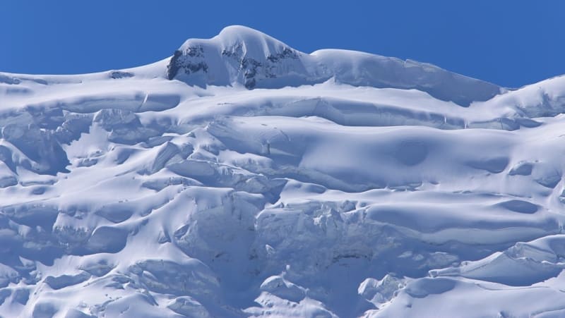
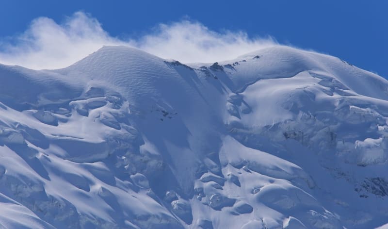
The snow line in the Pamir-Alai mountains rises in the direction from west-northwest to east-southeast. On the Turkestan ridge it is located at an altitude of about 3500 meters above sea level, in the area of the Fedchenko glacier - 4400 meters above sea level, in the central and eastern regions of the Pamir it rises to 5200 - 5240 meters above sea level.
A snow line height of more than 5000 m is typical only for the tropics and is due to the exceptional dryness of the climate here. In the northern ranges of the Pamir-Alai, the greatest glaciation is observed in the Matcha mountain cluster.
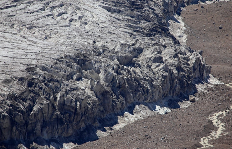
The Zeravshan glacier (in the upper reaches of Zeravshan) has a length of about 25 kilometers. The glaciation of the Pamirs is enormous, especially in the northern and northwestern parts. About 7,000 glaciers are known in the Pamirs, of which over 700 are more than 2 kilometers long, and seven glaciers exceed 20 kilometers.
The length of the Fedchenko glacier is 77 kilometers, the Grumm-Grzhimailo glacier (east of the Fedchenko glacier) is about 37 kilometers, the Garmo (between the Peter the Great and Darvaz ridges) is 27.5 kilometers, the Bolshoy Saukdara glacier (in the Trans-Alai ridge) is about 25 kilometers .
In terms of the number of largest glaciers and the area of glaciation, the Pamirs rank first among other mountain-glacial regions. The glaciated area of the Pamirs reaches almost 7,500 square kilometers, which is more than 10% of the entire surface of the Pamirs.
The amount of water contained in the Pamir glaciers, according to rough estimates, is equal to the amount of water in the Aral Sea (B.P. Alisov). The glaciated area of the entire Pamir-Alai is more than 9600 sq. km.
See the work “Fedchenko Glacier”, volume 1, Tashkent, 1962. The same monograph states that seismic sounding determined the maximum ice thickness in the middle part of the glacier to be 1000 meters above sea level.
The glaciers of the Pamir-Alai, like the Tien Shan, are in most cases in a state retreat. During the glacial epochs of the Middle and Upper Quaternary, glaciation developed most strongly in the same areas that are now most covered by glaciers, that is, in the Northwestern Pamirs and on the Trans-Alai Range.
The ancient Muksuisky glacier (a continuation of the current Fedchenko glacier) reached 164 kilometers. In the central and eastern parts of the Pamirs there were foot glaciers. They were also common in the Alai Valley along the foot of the Trans-Alai Range, where long moraine ridges now lie.
The Pamir-Alai rivers belong mainly to the Amu Darya basin. Of these, besides the Amu Darya itself, which in its upper reaches is called Pyanja, the largest is Kyzylsu - Surkhob - Vakhsh. he rivers of the eastern outskirts of the Pamirs belong to the basins of Yarkand and Kashgar.
From the rivers of the Kashgar basin, the upper reaches of the eastern Kyzylsu and Markansu enter our territory. The basin of the mountainous Zeravshan lies in the Gissar-Alai system; From the northern slopes of the Alai and Turkestan ridges, rivers flow towards the Syrdarya.
Large rivers starting in the highlands are fed by glaciers and snow, and compared to the rivers of the Tien-Shan, they have a larger share of glacial feed. This especially applies to rivers starting from the glaciers of the northwestern Pamirs, flowing from the Trans-Alay Range, and to the upper Zeravshan (Matcha River).
The rivers flowing from the Pamir-Alai mountains are no less important for irrigation than the Tien-Shan rivers. Particularly important in this regard are the Amu Darya with oases in its lower reaches and the Karakum Canal named after V.I. Lenin, tributaries of the Amu Darya with oases within the mountainous region itself (Gissar Valley, Vakhsh oasis and other oases of the Western Tajik depression), Zeravshan (Samarkand, Bukhara , Karakul oases), rivers of southern Fergana.
Geographic coordinates of Pamir-Alai mountain system: N39°19'45.98" E70°17'12.23"
Note:
If you are using geographic coordinates for Google Earth or Google Maps navigation systems, you must remove the last two digits from geographic coordinates and " (hundredths of a second) and enter the result in the input line. Example: N51°44'09.67" E72°39'40.81" = N51°44'09 E72°39'40
Authority:
N.A Gvozdetsky, Yu.N. Golubchikov. Series “Nature of the World”, Moscow, “Thought”, 1987.
Photos by:
Alexander Petrov.