


![]()
You are here
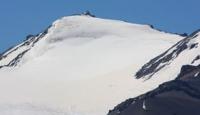
Glacier Adygene in Kyrgyz Ala-Too ridge.
Weekend tours in Ala-Archa park.
“Why are you standing on the path, why don't you want to go?
We need to finish the song, we need to be less sad.
Trains are screaming from below, but March ends,
An early star is rising, somewhere avalanches are rustling."
Yuri Vizbor. "Dombai Waltz". 1961.
Photos of Ala-Archa park.
Adygene South Glacier is located on northern slope of Kyrgyz Ala-Too ridge, in the lateral (western) gorge of Adygen, 44 kilometers southwest of city of Bishkek in Alamudun district of Chui region.
The length of the open part of the glacier is 4.7 kilometers. The perimeter of the open part of the South Adygene glacier is 9042 meters, the area is 3.01 square kilometers. The perimeter of the closed part of the glacier is 7665 meters, the area is 2.03 square kilometers. In the ridge of the eastern part, the sources of the glacier are located at an altitude of 4110.7 m. a. s. l.
In the western part of the ridge, the sources of the glacier are at an altitude of 4165 m. a. s. l. The tongue of the open part of the glacier is located at an altitude of 3640 m. a. s. l. The tongue of the closed, moraine part of the glacier is located at an altitude of 3374 m. a. s. l.
In the southern part of the glacier there are 13 moraine lakes, the largest of which is Lake Adygene. In the central western part of the Adygene glacier, behind a small ridge with a length of 1.2 kilometers, there is a small glacier with a length of 840 meters.
This glacier belongs to the Adygena river basin and further to the Ala-Arche. In the upper, western part of the glacier, there is the Jalamysh pass with a height of 4092 meters above sea level. From the western slope of this pass, the headwaters of the Guzeli glacier, 3.5 kilometers long, belonging to the basin of the Dzhelamysh River, begin.
Geographic coordinates of South Adygen glacier: N42°29'59 E74°25'59
Authority and photos by
Alexander Petrov.