


![]()
You are here
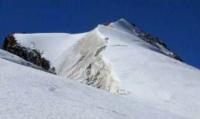
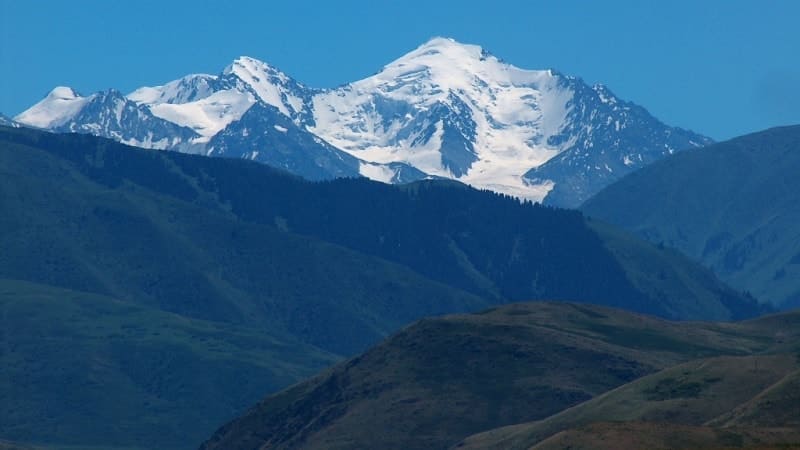
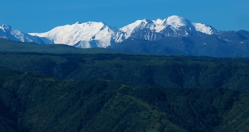
Glaciers of Dzungarsky Alatau.
Wildlife Tours in Dzungarsky Alatau.
“Though we travel the world over to find the beautiful, we must carry it with us, or we find it not”
Ralph Waldo Emerson.
Natural Wonders of Dzungarsky Alatau.
Dzhungarsky Alatau - a mountain system stretching from west-south-west to east-north-east along the border of Kazakhstan and the People's Republic of China at coordinates 44-46 ° c. W, 78-82 ° in. d. Its southern border is the Ili River, the northeastern border is Lake Alakol and the Dzungarian Gate.
The total length of the Dzungarian Alatau is about 400 kilometers. Dzhungarsky Alatau consists of several parallel mountain ranges, the main and longest of which is the Northern. The southwestern branch of the Northern Range is the Karatau Range.
The deep tectonic depression, occupied by the Koksu River and its tributaries, separates the southern group of ridges from the Northern Range: Toksambai, Bezhintau and Tyshkantau, which are continued in the territory of China in the form of the Boro-Khoro Range.
The jumper between the Northern ridge and the Toksambay ridge serves as a watershed between the sources of the Koksu and Boro-Tal rivers. The average height of the Dzhungarsky Alatau is 3580 meters above sea level, but many peaks rise to 4000 meters above sea level and more.
The highest point of the Northern Range is Mount Semenova-Tyan-Shansky, 4,560 meters above sea level at the headwaters of the Bolshoi and Maly Baskan rivers. The average height of the Toksambai and Tyshkantau ridges is 3770 meters above sea level, the highest point of the first of them is 4062 meters above sea level, the second - 4359 meters above sea level.
Most of the rivers of the Dzhungar Alatau in Kazakhstan belong to the basin of Lake Balkhash (the Lepsy, Baskan, Sarkand, Aksu, Bien, Kora, Koksu, Karatal rivers), the Tentek river - to the basin of Lake Sasykkol, the Irgaite river - to the basin of Lake Alakol.
Some of the rivers leaving the mountains are lost in the sands, and some are completely understood for irrigation of fields. In the axial zone of the ridge, the highest peaks are composed of granites and metamorphic schists, resistant to weathering processes.
In Neogene and Quaternary, the Dzungarian Alatau underwent a rise accompanied by tectonic ruptures. Uneven elevation along the planes led to the formation of a series of ledges in the relief located at different hypsometric levels.
As a result, the slopes of the ridge represent a staircase of ancient leveling surfaces, most clearly traced at levels: 700 - 1600, 1600 - 3100 and 3100 - 4560 meters above sea level. Dzhungarsky Alatau was subjected to powerful glaciation in the mountains and moraine deposits in the valleys and foothills.
Modern glaciers are confined mainly to the watershed zones of the ranges, characterized by large absolute heights, deep dissection of the slopes, a small number of preserved sections of ancient leveling surfaces, and relatively
weak dissection of the dividing ridges along the strike - the saddles between the neighboring peaks lie below them only 200 - 300, less often 400 - 500 meters. The peaks and saddles of the axial ridge are covered with firn fields and glaciers and for the most part have relatively soft outlines.
Pointed peaks are rare. The ridges of the lateral spurs are dissected approximately in the same way as the axial ridge. Modern glaciers are located mainly in negative landforms that served as larger Quaternary glaciers. The higher the mountains rise, the more fully modern glaciers fill the tanks of their predecessors.
There are 1369 glaciers in the Dzhungar Alatau with a total area of 1000 square kilometers. They conserved about 42 kilometers of cubic water. Glaciers occupy a height zone from 3000 meters above sea level to the ridge ridge (4000 - 4360 meters above sea level).
Moraines cover from 4 - 5% to 10 - 20% of the surface of glaciers. The company line on the glaciers runs at an altitude of 3480 to 3840 meters above sea level, depending on the exposure and morphological type of glaciers.
On the southern slopes the firn line is 100 - 120 meters higher than on the northern slopes, on the valley glaciers 70 - 80 meters lower. The vast majority of glaciers in the Dzungarian Alatau have an area of less than 1 square kilometers (1112 glaciers, or 81.3% of the total).
Glaciers of medium size (from 1 to 5 square kilometers) are only about 17% of the total, but they occupy 45% of the total area of glaciation. Glaciers are more than 5 square kilometers - 26. More than half of the total glaciation area is accounted for by glaciers of valleys (61.3%) and glaciers of slopes and flat peaks - 17.3%.
Most of the total area of glaciation is concentrated on the slopes of the northern points (84.1%). This distribution of glaciers is mainly related to conditions, as well as to orographic features that contribute to the accumulation of snow deeper and more complex than the dissected northern slopes of the ranges.
The main source of nutrition for the glaciers of the Dzungarian Alatau are precipitation, most of which in the accumulation area falls in solid form. The average rainfall at the height of the nutrition boundary is about 900 mm per year, varying from 770 to 1270 mm in different years.
According to the calculation of A. N. Krenke (1982), accumulation at the same level is in different parts area from 75 to 200 - 250 g / cm2 per year with an average concentration coefficient due to inspired snow and avalanches of 1.4.
The food boundary divides the glaciers of the Dzungarian Alatau into two parts of approximately equal area — the feeding region and the discharge region. The glacial coefficient of valley and hollow glaciers averages 1.12, valley glaciers - 0.89, hanging - 1.0.
The prevailing type of ice formation on the glaciers of the Dzungarian Alatau is firn and ice. The firn-ice zone covers most of the accumulation area above 3,500 meters above sea level. Below is the ice-feeding zone, which occupies about 20% of the area of glaciers.
The process of ice formation in the first of the zones is completed within several years, in the second - within one year. The active surface layer of the glacier within the first zone in the summer warms up to 0 °. In the zone ice supply and in the ablation region, ice has zero temperature only in a thin surface layer (up to 1 meter deep), the ice temperature goes down deeper: at a depth of 1.5 meters - to -0.4 °, at a depth of 2.5 meters - to - 1.2 °, at 4 meters - up to - 2.6 ° and at 6 meters - up to -3.1 °.
The temperature of glaciers of flat peaks is 3 - 4 ° lower than that of valley glaciers. At the bed of valley glaciers, an increase in ice temperature to the melting point is noted due to geothermal heat. The low temperature state of the glaciers of the Dzungarian Alatau is apparently associated with low speeds.
The average speed of ice movement in hollow glaciers, which usually have small slopes, is only 4 - 5 m/year. Valley glaciers move about twice as fast (9 - 10 m / year). The highest ice speeds were measured on the Besonova Glacier.
At 2 - 3.5 kilometers from its end, the average ice speed was 16.7 m/year. The daily ice speed during the ablation period exceeds the annual average by 1.2 - 1.4 times. The main factor in the melting of glaciers in the Dzungarian Alatau is solar radiation.
With a cloud of 4 points, its share reaches 74%, with a cloud of 6 - 7 points - 57% of the heat balance. Turbulent heat remains 26 and 43%, respectively. The intensity of the melting of the glaciers mainly depends on their albedo, exposure and the absolute height of the place.
The average duration of the ablation period at an altitude of 2900 - 3100 meters above sea level (at this at the height are the ends of most valley glaciers) is 65 days, and at an altitude of 3300 meters above sea level (the middle parts of most valley glaciers) - 46 days.
The average daily ice melting at the ends of the glaciers, depending on the weather, is from 2.2 to 4.6 cm, and in the middle parts of the glaciers - from 1.4 to 3.3 cm (in the water layer). Glaciers due to melting lose more ice than they get it from the firn area due to movement.
The mass balance of the glaciers on which observations were made is negative. The balance of glaciers of the Dzungar Alatau has been predominantly negative over the past few decades, as evidenced by the retreat of the ends of many glaciers and reduction of their area.
So, the end of the Bezsonov glacier from 1909 to 1972 receded by 880 meters, and its area decreased by 0.5 square kilometers. From 1952 to 1972, the Tronov Glacier became shorter by 425 meters and lost 0.26 kilometers of square area.
A number of other glaciers also decreased. In the whole region, glaciers annually lose 0.17% of their total area. (Zenkova. 1959; Cherkasov, Vilesov. 1972, 1974; Catalog of glaciers. 1969 - 1980).
Total area of glaciation in the Dzungarian Alatau is about 1000 square kilometers, over 1300 glaciers.
Largest glaciers of the Northern Range of the Dzungarian Alatau.
Abay Glacier, with a length of 10.9 kilometers, an area of 13.2 square kilometers, located at an altitude of 2830 to 4550 meters above sea level, belongs to the Lepsy river basin.
Kolesnik Glacier (Kora), with a length of 8.1 kilometers, an area of 15.3 square kilometers, is located at an altitude of 2940 to 4340 meters above sea level, belongs to the Lepsy river basin.
Balacore Glacier, with a length of 8.0 kilometers, an area of 16.7 square kilometers, located at an altitude of 2850 to 4174 meters above sea level, belongs to the Lepsy River Basin.
Tronova Glacier (Mukan), with a length of 7.9 kilometers, an area of 12.4 square kilometers, is located at an altitude of 2800 to 3850 meters above sea level, belongs to basin of the Kora River.
Geographical coordinates of Tronov Glacier: N44°53'22.09" E79°22'28.19"
Gacier Korolenko (Aktas), with a length of 6.2 kilometers, an area of 9.5 square kilometers, located at an altitude of 3,000 to 4,098 meters above sea level, belongs to the Tentek River Basin.
Taldy Glacier, with a length of 6.0 kilometers, an area of 11.2 square kilometers, is located at an altitude of 3120 to 4280 meters above sea level, belongs to the Lepsy river basin.
Bezsonova Glacier, 6.0 km long, 12.6 square kilometers in area, located at an altitude of 2880 to 3900 meters above sea level, belongs to Kora River Basin.
Geographical coordinates of Bezsonov Glacier: N44°53'05.13" E79°25'40.30"
Nekrasov Glacier (Kalmyksai), with a length of 5.8 kilometers, an area of 10.9 square kilometers, is located at an altitude of 3120 to 4098 meters above sea level, belongs to the Tentek river basin.
Kunakbai Glacier, 5.5 km long, 7.5 square kilometers in area, located at an altitude of 3140 to 4080 meters above sea level, belongs to the Lepsy River Basin.
Satpayev Glacier, with a length of 5.5 kilometers, an area of 7.5 square kilometers, is located at an altitude of 2950 to 4340 meters above sea level, belongs to the Lepsy river basin.
Kien sai Glacier, with a length of 5.5 kilometers, an area of 5.3 square kilometers, located at an altitude of 2920 to 4068 meters above sea level, belongs to the Lepsy River Basin.
Lepsy Glacier, with a length of 5.3 kilometers, an area of 6.2 square kilometers, is located at an altitude of 2980 to 4046 meters above sea level, belongs to the Lepsy River Basin.
Gagarin Glacier, with a length of 4.8 kilometers, an area of 5.6 square kilometers, located at an altitude of 3110 to 4232 meters above sea level, belongs to the Sarkan River Basin.
Avsyuk Glacier, with a length of 4.7 kilometers, an area of 6.2 square kilometers, located at an altitude of 3110 to 4262 meters above sea level, belongs to the Sarkan river basin.
Shumsky Glacier, with a length of 4.7 kilometers, an area of 4.4 square kilometers, located at an altitude of 3020 to 4463 meters above sea level, belongs to the Lepsy river basin.
Nevsky Glacier (Kabansai), with a length of 4.7 kilometers, an area of 3.6 square kilometers, located at an altitude of 3110 to 3881 meters above sea level, belongs to the Tentek River Basin.
Obruchev Glacier, with a length of 4.6 kilometers, an area of 4.5 square kilometers, located at an altitude of 3290 to 4260 meters above sea level, belongs to the Sarkan River Basin.
Abolina Glacier (Urman-Bien), with a length of 4.5 kilometers, an area of 8.1 square kilometers, is located at an altitude of 3140 to 4060 meters above sea level, belongs to the Bien river basin.
Araltobe Glacier, with a length of 4.3 kilometers, an area of 2.9 square kilometers, is located at an altitude of 2760 to 3760 meters above sea level, belongs to the basin of the Kora River.
Blok Glacier, with a length of 4.3 kilometers, an area of 3.4 square kilometers, located at an altitude of 3140 to 3940 meters above sea level, belongs to the Tentek River Basin.
Kavraisky Glacier, with a length of 4.3 kilometers, an area of 3.2 square kilometers, is located at an altitude of 3030 to 3890 meters above sea level, belongs to the Tentek River Basin.
Sapozhnikov Glacier, with a length of 4.2 kilometers, an area of 5.0 square kilometers, located at an altitude of 2960 to 3920 meters above sea level, belongs to the basin of the Kora River.
Geographical coordinates of Sapozhnikov Glacier: N44°54'11.03" E79°27'23.06"
Krasovsky (Aganakty) Glacier, with a length of 4.1 kilometers, an area of 3.4 square kilometers, is located at an altitude of 2960 to 3890 meters above sea level, belongs to the Tentek river basin.
Largest glaciers of Southern ridge of Dzungarian Alatau.
Chizhin Glacier, with a length of 8.6 kilometers, an area of 13.6 square kilometers, is located at an altitude of 2720 to 4250 meters above sea level, belongs to the Chizhin river basin.
Glaciologists Glacier, with a length of 5.8 kilometers, an area of 5.9 square kilometers, located at an altitude of 3160 to 4020 meters above sea level, belongs to the basin of the river Usek.
Cherkasov Glacier, with a length of 5.7 kilometers, an area of 6.1 square kilometers, located at an altitude of 2940 to 4010 meters above sea level, belongs to the basin of the Kazan River.
Glacier 50 years of Kazakhstan, with a length of 5.4 kilometers, an area of 5.6 square kilometers, located at an altitude of 2940 to 4240 meters above sea level, belongs to the Khorgos river basin.
Panfilov Glacier, with a length of 4.9 kilometers, an area of 5.3 square kilometers, located at an altitude of 3070 to 4358 meters above sea level, belongs to the Khorgos river basin.
Djildairyk Glacier, with a length of 4.4 kilometers, an area of 6.0 square kilometers, located at an altitude of 3260 to 4010 meters above sea level, belongs to the Ulken-Kazan river basin.
Altınmuz Glacier, with a length of 4.4 kilometers, an area of 5.1 square kilometers, is located at an altitude of 3200 to 3840 meters above sea level, belongs to the Usek river basin.
Auezov Glacier, with a length of 4.4 kilometers, an area of 2.6 square kilometers, located at an altitude of 3380 to 4280 meters above sea level, belongs to the Karasu river basin.
Khorgos Glacier, with a length of 4.2 kilometers, an area of 3.0 square kilometers, is located at an altitude of 3080 to 4240 meters above sea level, belongs to the Karasu river basin.
Glacier No. 91, with a length of 4.2 kilometers, an area of 2.8 square kilometers, located at an altitude of 3280 to 4050 meters above sea level, belongs to the basin of the Kazan River.
Dmitriev Glacier, with a length of 4.0 kilometers, an area of 2.8 square kilometers, located at an altitude of 2940 to 4160 meters above sea level, belongs to the Tyshkan river basin.
Kazan Glacier, with a length of 3.9 kilometers, an area of 4.4 square kilometers, is located at an altitude of 3220 to 4020 meters above sea level, belongs to the basin of the Kazan River.
Satyli Levy Glacier, 3.8 km long, 4.3 square kilometers long, located at an altitude of 3040 to 3760 meters above sea level, belongs to the Koktal river basin.
Tyshkan glacier, with a length of 3.7 kilometers, an area of 2.5 square kilometers, is located at an altitude of 3230 to 4220 meters above sea level, belongs to the Tyshkan river basin.
Shatalov Glacier, with a length of 3.5 kilometers, an area of 2.2 square kilometers, located at an altitude of 3070 to 4359 meters above sea level, belongs to the Khorgos river basin.
Dzhilandy Glacier, with a length of 3.4 kilometers, an area of 2.6 square kilometers, located at an altitude of 3380 to 4090 meters above sea level, belongs to the Ulken-Kazan river basin.
Glacier No. 213, with a length of 3.3 kilometers, an area of 2.0 square kilometers, located at an altitude of 2980 to 3820 meters above sea level, belongs to the Usek river basin.
Seyfulin Glacier, with a length of 3.3 kilometers, an area of 2, square kilometers, is located at an altitude of 3070 to 4250 meters above sea level, belongs to the Karsu river basin.
Amangeldy Glacier, with a length of 3.2 kilometers, an area of 1.6 square kilometers, located at an altitude of 3260 to 4100 meters above sea level, belongs to the Karsu river basin.
Glacier No. 116, with a length of 3.2 kilometers, an area of 1.6 square kilometers, located at an altitude of 3080 to 4160 meters above sea level, belongs to the Tyshkan river basin.
Glacier No. 130, with a length of 3.2 kilometers, an area of 1.4 square kilometers, located at an altitude of 3180 to 4250 meters above sea level, belongs to the Tyshkan river basin.
Koksay Glacier, with a length of 3.2 kilometers, an area of 3.5 square kilometers, is located at an altitude of 3090 to 3830 meters above sea level, belongs to the basin of the Kazan River.
Small Usek Glacier, with a length of 3.1 kilometers, an area of 3.0 square kilometers, is located at an altitude of 3200 to 3780 meters above sea level, belongs to the Usek river basin.
3.0 km long Karanbulak Glacier, an area of 4.0 square kilometers, is located at an altitude of 3320 to 3920 meters above sea level, belongs to the Kazan River Basin.
Glacier No. 125, with a length of 3.0 kilometers, an area of 2.3 square kilometers, located at an altitude of 3260 to 4280 meters above sea level, belongs to the Tyshkan river basin.
3.0 km long Mayak Glacier, an area of 1.6 square kilometers, located at an altitude of 3160 to 4260 meters above sea level, belongs to the Tyshkan river basin.
Karsuskin glacier, with a length of 3.0 kilometers, an area of 1.6 square kilometers, is located at an altitude of 3035 to 4100 meters above sea level, belongs to the Karsu river basin.
Authority:
"Glaciers." L.D. Dolgushin, G.B. Osipova. Series "Nature of the world." Moscow, the publishing house "Thought". 1989.
Photos by
Alexander Petrov.