


![]()
You are here
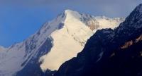
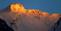
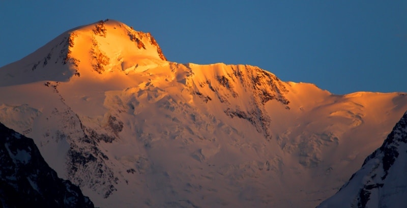
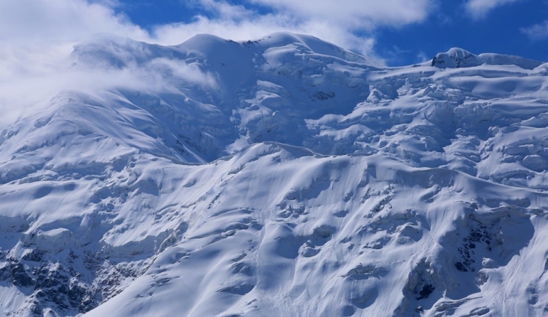
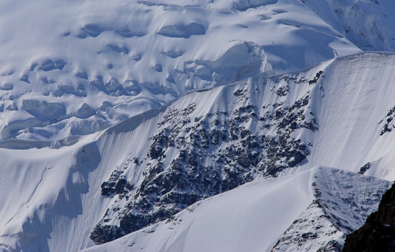
Glaciers of Northern Pamirs.
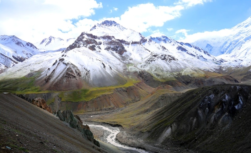
Hiking in mountains of Pamirs.
“Here is the life of a special breed of humanity -
She, like salt, crunches the galloons -
From here to rabies - halfway through,
From here to the city - like to the moon"
Nikolai Tikhonov.
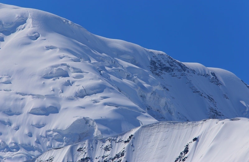
Tourist routes on glaciers of Pamirs.
The Zaalai ridge stretches from west to east, from the confluence of the Muksu and Kyzylsu rivers to Otchaylo peak (5820 m) on the border with China. The average height of the ridge is 5500 meters above sea level, the highest point is Lenin Peak 7134 meters above sea level.
The huge height and monolithicity of the ridge determine the powerful modern glaciation. A strip of firn fields feeding large glaciers stretches along the entire axial part of the ridge along both its slopes, interrupting only in the areas of the Tersagar and Kyzylart passes.
These passes divide the ridge into three parts: western, central and eastern, differing from each other in the nature of the relief and glaciation. The most significant is the glaciation of the central part of the ridge, where the largest glaciers of the Zaalai ridge - Lenin, Korzhenevsky, Oktyabrsky, Bolshoi Saukdara and others flow from the massif of the Lenin peak in all directions.
The northern slope of the Zaalai ridge, rising above the Alai valley, receives more precipitation than the southern, for account of moist air masses penetrating here along the Surkhob-Kyzyl-Su river valley. The height of the firn line on the northern slope increases from west to east from 4200 to 4500 meters above sea level, on the southern slope it is much higher - from 4500 to 5400 meters above sea level. In total, 550 glaciers with a total area of 1329.3 square kilometers on the Zaalaysky ridge.
The western section of the ridge is 64 kilometers long, stretching from the confluence of the Muksu and Kyzylsu rivers to the Tersagar pass. Its average height is 5100 meters above sea level, the highest point is Sat peak 5900 meters above sea level, on the southern spur of the ridge.
The northern slope facing the Alai Valley is wide and gentle, there are no deep valleys, nor high spurs. South is steep and rocky. Its valleys have the character of hanging troughs, steeply terminating towards the Muksu River.
There are 135 glaciers on this section of the ridge, their area is 222 square kilometers. Of these, 44 glaciers with an area of 94.6 square kilometers are located on the northern slope, the rest on the southern. The most common are valley and caravan and valley glaciers.
Kyzylsu Glacier, length 13.3 kilometers and an area of 22.5 kilometers square - the largest on this plot. Located on the southern slope at the northeast base of Sat peak. The main trunk of the glacier merges from two branches almost equal in length, and its tongue from 400 to 700 m wide flows from the lateral valley into the valley of the Kyzylsu River and descends down it for another 3 km.
The central section of the Zaalaysky ridge is the highest and monolithic. Its length is 92 kilometers, the average height is about 6000 meters above sea level. Here, 60% of the entire area of glaciation of the ridge is concentrated - 334 glaciers with an area of 803.7 square kilometers.
The nature of glaciation is determined by large dendritic, complex valley and hollow glaciers. 16 glaciers larger than 10 square kilometers have a total area of 504.7 square kilometers. On the northern slope of 98 glaciers with an area of 361.7 square kilometers.
95% of this area is accounted for by simple and complex valley and hollow glaciers. Glaciers of the northern slope form steep walls in the circuses of the axial zone of the ridge and slide down into the zone of a more gentle relief.
These are mainly large hollow and valley glaciers with short and wide tongues. An exception is the complex valley glacier of Korzhenevsky, which flows in a deep valley between the main ridge and its northeastern spur.
The surface of the tongue is 2/3 covered with a moraine cover. The glacier receives 5 large tributaries. The firn line on it is located significantly higher than on other glaciers of the northern slope, due to the fact that the high ridges surrounding the glacier intercept most of the precipitation brought by western air currents.
The existence of such a large glacier is possible here only because of the exceptionally favorable orography.
The largest glaciers of the Zaalaysky ridge:
The Lenin Glacier, located in the Chon-Alai district of Osh region on the northern slope of the Zaalai Range in Kyrgyzstan. Its length is 13.5 kilometers, an area of 55.3 square kilometers. This is the largest hollow glacier of the northern slope of the Zaalaysky ridge.
It has an extensive firn pool on the slope of Lenin Peak and a short tongue. Glacier surface is clean, few cracks. Its right tributary, separated from the glacier by a rocky nunatak, has twice intensified over the past 40 years - in 1945 and 1969.
Moreover, the surface of the glacier snout tongue was broken by cracks, and a wide convex glacier moved beyond nunatak at 500 and 1000 meters. At the end of the shifts, the end of the glacier collapsed and retreated.
On the southern slope of the central section of the ridge 236 glaciers with an area of 442.0 square kilometers. As on the northern slope, most of the area falls on the glaciers of the valleys (91%). There are many large glaciers, 13 of them exceed 5 square kilometers, including 4 glaciers larger than 25 square kilometers, and they account for 49% of the total area of glaciation.
These are the Kuzgun, Bolshoi Saukdara, Oktyabrsky and Uysu glaciers.
The Oktyabrsky Glacier is located in the Murgab district of the Gorno-Badakhshan Autonomous Region on the southern slope of the Zaalai Range in Tajikistan. The length of the Oktyabrsky glacier is 19.0 kilometers, an area of 88.2 kilometers square.
The glacier is located at the junction of the Zaalai ridge with the Zulumart ridge in the upper reaches of the Koksay River, the basin of Lake Karakul. Its main stream descends from a height of 6600 - 6800 meters above sea level, from the steep southern slope of the Zaalaysky ridge to the very ridge, completely covered with firn and snow.
he food area consists of 6 wide cameras. The tongue throughout is broken by cracks; the lateral tributaries are also very fragmented. Well-defined middle moraines - their dark stripes are traced to the end of the glacier. The moraine-free ice surface is covered in ablative landforms.
The right tributaries flowing down from the eastern slope of the Zulumart ridge have narrow moraine tongues pressed by the main trunk to the right side of the valley. The Uysu Dendritic Glacier is located east of the Oktyabrsky Glacier in the upper reaches of the Uysu river.
Powerful streams of ice, fan-shaped, descending from the slopes of the ridge 6000 meters above sea level, are connected at the bottom of the valley into a common language with a width of about 1.5 kilometers. Most of it is closed moraine.
A steep, sometimes steep front of the glacial snout is located at an altitude of 4390 meters above sea level. To the west of the Oktyabrsky glacier, on the other side of the Zulumart ridge, from the southern slope of the Zaalai ridge, in the area of Lenin peak, 4 large glaciers descend - Bolshoi Saukdara, Small Saukdara, Dzerzhinsky and Vali.
These glaciers have vast firn areas lying at high altitudes and narrow long snout. A feature of these glaciers is the periodic movement of their glacier snout, during which they descend into the floodplain of the Sauksai River and block it.
The Big Saukdara Glacier is located in the Murghab region of the Gorno-Badakhshan Autonomous Region on the southern slopes of the Zaalai Range in Tajikistan. The length of the glacier is 20.6 kilometers, an area of 23.5 kilometers square, located in the upper Sauksay River.
Below the active end to an altitude of 3940 metro above sea level, lies a large stretch of dead ice. This glacier intensified in the 1970s, and a dammed lake formed on its sharp bend in the valley of the North Zulumart River. In August 1977, the lake broke through, leaving icebergs on the ground.
The Small Saukdara Glacier is located in the Murghab region of the Gorno-Badakhshan Autonomous Region on the southern slopes of the Zaalai Range in Tajikistan. The length of the glacier is 14.3 kilometers, an area of 23.5 square kilometers, advancing in 1966 and 1974 - 1975.
His glacier snout emerges in the form of a wide blade of purer ice on the glacier snout of Big Saukdara, buried under a moraine. During the movement of 1974 - 1975, the speed of advancement of the end of the glacier was 6 meters per day, about 100 million meters of cubic ice and about 0.5 million tons of soil were carried out.
The area of the glacier increased by 1.5 square kilometers. After each of these movements, the glacier again receded into its valley. After the last movement in the floodplain of the Sauksay river, a three-tier ice section remained - buried ice of the Big Saukdara glacier below, then not having time to melt the remaining ice of the previous Small Saukdara glacier and, finally, from above - the ice of its last movement.
The Dzerzhinsky Glacier is located in the Murghab region of the Gorno-Badakhshan Autonomous Region, on the southern slopes of the Zaalai Range in Tajikistan. The length of the glacier is 14.9 kilometers, an area of 19.0 kilometers square.
The Dzerzhinsky Glacier began to advance rapidly in 1973, and by July 1975 its end advanced into the floodplain of the Sauksai River, spreading out over an area of about 0.5 square kilometers. Only a few meters separated the front of the glacier from the opposite side of the valley, leaving a clear passage for the river.
Around the same time, the Vali glacier was moving along, with a length of 7.6 kilometers and an area of 11.9 kilometers square. In May 1976, the front of this glacier did not reach the port side of the Sauksay River valley for about 60 - 80 meters, crawling along the flat bottom of the valley in the form of a “lion's paw”.
The lower 6 kilometers of the glacial snout were split by a network of cracks, and in the upper reaches the surface decreased by 30 - 50 meters. In the spring of 1977, the front of the glacier for 300 meters abutted against the left side of the valley, blocking the channel of the Sauksai River, which flowed under the glacier (Desinov et al. 1977).
There are several more large glaciers to the west, but overall glaciation is becoming less significant. The eastern section of the Zaalaysky ridge 30 kilometers long from the Kyzylart pass to Otchaylo peak has an average height of 5500 meters above sea level, the maximum - 6610 meters above sea level - the peak of Kurumdy.
On this site, 81 glaciers with a total area of 303.6 square kilometers, 45 glaciers with an area of 240.1 square kilometers, are located on the northern slope of the ridge. There are 8 glaciers larger than 5 square kilometers. The largest are the Kyzyl su and Nura glaciers.
Vali Glacier is located in the Murgab district of the Gorno-Badakhshan Autonomous Region in the northern part of the Zaalai Range in Tajikistan. The length of the glacier is 7.6 kilometers, an area of 11.9 kilometers square.
In May 1976, the front of this glacier did not reach the port side of the Sauksay River valley for about 60 - 80 meters, crawling along the flat bottom of the valley in the form of a “lion's paw”. The lower 6 kilometers of the glacier snout were split by a network of cracks, and in the upper reaches the surface decreased by 30 - 50 meters.
In the spring of 1977, the front of the glacier for 300 meters abutted against the left side of the valley, blocking the channel of the Sauksai River, which flowed under the glacier (Desinov et al. 1977).
The Kyzylsu glacier is located in the Chon-Alai district of the Osh region on the northern slope of the Zaalai ridge in Kyrgyzstan. Its length is 15.1 kilometers, an area of 43.0 kilometers square - a complex valley glacier. Its main stream has a three-chamber feeding area, the tongue is broken by cracks and dissected by a network of watercourses, and the end is covered with a solid bog cover.
Left tributaries, located in narrow steep valleys on the eastern slope of the spur of the Zaalai ridge, are similar in type to Turkestan ones. The feeding areas of the right tributaries lie in vast, high-lying caravans.
The Nura glacier is located in the Chon-Alai district of the Osh region on the northern slope of the Zaalai Range in Kyrgyzstan. Its length is 5.7 kilometers, an area of 9.0 kilometers square. The Nura glacier consists of two streams of almost the same area, flowing towards each other from the west and east.
Their feeding areas are elongated along the axis of the ridge. After the merger, they form a short glacier snout with a width of more than 3 kilometers, flowing north. Due to the high dryness of the air, the area of glaciation on the southern slope of this section is much smaller than on the northern (36 glaciers with an area of 63.5 km square.
The firn line rises here to 5,200 - 5,500 meters above sea level. 35% of the area falls on the Kurumdy glacier, located in a valley protected from the influence of dry and hot winds of the Tarim Depression by the southwestern spur of the Zaalai Range.
Two large streams descend along narrow and deep valleys to the south. Their glacier snout are broken by cracks and have icefalls in the upper parts. After merging the glacier turns to the west, flowing all the bottom of the valley from side to side to an altitude of 4480 meters above sea level, below the active end of the tongue lies a field of dead ice of about 3 square kilometers currently separated from it by the riverbed.
The surface of the dead ice is dissected by waterways, dips, covered with lakes.
Authority:
"Glaciers." L.D. Dolgushin, G.B. Osipova. Series "Nature of the world." Moscow, the publishing house "Thought". 1989.
Photos
Alexander Petrov.