


![]()
You are here
Gorge Gorelnik North Tien-Shan.
Tours Travel Northern Tien-Shan.
“may came home with a smooth round stone as small as a world and as large as alone”
E.E. Cummings.
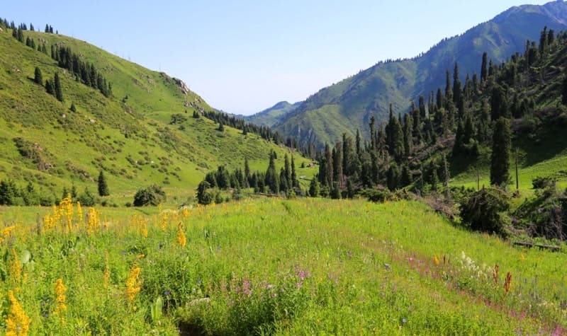
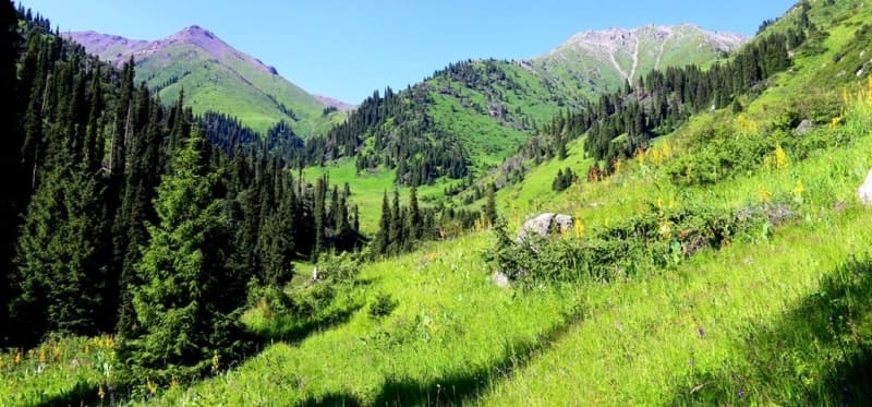
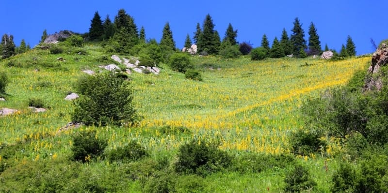
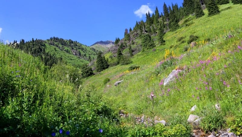
Hiking in sights Northern Tien-Shan.
Gorelnik Gorge, located at an altitude of 3317 to 1904 meters above sea level, is located on left, eastern slope of Maloalmatinsky Gorge, on northern slope of Zailiysky Alatau ridge, between high-mountain skating rink "Medeu" and the ski resort "Shymbulak" in Medeu district of Almaty.
Gorelnik Gorge received its name due to a strong fire that happened here in the early 30s, which was carelessly started by cadets of the border school. A large fire destroyed the spruce forest in the upper reaches of the narrow Kuigen-Sai gorge, after which it received the name "Gorelnik".
The name Gorelnik is explained from the Kazakh Kuigen-Sai "burnt log". However, the origin of the toponym from the Kazakh Kuigan - "flowing into" (this is the name for the mouth of rivers or the confluence of two rivers) is more plausible.
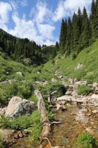
The Gorelnik River, a tributary of the Malaya Almatinka, flows through the gorge. The length of the Gorelnik gorge is 7.4 kilometers (according to other sources, 7.8 kilometers). The Gorelnik River of the same name flows through the gorge, one of the most abundant left tributaries of the Malaya Almatinka River, the length of the river is 7.4 kilometers.
The catchment area reaches 12 square kilometers. There are 3 moraine lakes in the upper reaches of the river. The width of the river bed varies from 1.8 to 2 meters, the depth reaches from 0.15 to 0.2 meters. The average long-term, annual water flow is 0.24 cubic meters per second, the flow is all year round.
The river is dangerous during mudflows. The largest mudflows were observed: May 10, 1944 (the mudflow rate was 9.9 cubic meters per second) and May 22, 1951 (the mudflow rate reached 20 cubic meters per second). The river originates on the northern slope of the Zailiyskiy Alatau, has several tributaries with a total length of 4 kilometers.
In the upper reaches, the main channel of the river receives a few tributaries. One of them, the right tributary on which there are two waterfalls, Lower and Upper, originates from the southern slopes of Mount Pribornaya, 3,340 meters above sea level, and from the eastern and southern slopes of Mount Chasovaya, 3,230 meters above sea level.
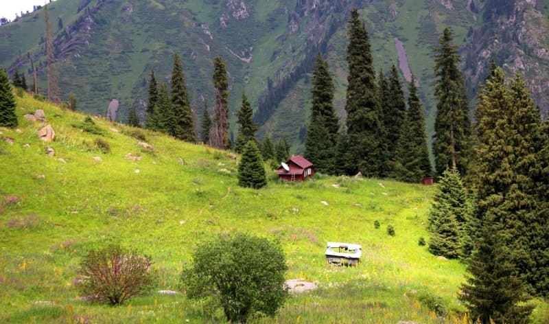
The Gorelnik gorge is located 1.8 kilometers southwest of the Shymbulak ski resort, and 1.8 kilometers south and a little to the east of the Medeu high-mountain skating rink. At the mouth of the Gorelnik River there is a narrow rocky cape, on which you can see the buildings of the former Gorelnik tourist base, which at one time played an outstanding role in the development of mountaineering and tourism in Kazakhstan.
There you could meet fans of mountain hikes and climbing from all the republics of the former Union. Its convenient location made it possible to lay dozens of routes in the mountains of the Zailiysky Alatau and beyond. In 1943, the All-Union School of Mountain Training Instructors, headed by Honored Master of Sports in Mountaineering M.T. Pogrebetsky, was located in Gorelnik.
It was here that many Soviet soldiers received their initial skills in behavior in the mountains, which they used in the war. Many famous Kazakhstani mountain climbers also received their training here, laying routes to all ends of the Zailiysky Alatau.
At the mouth of Gorelnik there is a warm hydrogen sulphide spring, remarkable for its healing qualities, temperature 22 degrees, flow rate 80,000 liters per day, confined to a crack in biotite granites. Because of the specific hydrogen sulphide smell of water before the revolution the river was called Rotten stream.
There are two waterfalls in the gorge. The lower waterfall in the Gorelnik gorge is located at an altitude of 2435 meters above sea level, is on the right slope of the Gorelnik gorge, 140 meters from the mouth with the Gorelnik River, on the right unnamed stream, in the eastern part of the Kumbel Tau ridge.
The height of the water fall at the Upper waterfall is about 20 meters and consists of three cascades. At the Lower waterfall the height of the water fall reaches about 5 meters, the waterfall is the first on the way when moving from the bottom up.
The Upper Waterfall in the Gorelnik Gorge is located at an altitude of 2486 meters above sea level, is located on the right slope of the Gorelnik Gorge, on the right unnamed stream, in the eastern part of the Kumbel Tau ridge. The height of the fall of water at the Upper Waterfall is about 20 meters and consists of three cascades.
3 kilometers upstream is the weather station "Upper Gorelnik".
Geographical coordinates of Gorelnik Gorge: N43 ° 08'26 E77 ° 03'56
Authority:
http://almatyregion-tour.kz/ru/location/gorelnik-gorge.html
Photos by:
Alexander Petrov.