


![]()
You are here
Gorge of Saura.
Excursion tour Kazakhstan.
“Nature is an infinite sphere whose center is everywhere”
Ralph Waldo Emerson.
Trip from Aktau to Saura gorge.
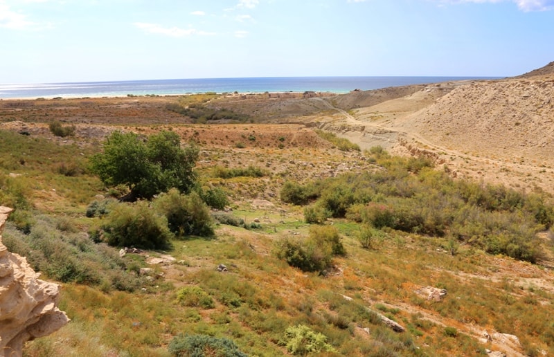
The Saura valley is located on the eastern coast of the Caspian Sea, along the latitude of Saura, the Tyupkaragan peninsula begins from here, 53.4 kilometers southeast of the town of Fort Shevcheno, 69 kilometers northwest of the town of Aktau in the Tyupkaragan district of the Mangistau region.
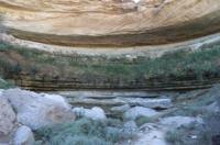
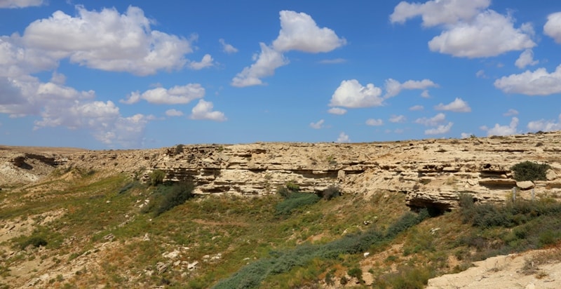
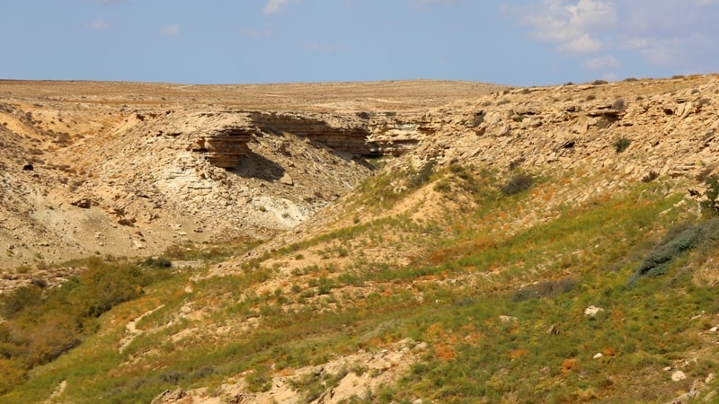
Lake "Saura" Saura is a coastal area of the Caspian Sea, where a peculiar black pearl of the Mangyshlak peninsula is hidden in a small canyon - a small freshwater lake Karakol overgrown with reeds. The stony dry bed, formed by seasonal streams, is cut off by a ten-meter step, which forms a waterfall, unusual for these places during rainy periods.
For many millennia, the falling water has pierced a deep hole in the loose rocks, which was filled with fresh water from the spring. The depth of the lake is not known, it is impressive and allows the relict species of freshwater marsh turtle to live here.
In the morning, when the coastal stones are heated by the sun, the turtles crawl out on them to warm themselves. Turtles crawl out on stones, the whole family: there are about 20 individuals. It turned out that the local turtles are simply sleeping, softened by the heat of the sun.
How and when they appeared in this lake is unknown. There is unusual evidence from the local diver Oleg Alferyev that the marsh turtle lives quietly in the salty waters of the Caspian! He twice observed turtles peacefully "grazing" on the coastal stones algae in 8 and 18 kilometers of the Saura coast!
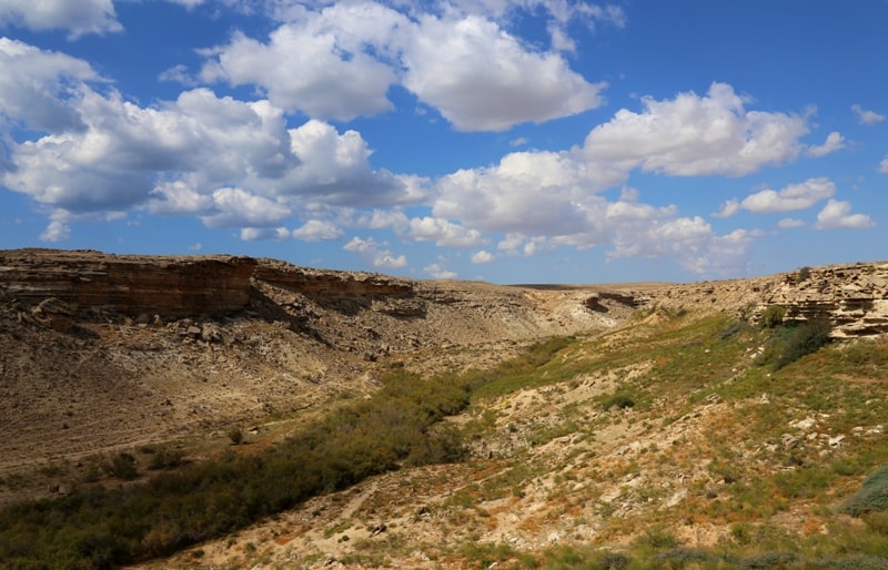
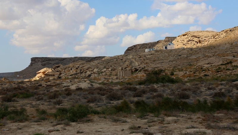
Lake Saura is located 1.5 kilometers from the sea coast. The lake has been giving life-giving moisture since the end of the Stone Age. In the Neolithic, a small settlement was founded on the side of the canyon directly above the lake, and in the Bronze Age a powerful fortress wall with towers was erected, blocking the narrow isthmus of a natural landscape refuge.
The remains of the fortress have come down to us in the form of a stone-earthen rampart, with massive stone slabs sticking out of it, which are elements of former structures. It is possible that in earlier times, the bottom of the canyon could be flooded by the waters of the Caspian, the level fluctuations of which were very significant.
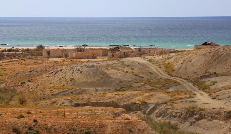
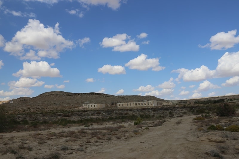
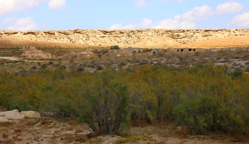
The seaside of Saura is very attractive for beach tourism. The beach area stretches southward for almost 6 kilometers. In the 40s - 50s of the last century, a large fishing village was located here, from which the remains of houses remained.
During the industrial development of Mangyshlak, a seismological base was set up on the coast, from which a lot of man-made debris remained.
Geographic coordinates of the Saura valley: N44 ° 13'46.45 "E50 ° 48'23.85"
Authority:
Andrey Astafyev, Aktau town.
Photos by
Alexander Petrov.