


![]()
You are here
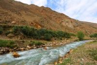
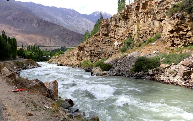
Gunt River.
Walks and Hikes in Tajikistan.
“I am awfully greedy; I want everything from life. I want to be a woman and to be a man, to have many friends and to have loneliness, to work much and write good books, to travel and enjoy myself, to be selfish and to be unselfish… You see, it is difficult to get all which I want. And then when I do not succeed I get mad with anger”
Simone de Beauvoir.
Guided tours in Pamir Mountains.
The Gunt River flows through the territory of the Shugnan region of the Gorno-Badakhshan Autonomous Region of Tajikistan. It begins on the northern slopes of the South Alichur Range in the Eastern Pamirs, is a right tributary of the Panj River.
It starts from the confluence of the rivers Irisu and Kuldzhilgi. Before the confluence of the Muzduireksai river, it is called Gurumdy, below, until the confluence of the Bashgumbez river, - Iri-Yak (Irikyak), and even lower, before the confluence of the Yashilkul lake, - Alichur.
After the river flows from the lake Yashilkul - called Gunt. The length of the river is 246 kilometers, the basin area is 14,840 square kilometers. The Gunt River Basin has 49 lakes with a total area of 83.3 square kilometers.
The average water flow at the mouth (the city of Khorog) is 103 meters cubic per second, the maximum is 136 meters cubic per second, and the minimum is 72 meters cubic per second. The average consumption of suspended sediment is 17 kilograms per second.
Glacial and snow food. High water falls on the period from the end of April to September. The maximum flow of water is observed in July. The winding valley of the Gunt River in the upper reaches has a trough-like shape (up to 5 kilometers wide) with a flat boggy bottom, below it turns into a gorge with steep, sometimes terraced slopes.
The river flows through Lake Yashilkul, after which it flows through a narrow valley between the Rushansky and Shugnansky ranges. On the section from the lake to the mouth, the Gunt flows in a stormy rapid stream, forming numerous rapids on its way.
The largest left tributary is the Shahdara River. Near the city of Khorog it flows into the Panj River. In the lower reaches of the river two hydroelectric power stations were built: Khorog and Pamir-1.
Authority:
Books of: "Mountain Fanye". Authors A.S. Mukhin, V.F. Gusev: «Nature of Tajikistan » publishing house " Idea ", 1982: Pavel Luknitsky.” Travel across Pamir”, «Molodaya guards », 1955: "Pamir", publishing house " Planet " 1987, under edition of member correspondent AN the USSR M.S. Asimova.
Photos by
Alexander Petrov.