


![]()
You are here
Hhistory of Wakhan Corridor.

Informative travel to Tajikistan.
“Travel brings power and love back into your life.”
Rumi.
Sights of Pamir mountains in Tajikistan.
The Wakhan Corridor is the narrow strip of territory in northeastern Afghanistan that extends to China and separates Tajikistan from Pakistan. The corridor, wedged between the Pamirs to the north and the Karakoram range to the south, is about 350 km long, inside the Wakhan Corridor is a high mountain valley from which the Panj and Pamir Rivers emerge and form the Amu Darya.
A trade route through the valley has been used by travelers going to and from East, South, Wakhan Corridor can also refer to the valley and the trade route. The closure of the Afghan-Chinese border crossing at the Wakhjir Pass at the east end of the Wakhan Corridor, the corridor was a political creation of The Great Game.
On its south side, the Durand Line agreement of 1893 marked the boundary between British India and Afghanistan and this left a narrow strip of land as a buffer between the two empires, which became known as the Wakhan Corridor in the XXth century.
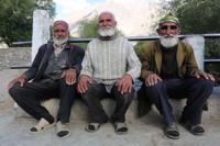
As of 2010, the Wakhan Corridor had 12,000 inhabitants, the northern part of the Wakhan is also referred to as the Pamir. The Wakhan Corridor forms the panhandle of Afghanistans Badakhshan Province, at its western entrance near the Afghan town of Ishkashim, the corridor is 18 km wide.
The western third of the corridor varies from 13 – 30 km in width, at its eastern end, the corridor forks into two prongs that wrap around a salient of Chinese territory, forming the two countries 92 km boundary. The Wakhjir Pass, on the southeastern prong is about 300 km from Ishkashim, the easternmost point of the northeastern prong is about 350 km from Ishkashim.
On the Chinese side of the border is Tashkurgan Tajik Autonomous County of Xinjiang Uyghur Autonomous Region, the northern border is formed by the Pamir River and Lake Zorkul in the west and the high peaks of the Pamir Mountains in the east.
To the north is Tajikistans Gorno-Badakhshan Autonomous region, in the south, the corridor is bounded by the high mountains of the Hindu Kush and Karakoram. The Broghol and Irshad Passes along the southern flank offer access, respectively, to Khyber Pakhtunkhwa, the corridor is higher in the east and descends to about 3,037 m at Ishkashim.
The Wakhjir River emerges from an ice cave on the Afghan side of the Wakhjir Pass and flows west, joining the Bozai Darya near the village of Bozai Gumbaz and forms the Wakhan River. The Wakhan River then joins the Pamir River near Kala-i-Panj to form the Panj River, Chinese considers the valley east of Wakhjir Pass on the Chinese side connecting Taghdumbash Pamir to be part of Wakhan Corridor.
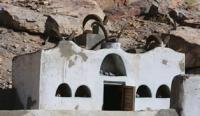
The high mountain valley is about 100 km long and this valley, through which the Tashkurgan River flows, is generally about 3 – 5 km wide and less than 1 km at its narrowest point. This entire valley on the Chinese side is closed to visitors, however, local residents, although the terrain is extremely rugged, the Corridor was historically used as a trading route between Badakhshan and Yarkand.
It appears that Marco Polo came this way, the Portuguese Jesuit priest Bento de Goes crossed from the Wakhan to China between 1602 and 1606. In May 1906, Sir Aurel Stein explored the Wakhan and reported that at time,100 pony loads of goods crossed annually to China.
Authorship:
Zia ul Haque. http://www.discovery-central-asia.com
Photos by
Alexander Petrov.