


![]()
You are here
Karynzharyk Ush Agayyndy Tau.


Most fascinating travel to Mangyshlak.
"It is a lot of to see - a lot of the nobility!"
Travel to Mangyshlak.
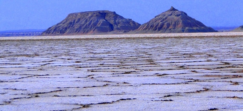
Karynzharyk Ush Agayyndy Tau (Lost mountain Three brothers) are located in the southern part of the Karynzharyk depression in the southeastern part of the Mangistau region, on the territory of the Ustyurt natural reserve, 37.1 kilometers southeast of the Ak-Kuduk village and 64.1 kilometers to the east and a little to the south of the Basgurly depression in the Karakiyan region in the southeast of the Mangistau region.
In the southern part of the depression there is a denudation mountain range of five isolated table Lost mountain, the northernmost of which are three:
- northern Karynzharyk Ush Agayyndy Tau with a height of 116.7 meters above sea level,
- western Lost mountain 83 meters above sea level,
- the eastern Lost mountain 79.7 meters above sea level.
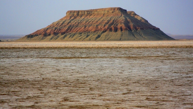
The northern Lost mountain of Karynzharyk Ush Agayyndy Tau is stretched from the southeast to the northwest, its foot of hill at the bottom of the depression is: 1.4 kilometers long, 952 meters wide in the central part.
The distance from the Western cliff of Ustyurt to the northern Lost mountain is 6.8 kilometers, from the western part of the depression to the Lost mountain is 3 kilometers.
The remains are located at the bottom of the depression - 64.8 meters below sea level.
Geographic coordinates of northern outlier of Karynzharyk Ush Agayyndy Tau: N42 ° 39'14 E54 ° 15'24
Geographic coordinates of western Lost mountain: N42 ° 38'36 E54 ° 14'49
Geographic coordinates of eastern Lost mountain: N42 ° 38'35 E54 ° 15'21


Authority and photos:
Alexander Petrov.