You are here
Karzhantau of mountain.


Tours to mountains Karzhantau.
“Thought is invisible nature”
Heinrich Heine.
Sights of mountains Karzhantau.
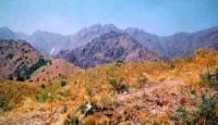
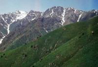
Karzhantau the ridge in the Southern Kazakhstan area of Kazakhstan and the Tashkent region of Uzbekistan, enters the mountain system of the Western Tien-Shan. The most part of the ridge settles down in the territory of the Southern Kazakhstan area of Kazakhstan, the western part of the mountains Karzhantau is located in the territory of the Tashkent region of Uzbekistan.
Mountains are located in the direction from the southwest on the northeast Average heights in the central part of the ridge make 2000 meters above sea level, in its southwest part - 700 - 800 meters above sea level. Separate tops reach 2500 - 2800 meters above sea level.
The highest point of Karzhantau - the mountain Mingbulak of 2823 meters above sea level. Going down to the southwest, the ridge passes into Karachatau height. In this area, along the ridge there passes the site of frontier between Kazakhstan and Uzbekistan 30 - 40 km long.
In the north Karzhantau lasts practically in the width direction. Total length of the ridge makes 90 km. The ridge has an asymmetric structure. From Karzhantau southeast forms very steep, steep side slopes which are cut deeply up by gorges. Karzhantau limits in the West the valley of the river Ugam.
Northwest slopes pass hollow. They are cut by the left inflows of the river Keles. Karzhantau acts as a watershed between Ugam pools and Chirchiq on the one hand, and the Keles pool - with another. Among the rivers of the pool of Keles from a northwest slope of the ridge Kyzylatasay, Zhuzumsay, Uyasay, Karzhansay, Kokparsay, Mugalysay, and also the river Dietary supplements (inflow of the river Arys) flow down.
In the southern and southeast direction the rivers of the basin of Chirchiq of Chir-alm, Orkutsay, Kyzylsu, Aktashsay, Tavaksay, Azadbashsay flow down. Vegetation on slopes is presented by raznotravno-pyreyny steppes above which mountain meadows lie.
In deep valleys fir-trees meet, up to the height of 1400 - 2000 meters gardens and the woods of walnut above sea level grow. Highlands flora from 2500 meters above sea level. Karzhantau, grow on watersheds and adjacent sites of slopes, is of great importance for development of livestock production in the Tashkent region with mountain vegetation of several more ridges.
The ridge Karzhantau is formed, generally by Paleozoic magmatic breeds, sandstone, clay slates, conglomerates. Places of the mountain are put by coal and Devonian limestones and dolomite which create conditions for a karst relief.
There are Carrhae, karst funnels, karst mines and karst caves.
Authority:
http://www.sijjak.com


