


![]()
You are here
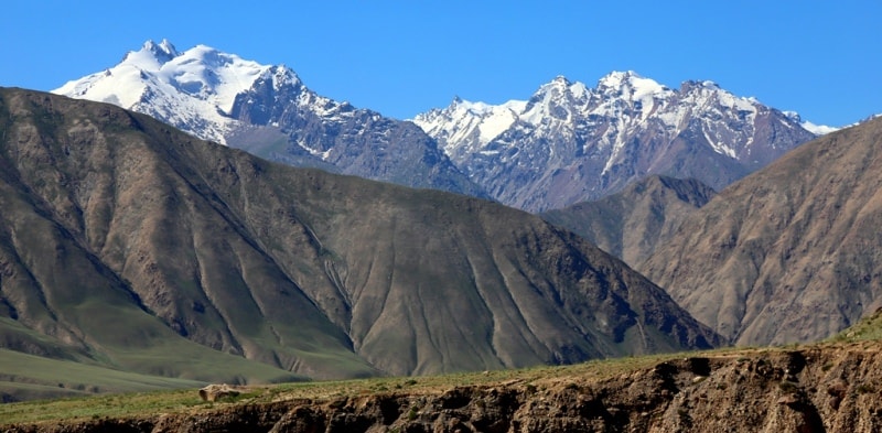
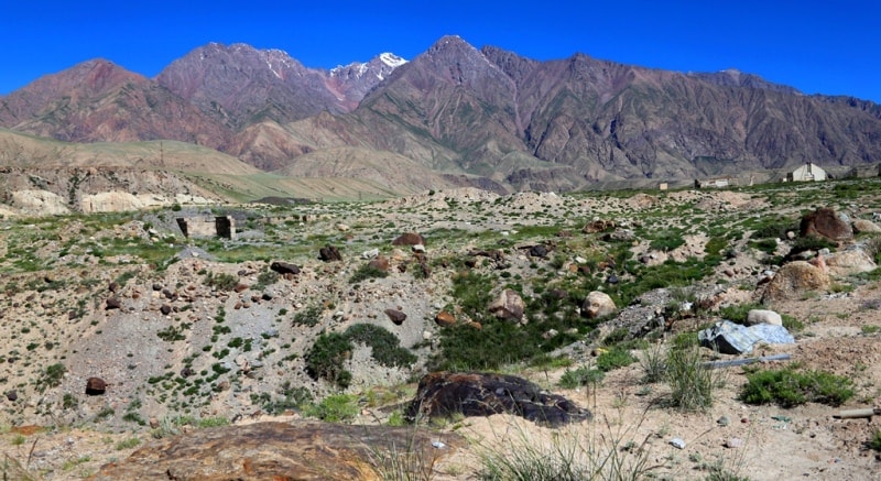
Kuylyu-Too ridge.
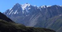
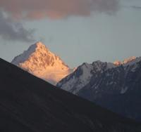
Tours Kyrgyzstan mountains.
“Nature is wise. You can learn everywhere and from everything”
Leonardo da Vinci.
Campaigns on ridges of Central Tien-Shan.
Kuylu-Too ridge is located between the Akshyirak ridge in the west, Terskey Ala-Too in the north, the Uch-Kel valley in the south and the western spurs of the Saryjaz ridge in the east in the Djety-Oguz and Ak-Suu districts of the Issyk-Kul region.
The Kuylyu ridge massif stretches in sublatitudinal (from south-west to north-east) for 53 kilometers, 36 kilometers wide from south-east to north-west. From the north, the ridge is bordered by the valley of the Kuylyu River, the sources of which are located on the eastern side of the Kuylyu Pass, 4303 meters above sea level. From the north-west, the border is the Western Kuylyu River, whose sources are located on the western slope of the Kuylyu Pass.
From the west, the natural boundary of the ridge is the source of the Irshat River, the main tributary of the Uch-Kel River. From the south, the ridge is limited by the valley of the Uch-Kel River stretching from west to east for 41 kilometers.
From the east, the ridge is bordered by the Saryjaz River. In the northeastern part, the western spurs of the Sarydzhaz ridge adjoin the ridge. In the southeastern part, the border of the ridge is the Sarydzhaz rivers and the Uchat mountains.
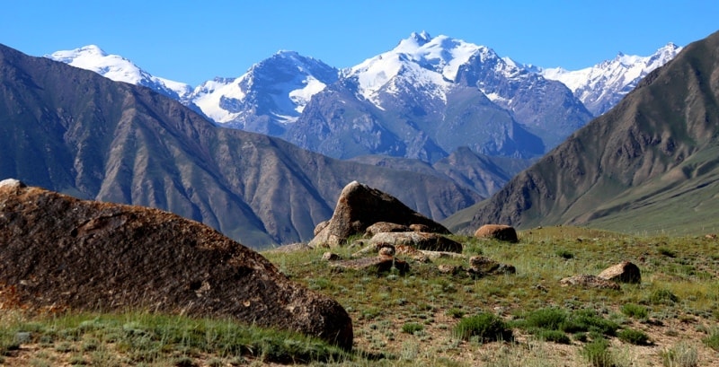
The ridge is located parallel to the Terskey-Ala-Too ridge, but south of it. In the east, it almost adjoins the Saryjaz ridge, and in the west - to the Akshiirak massif. The average height of the Kuylyu ridge is 4700 meters above sea level.
The highest peak of the region is the peak of the Constitution (Stalin) 5281 meters above sea level. Other peaks are Obruchev peak, 5203.2 meters above sea level, Menzu peak, 5068 meters above sea level. The relief of the ridge is very diverse and differs significantly from the traditional Tien-Shan one, resembling the sheer walls of circuses, powerful steps of icefalls, large slopes of gorges and short approaches. The average height of the snow line is about 3700 - 3900 meters above sea level on the northern slopes and 4000 - 4200 meters above sea level on the southern slopes.
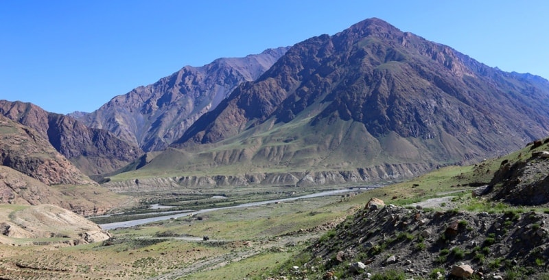
The heights of the glacier tongues are 3700 - 3900 meters above sea level. The rivers of the northern slope have wide, easily accessible trough-type valleys. The valleys of the southern slope in the upper reaches, as a rule, are troughs, and in the middle and lower reaches they are rugged and difficult to access, with the exception of the Terekty River.
In the area of Obruchev peak, a branched spur extends to the east, over 30 kilometers long, up to 4930 meters above sea level. The northern slope is steeper, dissected by tributaries of the Kuylyu River into spurs up to 10 kilometers long, the height difference of the valleys is from 3000 to 4500 meters above sea level.
The southern and western slopes are also steep. The gentle valleys face east, the elevation difference is from 3000 to 4500 meters above sea level with a length of 15 to 25 kilometers. The total area of glaciation is over 250 square kilometers, over 150 glaciers.
The snow line is located at an altitude of about 4000 meters above sea level. The valleys at the foot of the ridge represent alpine tundra, on the slopes - alpine meadows. In the gorges of the rivers and the valley of the Kuylyu river, there are areas of spruce forests.
More than 50 passes are known in Kuylyu-Too and its spurs. The easiest way to cross is the Petrovsky Pass, 4400 meters above sea level. More than 50 peaks are known, to which more than 70 routes have been laid.
The main approaches are from the east along the valleys of the rivers Kyoluu Vostochnaya and Uch-Kel from the road in the valley of the Sary-Dzhaz river. The passes of the Kuylyu-Too massif are predominantly snowy, snow-ice, less often rocky-ice in nature and have difficulty categories from 1A to 3B. The heights of the passes are 3600 - 4800 meters above sea level.
History of the exploration of the Kuylyu ridge.
In 1936, Avgust Andreevich Letavet went to the mountains of the eastern Tien Shan. The object of his visit was the region of the Kuylyu ridge. The expedition members decided to cross the ridge in several places in the eastern part.
The Letavet group passed the Bolshoi and Maly Taldy-Su gorges (tributaries of the Sarydzhaz). The climbers managed to find the passes to the Terekty system. In the upper reaches of the Bolshoi Taldy-Su river, they saw the peak, which is the highest point of the Kuylyu ridge.
This peak with an absolute height of 5250 meters above sea level rose above the glaciers lying at its foot by at least 2500 meters above sea level (the peak of the Constitution (Stalin's) 5281 meters above sea level).
The contours of the ridge and slopes of the summit foreshadowed significant difficulties in the ascent. The peak was named after the Stalinist constitution. In addition to this, another peak was discovered, which was named Karpinsky Peak (Menzu Peak 5068 meters above sea level).
Three members of the group (Maron, Mashkov, Kargin), in the order of scattering ", climbed on his western shoulder. Returning from a hike to Kuylya, the climbers passed the Karakol pass, which is not marked on the map (over the Terskey Ala-Too ridge). With this pass they fled in 1916, participants in the Kyrgyz uprising.
A.A. Letavet continued the survey of the Kuylyu Ridge, begun in 1936. The expedition organized by him in 1937 included several experienced mountain climbers-athletes; the group had to climb the peaks discovered in 1936.
Even during the period of completing the caravan, a group of expedition participants went to the slopes of the Terskey Ala-Too ridge and made the first ascent to the main peak of the ridge - Karakol peak 5250 meters above sea level (Karakol peak 5216 - 5281 meters above sea level).
A participant in this ascent, the Kyrgyz climber Ratsek later, in 1939, led the ascent to another remarkable peak of this ridge - Dzhigit Peak. Together with him, this peak was won by Kemarsky and Berezin.
Geographic coordinates of the Kuylyu-Too ridge: N42 ° 03'14.93 "E78 ° 46'38.71"

Authority:
Alexander Petrov.
"Glaciers". L. D. Dolgushin, G.B. Osipova. Series "Nature of the World". Moscow, publishing house "Mysl". 1989.
Zatulovsky D.M. "On the glaciers and peaks of Central Asia." OGIZ, State Publishing House of Geographical Literature. 1948.
Photos by
Alexander Petrov.