


![]()
You are here
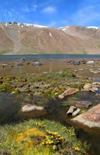
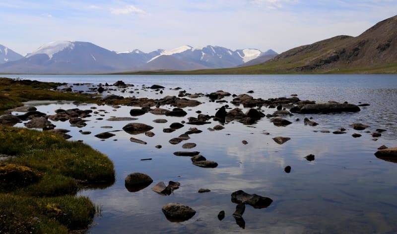
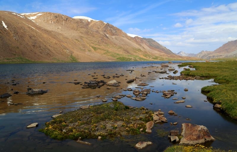
Lake Central Dzhashyl-Kel.
Trip to Arabel lakes from Bishkek.
"Life is beautiful when you travel."
Arabel lakes in ridge Terkskey Ala-Too.
The flowing, fresh lake Central Dzhashyl-Kel is located at an altitude of 3779.1 meters above sea level, located 2.8 kilometers southeast of the Barskoon pass on the southern slope of the Terskey Ala-Too ridge in the Jety-Oguz district of the Issyk-Kul region.
A full-flowing stream flows from the Barskoon pass into the Barskoon lake, which then flows from the north-west into the Western Dzhashyl-Kel lake after 1.2 kilometers and then, after 200 meters, bypassing the swampy dam, flows into the Central Dzhashyl-Kel lake.
The Arabel-Su River, 41 kilometers long, flows out of the Central Dzhashyl-Kel Lake, which is one of the rivers of the headwaters of the Naryn River. The length of the lake from southeast to northwest is 2.1 kilometers, the largest width in the northwestern part of the lake is 522 meters.
The area of the lake is 0.9 square kilometers, the perimeter is 4.81 kilometers. The main filling of the lake comes from the river, which comes from the Western Dzhashyl-Kel Lake located at an altitude of 3779.1 meters above sea level, also from a glacier located on the northeastern slope of a mountain spur in the southwest of the lake.
The length of a small nameless glacier is 470 meters, the area is 0.16 and the perimeter is 1.86 kilometers. The lake is separated by a 200-meter swampy jumper from the neighboring lake West Dzhashyl-Kel. From Lake Central Dzhashyl-Kel to the south and southeast there is the Arabel valley with numerous syrt lakes.
To the east of the lake, 160 meters away, there is a road connecting the syrts of the Inner Tien-Shan with the Issyk-Kul valley, and a high-voltage power line. By road A 364 you can get to the Kumtor mine, the Karasai border outpost, the Uchkoshkon deposit, and through the Ashu-Suu pass you can get to the Uzengegush river valley.
At 8.6 kilometers to the south-west of the pass is the dominant mountain Chymchyk with a height of 4467.2 meters above sea level.
Geographical coordinates of lake Central Dzhashyl-Kel: N41°52'04.80" E77°43'47.81"


Authority and photos by
Alexander Petrov.