







You are here
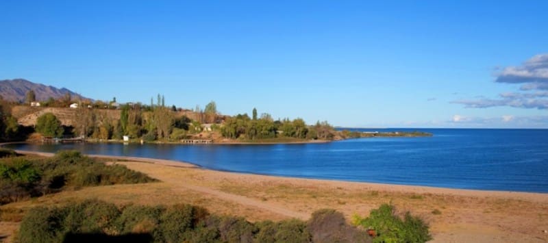
Lake Issyk-Kul and its shores.
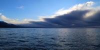
Sights of Issyk-Kul Basin.
"June 15"...reached the very shore of Issyk-Kul east of Kyzyl-Su Bay. On the coastal strip, one could find everything that the lake's waves... washed up on its shores... On this very coast, shortly before my journey, the goddesses discovered a very ancient copper cauldron, large in shape and decoration, and several copper tools, apparently from the Bronze Age... (Among other exhibits from Semirechye, archaeological antiquities from Issyk-Kul were brought to the Paris World's Fair in 1900, and P.P. Semenov was extremely interested in "where a certain cauldron found on the shores of Issyk-Kul is currently located and whether it could be obtained for the exhibition?"
P.P. Semenov-Tyan-Shansky. "Journey to the Tien Shan." 1856-1857.
Journey around Lake Issyk-Kul.
Issyk-Kul Basin is part of the Northern Tien Shan (Kyrgyzstan) geographic province, located on Sukhumi-Batumi latitude and an altitude of 1,608 m (the level of Lake Issyk-Kul). The lake basin extends 240 km from west to east and is approximately 75 km wide at the meridian of the village of Tossor.
Lake Issyk-Kul is tectonic in origin, formed as a result of faults, normal faults, and depressions in the earth's surface; a large part of it sank and filled with water, while adjacent areas rose to 3,000-3,500 m above sea level and formed the Terskey-Alatau mountain range (Turkic:
"Motley mountains facing away from the sun") to the south and the Kungey-Alatau ("Motley mountains facing the sun") to the north of the lake. To the east, the basin is enclosed by the isolated Chaar-Dzhon (2,722 m) and Ala-Bel, and to the west, Kara-Koo and Kizyl-Ompol.
The mountainous setting of Issyk-Kul turns into the narrow Boom Gorge in the west, through which the Chu River flows. The Chu River is only 4 km short of Issyk-Kul, but is connected to it by the Kutemaldy Channel, through which it sometimes discharges water during floods.
Issyk-Kul is 182 km long, 58 km wide at its widest point, with an average depth of 280 m and a maximum of 702 m (approximately in the middle of the lake, closer to the southern shore). Its area is 6,206 square kilometers. Among the world's lakes located at an altitude of over 1,200 m, Issyk-Kul ranks second, only slightly behind Lake Titicaca in South America in surface area, and first in depth and water volume.
Issyk-Kul ranks seventh in area. Among the CIS lakes, it is the third deepest (after Lake Baikal and the Caspian Sea), and its water volume (1,732 cubic kilometers) is 1.7 times greater than that of Lake Balkhash. Issyk-Kul has no outflow, making its water brackish, but its salinity is insignificant, almost half that of the Aral Sea.
The water is dark blue, greenish near the shore, and exceptionally clear. Visibility in the central part of the lake averages 15 meters, reaching 20.4 meters in September, and decreases to 5-10 meters closer to the shore. Sunlight penetrates so deeply into the clear water that algae in Issyk-Kul grow at depths of up to 70 meters. It is not recommended to regularly use the lake water for drinking or cooking, as it contains harmful fluoride salts, which cause tooth decay.
The surface water temperature during the coldest months Winter temperatures never drop below 3-4°C, preventing the open part of the lake from freezing; only shallow bays and a narrow coastal zone in some areas are covered with a thin crust of ice.
Perhaps this feature of the lake, or the presence of hot mineral springs along its shores, is responsible for the lake's name (Turkic for "Hot Lake"). In summer, the surface layers warm up from 18-23°C to 29-30°C. From a depth of 200 meters to the very bottom, the temperature remains constant at 4.3°C.
The 587-km-long coastline of Issyk-Kul is leveled and slightly indented; in the eastern part of the lake are two significant estuaries-Tyupsky and Dzhergalansky-and in the southeast is Pokrovsky Bay near the village of the same name.
Topography of Issyk-Kul Basin.
In The Issyk-Kul Basin is characterized by flat, foothill, and mountainous terrain. The lake is bordered by a coastal strip of typical foothill plain, composed of river and lake sediments; boulders, crushed rock, pebbles, and gravel predominate in the west. The basin is dominated by clay and sand in the east.
The plain borders the steep, dissected slopes of mountain ranges, with the exception of the eastern and southwestern parts of the basin, where the plain is separated from the high watershed ridges by strips of foothills. The width of the foothill plain does not exceed a few kilometers; it reaches its greatest development in the east of Issyk-Kul in the Jergalan River valley (the plain's valley is 70 km long) and the Tyup valley, indented by tributaries and branches (the plain is 50 km long and 20 km wide at the mouth).
The lakeside plain gives way to foothills (adyrs) as it approaches the mountains. Sometimes the foothills appear as isolated elevations, rising 300-1100 m above the plain, and on average 700 m. They are composed of loose sediments and intersected by river valleys and sais (dry riverbeds).
The largest elevations are Chaar-Dzhon (2,722 m), Chon-Tosma (2,382 m), Kara-Beltek (2,668 m), Belbulak and Dzhanbulak (2,364 m), Kara-Kungey (2,653 m), and others. The southern shoreline of Lake Issyk-Kul, especially on the southern coast, is so close to the foothills of the Terskey Alatau Mountains in places that the lake's waters wash the foothills of the Kizyl-Chokdu, Kizyl-Eshme, and Bozbeshik adyrs.
Vegetation around Lake Issyk-Kul.
Along the Issyk-Kul coast, up to and including the foothills, at an altitude of 1,630-1,850 m, there is a zone of flat-foothill desert (in the west) and semi-desert (in the east), while at an altitude of 1,850-2,100 m, there is a foothill-mid-mountain steppe zone.
At the entrance to the Issyk-Kul Basin from the Boom Gorge, a rather monotonous scene unfolds: the blue waters of the lake are bordered by a narrow strip of meadows, beyond which stretches a waterless, stony desert. Precipitation here is only 110 mm per year.
The sparse wormwood-saltwort-fescue vegetation is barely noticeable. Only tall, vigorous bushes of chia (sand oats) stand out in sharp contrast against the lifeless desert backdrop. The extensive, deep root system of the chia plant allows it to draw nutrients and moisture from the poor, gravelly desert soils and even from shifting sands.
Only near the mouths of mountain valleys, on stream-fed alluvial fans, do meadows and sometimes even crops grow green. As precipitation increases eastward, the coastal desert zone narrows further and gives way to dry steppes occupying the plains and foothills.
Here, on poor brown soils, and less commonly on sierozem soils, grow tussock grasses such as feather grass, fescue, and sable grass, as well as milkvetches and such dry-loving plants as wormwood subshrubs, teresken, tansy, and prickly caragana.
In the eastern Issyk-Kul Basin, dark chestnut steppe soils are widely cultivated for rainfed (non-irrigated) agriculture; in the remaining coastal area, they are used for grazing livestock, primarily sheep.
Fauna of Issyk-Kul Basin
The fauna of the Issyk-Kul Basin, especially in its mountainous zone, is rich and diverse. The western desert part of the basin is inhabited by typical desert fauna such as the Eurasian jerboa and the tamarisk gerbil, while in the southwest, even the slender, thin-legged goitered gazelle has survived.
In the eastern part of the basin, the relict Tien Shan ground squirrel reaches the lower forest line. House sparrows, the paler Spanish sparrow, and turtle doves are found in populated areas. Rooks, starlings, and hoopoes are found near settlements.
Pheasants inhabit the dense thickets of sea buckthorn and reeds along the coast. Voles damage crops in the foothills, and the small Central Asian tolai hare and gray hamster are also found here. Birds such as the Isabelline wheatear, Black redstart, Buchanan's bunting, and Egyptian vultures are common in the foothill steppes.
The ice-free waters of Lake Issyk-Kul, primarily in its western corner, are home to up to 50,000 different ducks (primarily red-crested pochards), coots, teals, and graylag geese, as well as about 850 mute and whooper swans. These rare, beautiful birds are only permitted to be captured for zoos.
In 1944, a muskrat was released into Lake Issyk-Kul; It quickly acclimatized and colonized Pokrovsky Bay, several other vegetated shallow bays, and river estuaries. Currently, approximately 70,000 muskrat pelts are harvested annually in Kyrgyzstan and comparatively recently, in the Tertiary and Quaternary periods.
Massive granites and diorites of the Terskey and Kungey ranges remain from the Paleozoic intrusion of magma into the Earth's crust; the cores of these ranges are composed of ancient (Precambrian and Lower Paleozoic) deeply metamorphosed (altered) rocks: gneisses, marbles, quartzites, and crystalline schists.
Orography of Issyk-Kul Basin.
The Terskey-Alatau range is characterized by a deeply dissected alpine relief with modern glaciation and relative altitude ranges of over 1000 m. The range is asymmetrical: it has a short, gentle southern slope and a long northern slope. Dissected by deeply incised gorges, the northern slope descends in giant steps to Issyk-Kul.
The crest of the ridge is slightly dissected, with flat surfaces sloping southward, in places blending imperceptibly into the southern slope. The highest central part of the ridge is between the Barskaun and Turgen-Aksu gorges, the highest point being Karakol Peak (5280 m) in the upper reaches of the Ontor, the left source of the Karakol.
The passes located here (from west to east) include Barskaun, Dzhuuk, Kashkasu, Dzhukuchak, Ashutor, Karakol, Festivalny, Chon-Ashu, and the most significant tracts of spruce forest. The western part of Terskey is very rugged, with many saddles and relatively low passes, but few glaciers and rivers.
The northern slope is heavily dissected by longitudinal valleys into a system of short, low ridges. The extreme western part of the ridge is devoid of vegetation due to low precipitation. Between the gorges of the Akgerek and Ton rivers, massive granite outcrops are observed in the lateral spurs. Particularly powerful mountain-building processes occurred during the Neogene and Quaternary periods, when the earth's crust was folded.
These tectonic movements of the Alpine folding formed the modern high-mountain terrain of Terskey and Kungey, as well as the lake basin. Mountain-building processes in Terskey and Kungey continue today, resulting in earthquakes in the eastern part of the Issyk-Kul Basin, accompanied by rockfalls and landslides.
Earthquakes measuring up to 11 points were recorded in the lake area in 1887, 1889, and 1911. Hot mineral springs are found along the zone of deep tectonic disturbances in the Aksu and Jetyoguz gorges. Modern mountain-building processes are accompanied by the uplift of the western part of Issyk-Kul, resulting in ancient river deltas on the western and northern shores rising to form long capes and peninsulas extending far into the lake near the river mouths. Conversely, the eastern shores are subsiding, leading to the flooding of the Tyup and Dzhergalan estuaries and the formation of the bays of the same name.
From a boat, and sometimes even from the eastern shore of Issyk-Kul, as well as on the southern shore near the mouth of the Ton River, the outlines of submerged villages, stone buildings, and monuments are visible, giving rise to legends of a sunken city, a kind of frozen city of Kitezh, frozen in the depths.
East of the Turgen-Aksu Gorge, the ridge is less than 4,000 meters high, rising above 4,000 meters only in the far east, near the Semenov Glacier. There are many relatively low passes here: Ichketash, Mintor, Kash-kator, Ashutor, and others.
During the Ice Age, the valleys and slopes of the Terskey-Alatau ridges were twice covered by powerful ice flows. The valleys, now occupied by spruce forests, were then covered by ice up to 400-500 meters thick. The glaciers descended to 2,200-2,500 meters and were 20-26 kilometers long.
Along the southern slope of the Terskey-Alatau, on the Alabel and Kumtor syrts, there likely lay a huge, wide glacier, occupying the entire valley; only a few peaks of the ridge remained. Traces of ancient glaciation remain in the form of troughs-widened, trough-shaped valleys with smoothed sides and clusters of moraines.
Climate of Issyk-Kul Basin.
The moderate continental climate of the Issyk-Kul Basin-the mildest in Central Asia-is due to the influence of the ice-free Issyk-Kul Lake. The lake raises the air temperature in January by approximately 10 degrees, resulting in a cool summer, unusual for Central Asia: the average monthly temperature in July and August in Przhevalsk (1,774 m) is 16.5-16.9 degrees, in Jetyoguz (2,300 m) 13.9-14.2 degrees, in the Chon-Kzylsu gorge near the physical-geographical station (2,555 m), 9.5-9.7 degrees, and in the highlands, near the tongue of the Karabatkak glacier (3,250 m), 6-6.2 degrees.
On the southern coast, vegetables and fruits ripen a month later than in Frunze and the Chui Valley; the earliest fruits-apricots and plums-appear on the market in late August, and the first tomatoes only in September. In a cool summer, cloudless weather prevails: in June and August in Przhevalsk there are 300-320 hours of sunshine, or 67-70% of the possible, but in the mid-mountain region - in Chon-Kzylsu (2555 m) - 190-240 hours.
Intense solar radiation is caused by the sun's high position: 70-72' on the summer solstice and 23' on the winter solstice. Precipitation in the mountains of Central Asia is largely due to westerly winds. At first glance, it seems surprising that air currents originating in the Atlantic Ocean, after traveling many thousands of kilometers and overcoming the sultry deserts of Central Asia, carry ocean moisture to the Tien-Shan, thereby significantly determining the weather patterns in the Tien Shan mountains.
After passing through the Boom Gorge, the air expands in the Issyk-Kul Basin, dries dynamically, and takes on the character of a foehn wind. Passing over the surface of the lake, the air masses are again saturated with moisture from the lake's evaporation, and upon entering the eastern part of the lake, which is favorable for moisture condensation, they form precipitation, primarily during the warm season.
Due to these characteristics, precipitation in the lake basin increases from west to east: 115 mm per year in the western part (Rybachye), 200-250 mm in the central part (Bokonbaevskoye, Cholpon-Ata), 415 mm in the eastern part (Przhevapsk), and 570-676 mm near the Kungey-Apatau ridge (Kurmenty, Tyup).
Winds in Issyk-Kul Basin.
The predominant wind in the Issyk-Kul Basin (60%) is a warm and dry westerly wind coming through the Boom Gorge and known locally as "ulan" or "boom." The cold easterly wind, "santash," sometimes meets over the lake with a westerly wind, causing the formation of waterspouts.
Coastal winds-breezes-are common here: during the day, they blow from the lake to the shore (known locally as the "sea wind"), and at night, from the shore to the water (called the "gornyak"). The same wind direction changes in the mountain gorges.
A sharp evening breeze raises high waves, as if at sea in bad weather, and a boat caught in the wind can be tossed about until morning, as oars are useless. In the village of Pokrovka on the southern shore of Issyk-Kul, tomatoes appear only in September, and early fruits like apricots and plums ripen only in late August.
Grapes and cotton are not grown here: they lack warmth. This is all a result of the Issyk-Kul basin's high altitude. The position of Pokrovka and the lake's southern shore, open to the north, also plays a role. The surface of Issyk-Kul is not always calm and quiet.
Fishermen say the lake's enticing distance can be treacherous and capricious. Breezes are the usual winds on Issyk-Kul. During the day, they blow from the lake to the shore, and at night, in the opposite direction-from the land to the lake. In the local dialect, the daytime wind is called a sea wind, and the nighttime wind is called a miner.
The prevailing winds on Issyk-Kul are westerly, blowing parallel to the lake's long axis. They bring moisture to the eastern shore, where much more rain falls than in the dry west. The calm surface of Issyk-Kul changes in five to ten minutes under the influence of a sharp evening breeze.
The waves roll like those on the sea in bad weather, and the fishing boat is irresistibly carried toward the center of the lake. Oars are then useless. The boat will be tossed and tossed until morning, and if it survives, the exhausted fisherman will survive.
It reaches the shore. For its capriciousness, its storms, and its frequent gales, local elders call Issyk-Kul the Kyrgyz Sea. Winds are common here. Fishermen name them after the geographical locations from which the wind blows. A sudden, strong wind from the west is called an ulan, while one blowing from the east is called a santas, named after the mountain pass east of the lake.
The Boam Gorge, from which the ulan blows, is called the Ulan Gorge by locals. In 1927, the motor ship "Progress Kirgizstana" experienced the effects of a powerful ulan. One winter evening, a severe storm raged on the lake. The motor ship battled the storm for a whole day, finally sheltering in one of the bays and wisely waiting for the storm to pass.
That same year, during a storm, the ship's helmsman was swept away by a wave.
Geographic coordinates of Lake Issyk-Kul: N42°26'17 E77°09'30



Authority:
https://issykul.kg/index.php?option=com_content&view=article&id=22&Itemid=35
"Years of Searching in Asia." E. Murzaev. 1950.
Photos by:
Alexander Petrov.