


![]()
You are here
Markakol nature reserve.
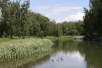
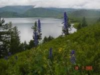
Sights of reserve Markakol.
"Lake Marka-Kul is located on the southern side of the Great Altai, covered with eternal snow, which gives it a grandiose and majestic appearance in this place. The abundance of snow on this ridge gives a lot of water, which flows through streams into Marka from its northern side. On the western side of the lake are the Kurchum Mountains with the main peak Sary-tau, also covered with snow. From the south stretch the Azu Mountains, insignificant in size, and therefore covered to the tops with larch (Pinus Ledebouri), and the trees come right up to the lake. In the southeast, the snowy peaks of Tarbagatai are visible, as well as the Saur and Monrak ridges, completely covered with snow all summer. Thus, Marka-Kul is surrounded on all sides by mountains and its shores are quite steep, except for the western shore, where the Kurchum Mountains are pushed back and form a hummocky lowland, partly overgrown with forest."
A. Suvortsev. "Fishing on Lake Marka-Kul". Bulletin of the fishing industry. 1888.
Markakol nature reserve Tours.
State institution "Markakol State Nature Reserve" (hereinafter MGNZ) is located on territory within Markakol depression in Markakol district of East Kazakhstan region.
The central estate of the MGNZ is located in the village of Urunkhaika. The area of the reserve as of January 1, 2006 is 75,040 hectares. A two-kilometer protected zone with an area of 34,000 hectares has been allocated around the Markakol Reserve.
The highest point of the MGPZ is Mount Aksu-Bas - 3304 m. a. s. l. The Markakol Reserve includes three sections: lake, northern mountain-forest, and southern mountain-forest. The lake section covers the entire water area of Lake Markakol.
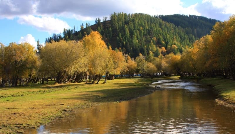
The northern mountain-forest section includes the lower reaches of the Zhirenka River, almost the entire catchment area of the Topolevka River, high-mountain sections of the Kurchum Range, covering the sources of the Akbulak, Maralenok, Sorvenok rivers, and part of the sources of the Tau-Tekeli River.
In administrative and economic terms, the border of the northern mountain-forest section from the north and northeast runs along the border with the State Institution "Markakol State Institution for the Protection of Forests and Wildlife" (former Markakol Forestry), then from the north and northwest - with the lands of the State Land Reserve.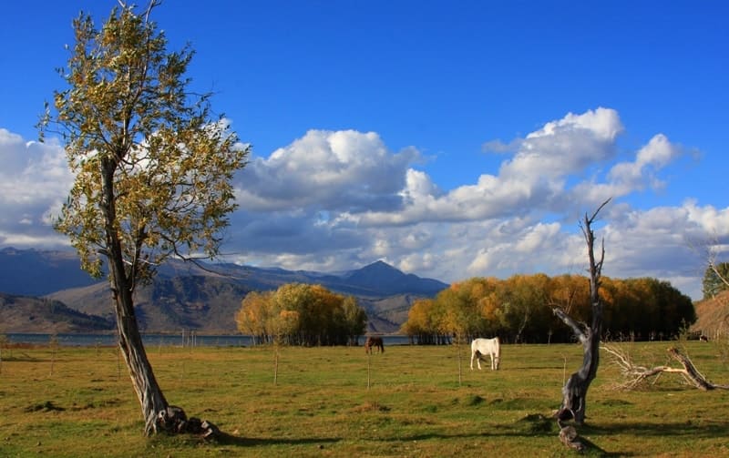
The southern mountain forest area includes the northern macroslope of the Azutau ridge from Zhukova apiary to the Turbaza, including watershed areas. In administrative and economic terms, the border of the southern mountain forest area runs along the southeastern shore of Lake Markakol to the southwest along the border with the State Institution "Markakol State Institution for the Protection of Forests and Wildlife", then along the border with the lands of the State Land Reserve.
The Markakol Nature Reserve is located 250 kilometers east of the village of Kurchum and 500 kilometers southeast of the city of Ust-Kamenogorsk. From Astana to Ust-Kamenogorsk you can fly (about 2 hours), take a regular bus (23 hours) or drive a car.
Then there are two possible ways to arrive by car to the Markakol Nature Reserve. The first: from Ust-Kamenogorsk to the village of Urunkhayka through the village of Kurchum with a crossing over the Bukhtarma reservoir. This option is used more often than the next one due to its greater seasonal availability.
The second: from Ust-Kamenogorsk through the village of Katon-Karagay with overcoming the Alatay pass and further to the village of Urunkhayka. It should be noted that the Ust-Kamenogorsk - Kurchum highway is of good quality, the next section Kurchum - Terekty (Markakol) is of poor quality, and the dirt road Terekty - Urunkhayka has sections of varying passability and quality: in the spring-autumn period and the period of prolonged summer rains, long sections of the road are often heavily washed out.
In the summer dry time, washed out rocky sections are difficult to pass, in winter, often during heavy snowfalls, the highway is generally closed in several places. On the way from Terekty to Urunkhayka, you need to climb the Mramorny Pass (1,371 meters above sea level), along which there is a serpentine road with sharp turns.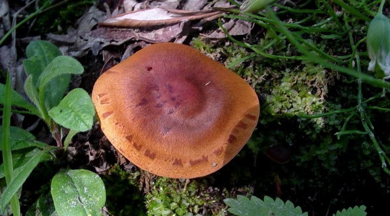
The difference in altitude is 746 meters, which can create a danger of overheating the car in the hot summer. The Ust-Kamenogorsk - Katon-Karagay highway is distinguished by its good quality throughout its entire length. The section of the road from Katon-Karagay to Urunkhayka is a mountain dirt road, passable only in the dry summer season.
For both options for access to the Markakol Nature Reserve, there is also the same seasonal inaccessibility of the crossing section across the Bukhtarma Reservoir during the instability of the ice cover in the spring (late March - late April) and autumn (late November - mid-December).
There are ways to bypass this obstacle through the city of Zaysan and further - the village of Terekty, where part of the the highway from Ust-Kamenogorsk to Zaysan is of good quality, further on - of poor quality. Thus, provided that the summer weather is good, the journey from Ust-Kamenogorsk to Urunkhaika can be covered in 8-10 hours in a medium-capacity passenger car. Legal status and history of creation.
The Markakol State Nature Reserve was organized by the Resolution of the Council of Ministers of the Kazakh SSR No. 365 of August 4, 1976 on an area of 71,367 hectares for the preservation and study of natural complexes of the southern part of Altai, the development of methods for restoring the biocenoses of the black taiga, and the study of the ecology and dynamics of the fish population of the unique reservoir of Lake Markakol.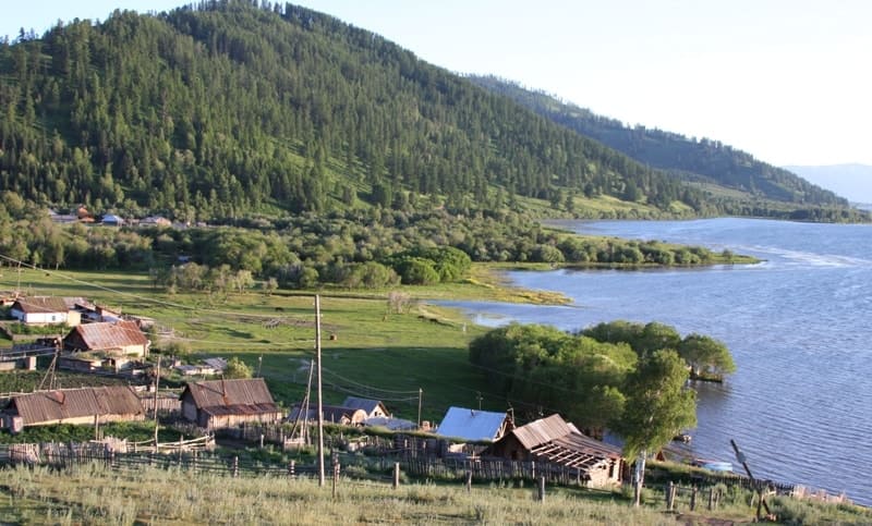
Initially, the area of the reserve was 71,367 hectares, of which 26,917 hectares were on land, and 43,900 hectares were on the water area of the lake and some of the watercourses flowing into it. In 1988, according to the Resolution of the Council of Ministers of the Kazakh SSR No. 5 of January 6, 1988, the eastern and north-eastern parts of Lake Markakol from Zhukov Spring to the Tikhushka River, as well as the middle reaches of the Topolyovka River, were added to the reserve.
Thus, the entire water area of the lake became a reserve. Currently, the total area of the reserve is 75,040 hectares, which is 63.4% of the territory of the Markakol Basin. More than half (61%) of the reserve territory is in the water area of the lake.
The reserve is divided into three sections, occupying the entire water area of Lake Markakol, the south-eastern coast and the northern slopes of the Azutau ridge, the valleys of the Topolyovka and Zhirenka rivers, part of the watershed of the Kurchum ridge between the upper reaches of the Topolyovka and Tau-Tekeli.
Currently, the reserve has the status of a state institution. Its full name is the State Institution "Markakol State Nature Reserve". The history of the reserve has several dramatic moments, mainly related to the preservation of Markakol fish stocks, which was the main reason for the creation of this specially protected natural area.
At the end of the XIXth century, permanent settlements appeared on the shores of the lake, for the inhabitants of which one of the main activities was fishing. For the most part, two types of commercial fish were caught - lenok (Brachymystax lenok) and grayling (Thymallus arcticus).
Fish was harvested not only for personal consumption, but also for export to remote regions. According to eyewitnesses, intensive fishing led to the depletion of fish stocks already in the first third of the 20th century. The size of the catch reached 1,500 tons.
Later, during collectivization in the 1930s and the Great Patriotic War (1941-1945), the fishing pressure dropped and consumption was carried out only for the subsistence of the population near the lake. In the post-war years until the creation of the Markakol State Nature Reserve in 1976, commercial fishing for lenok and grayling was poorly developed due to various reasons, and the size of the seizure did not exceed 60 - 70 tons.
Since the mid-1960s, amateur fishing has been developing intensively. Poaching was carried out mainly during the spawning period. Both amateur fishing and poaching were aimed at subsistence of the local population: the fish were used for food and for natural exchange with residents of nearby villages.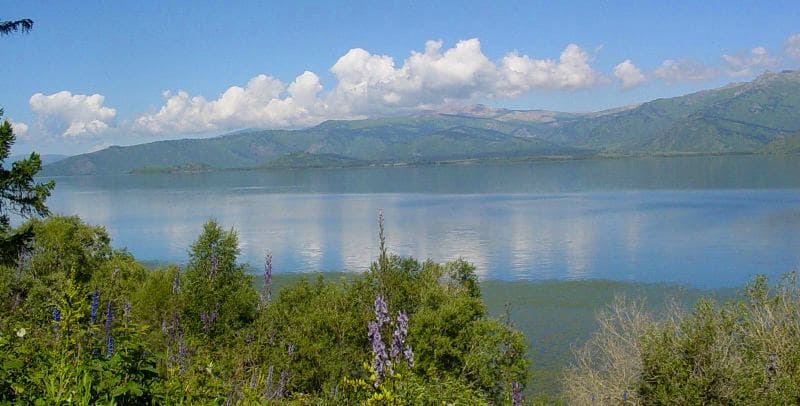
In general, the total size of the fishery in these years can be estimated at 120-150 tons per year (Development..., 2005). In 1981, 1983 and 1985, in violation of the reserve regime, state fishing for lenok and grayling during the spawning period was carried out throughout the water area of Lake Markakol.
In 1981, about 300 tons of fish were seized, in the other two years 60 and 90 tons, respectively. In 1981, the fishery was first organized with a fine-mesh (20 mm) fixed seine. Juvenile lenok and grayling were found dead in the meshes of the seine.
In addition to the enormous damage to the lake's fish stocks, the fishery discredited the idea of the reserve in the eyes of the local population for many years. In 1986, thanks to the efforts of the reserve workers, the fishery was stopped. It is noteworthy that the local population was divided in its opinions in approximately the following ratio: 30% were for further fishing, 70% were against.
The opponents of the fishery justified their position by the fact that "there was significantly less fish" and it became difficult to access for amateur fishermen. n order to prevent further attempts by fishing organizations and local authorities to achieve fishery on the lake, in 1988 a small part of the lake's water area, previously not covered by the reserve regime (4% of the lake's area), was included in the reserve.
However, the corresponding Resolution of the Council of Ministers of the Kazakh SSR did not provide for amateur and sport fishing on the lake, the preservation of which was justified by the reserve's employees. In the early 90s of the XXth century, due to the onset of mass unemployment, the devaluation of money and the shortage of almost all types of essential goods, fish and its derivative - caviar - on Markakol became a kind of measure of moral and material values.
It was during this period that the phenomenon of gutting fish for caviar and then throwing away the carcasses first became widespread and characteristic of Markakol. Dozens of tons of gutted fish were rotting in secluded corners of the lake shore.
In all coastal villages and in some other settlements near the lake, fish and caviar collection and exchange points were opened. The Markakol Reserve could not resist the massive and daily poaching of fish. Only in 1993, on the initiative and through the efforts of the Markakol Reserve, a subordinate act of the Ecology Committee was developed and adopted, giving the right to residents of coastal villages on a limited area of Lake Markakol to conduct
But by this time, the practice of general poaching had already developed, and the opinion of impunity for violations of the reserve regime had become established in the public consciousness. During 1993-1997. The efforts of the Markakol State Nature Reserve were aimed at regulating amateur fishing by localizing it in specially designated areas and limiting its volume in accordance with the developed Regulation on Amateur Fishing.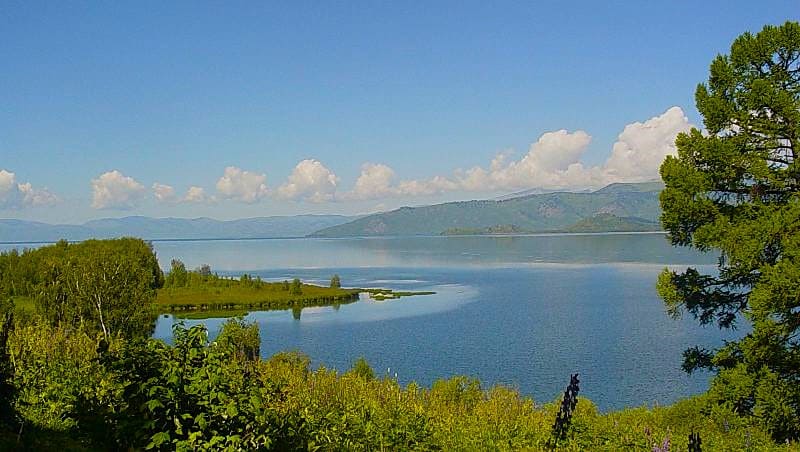
During this period, with the support of the UNESCO Man and Biosphere program, a model for regulating fisheries on Lake Markakol was developed (Baimukanov, 1994; 1996). According to the model, the leading role in regulating relations between the reserve and the local population was assigned to a public organization, which was supposed to accept fish from the population, monitor the volume of fish caught and assist the reserve in financing its main activities.
In general, the implementation of public control, the involvement of local residents in the process of managing fish populations should have formed an environmental worldview among local residents. The foundations were laid for involving the local population in the joint management of the Markakol State Nature Reserve, and the formation of traditions of sustainable nature management.
The local community was to participate in monitoring the size of the fish harvest from Lake Markakol and in protecting fish resources. In general, a worldview was to be formed that it is the local community that is responsible for the conservation and rational use of fish resources.
In 1997, the Law of the Republic of Kazakhstan "On Specially Protected Natural Areas" was passed, according to Article 35 of which fishing in the territory of reserves was prohibited. The Committee for Forestry, Fishing and Hunting, which was in charge of the reserve, could not independently decide on the use of part of the water area for limited economic purposes, since Article 33, paragraph 2 allows this to be done only with the permission of the Government of the Republic of Kazakhstan.
Thus, the Markakol State Nature Reserve received only temporary permits for fishing for 3 years. Only in 2001 were amendments made to the legislation (Law of the Republic of Kazakhstan "On Specially Protected Natural Areas" dated 23.01.01 N 151-II), according to which Article 37 states that: "... In state nature reserves, in specially designated areas that do not include particularly valuable ecological systems and objects, sport and amateur fishing is permitted in the manner established by the authorized body."
Three areas were designated - the north-eastern end of the lake with an area of 1,550 hectares, an area near the village of Matabay (200 hectares), near the villages of Verkhnyaya and Nizhnyaya Yelovka (400 hectares). Currently, sport and amateur fishing is carried out in these areas throughout the year, excluding the period from May 1 to July 1, control over which is assigned to the Markakolsky Reserve.
Geographic coordinates of Markakol National Nature Reserve: N48°44'22 E85°44'53
Authority:
Tatiana Rafailovna Utyasheva. "Nature Reserves of Kazakhstan and Central Asia". Materials of the IUCN project "Assessment of the Management Effectiveness of Nature Reserves in Central Asia and Kazakhstan". Project Manager: Roman Yashchenko (Kazakhstan).
National consultants: Ogulsoltan Ashirova (Turkmenistan), Venera Surappaeva (Kyrgyzstan), Alexander Kreitsberg (Uzbekistan) Kokul Kasirov (Tajikistan) International Union for Conservation of Nature IUCN - The World Conservation Union. Almaty, Kazakhstan, 2006
Photos by:
Alexander Petrov.