


![]()
You are here
Narrow-gauge road from Tuchik to Sarytash pier.

Trip from Aktau to Tupkaragan peninsula.
“The farther, the easier it is for modern technology to turn fictions and conjectures, fantasies and hypotheses into reality, arming a person in his struggle for life”
Maksim Gorky.
Sights of the Tupkaragan peninsula.
The development of coal deposits in Mangyshlak began in 1939. Soviet geologists have identified coal reserves in the vicinity of the village of Tauchik, there were not so many, about 100 million tons. The Taushyk settlement is located in the Tupkaragan district of the Mangistau region in the northeast of the Mangyshlak peninsula.
This is the administrative center and the only settlement in the Taushyk rural district, located about 88 kilometers southeast of the city of Fort Shevchenko and north of the city of Aktau. Taushyk village is located at an altitude of 70 metro above sea level.
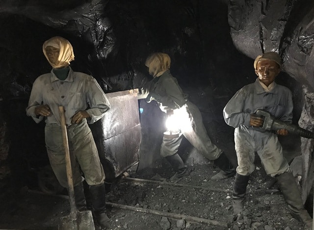
Coal mines were located 2 - 3 kilometers west of the village of Taushyk. In the spring of 1939, the construction of coal mines began. It was planned to build more than ten types of different mines and by 1943 to bring coal production to one million tons per year.
The main consumers of coal were the Caspian and Volga shipping companies. In the vicinity of the village of Taushyk, six brown coal mines were built. For coal mining, skilled miners were needed. The Soviet government evacuated from the western regions of the Soviet Union, in particular from Donbass, about 900 workers related to coal mining.
A small pier Sarytash was built, which was located on the southern coast of the Gulf of Sarytash. At this time, an embankment of large stones has been laid to the pier, on both sides of the embankment, among the stones this place was chosen by a large number of bull-calves, this is already water (Natrix tessellata).
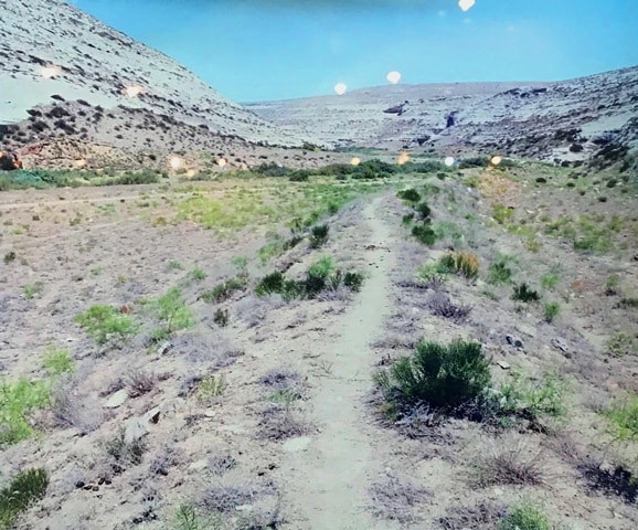
Now the berth is not working (2019). In the late 30s and early 40s of the last century, a narrow-gauge railway with a length of 26 kilometers was laid to the pier. Coal was transported from the mines in the vicinity of the Taushyk settlement along the narrow gauge railway.
Only 11 kilometers of this road were laid along the plain and the shore of the southern part of Sarytash Bay, the remaining 16 kilometers were laid along the Kumakapa River. From coal mines to the Donspan building, coal was transported by carts and trucks, the length of the road was about 5 kilometers.
It should be noted that the narrow gauge road was laid to the Donspan building in the Taushyk tract, which is located 5 kilometers northwest of the Taushyk village. In late 1941, the construction of coal mines was completed.
The dynamics of growth in coal production in subsequent years, which were announced in the report of the Tupkaragan district party committee at the first district party conference in April 1944. In 1941, the planned indicators for coal production were fulfilled by 19.2%, and in 1942 - by 28%, and in 1943 - by 40.9%.
Many problems arose during coal mining at the Taushyk mines, for example, spontaneous combustion of the Taushyk coal and untimely export of coal. In 1941, coal mines were tasked with delivering 125,000 tons of coal “to the mountain”.
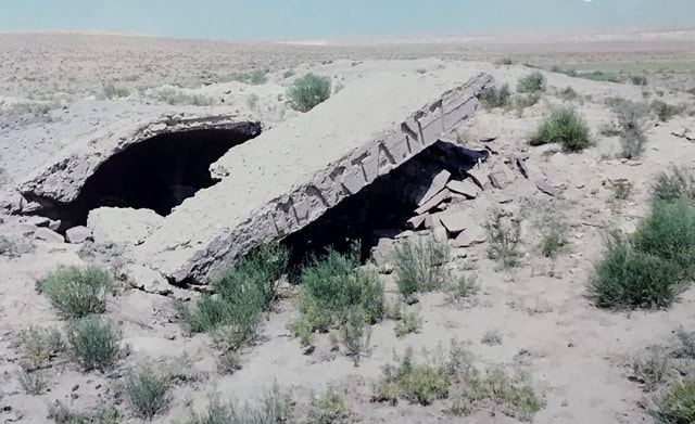
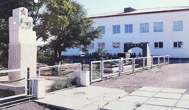
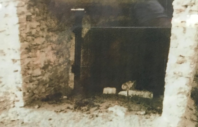
Extraction of the Taushyk brown ceased after the war, the mines were mothballed. At present, there is “Mine No. 2”, its mine tunnel goes underground, with a length of about 50 meters.
Authority
Alexander Petrov.
Photos by
from the museum of the history of the city of Aktau.