You are here
Nature of Kugitang.
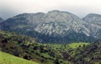
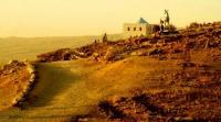
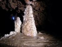

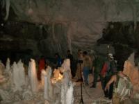
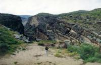
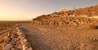
Sights of nature of Kugitang.
“Nature is an infinite sphere whose center is everywhere”
Ralph Waldo Emerson.
Tours by nature of Kugitang.
Kugitangtau (turkmen Köýtendag) - the ridge in a southwest part of Pamir-Alay, in the territory of Uzbekistan and Turkmenistan. Southern continuation of the ridge Baysuntau. The ridge stretches from the valley of Amu Darya to the gorge Sherabad for 100 kilometers.
The maximum height - 3139 meters above sea level, the Mount Aýrybaba. The ridge consists of sedimentary breeds, limestones and plaster. Manifestations of a karst are widespread. The prevailing landscapes the efemerovy semi-desert (in the foothills) and mountain subtropical steppes with bushes.
Almost at the border with Afghanistan, on the right coast of Amu-Darya the Gissar Range - one of the largest in system of Pamir-Alay comes to an end. Southeast rocky "cape" under the name of Kugitang, in translation is meant by "the mountain of canyons", from a watershed is divided between two states of Central Asia.
The western slope belongs to Turkmenistan, and east - to Uzbekistan. From the South, Kelifsky gate squeezing the mighty river in a narrow stream on the other side of which - Afghanistan. There is a convenient crossing.
It to use the first conquerors of Turan - Akhemenida and Alexander of Macedon. In 1986, the reserve was established in the mountains Kugitangtau. On the part of Turkmenistan, on the western slopes Kugitangtau organized Koytendag (formerly Kugitang) reserve (over 27 thousand. Ha).
The eastern border of which runs along the border (the ridge) with Uzbekistan and logically connected to Surkhan reserve, which in turn was established in that same year, and is already located in Uzbekistan - on the western slopes of the ridge Kugitangtau.
Surkhan Reserve in 1986 was established on the site of a pre-existing Kugitang goszakaznika (since 1970) and merged with Aral-Paygambar reserve (established in 1971) into a coherent whole - in Surkhan State Reserve.
It is true in the future island Aral-Paygambar was transferred to the Border Guard Service. Area Kugitang Surkhan reserve portion is more than 24 thousand. Ha. This joint position preserves the two neighboring countries has a positive effect in the protection of both animal and plant life, as well as many monuments of nature of the geological, botanical and historical and cultural character.
The territory of the reserve covers both medium and high belt of mountains. The highest point of hot Kugitangtau - Ayrybaba peak (3137 meters above sea level), Turkmenistan is called "Beyik Turkmenbasy". To the west of the ridge slopes Kugitangtau mostly flat, dissected by a variety of long and narrow canyons.
Thick layers of stacked, among which there is an extensive network of caves, of which the above mentioned. To the east - vertical rock cliffs, in some places up to 500 meters - they can be clearly seen from the Pashhurtskoy basin, is perceived as a grand bastion walls or the vast fortress.
To the foot of the steep ridge close fit midlands, gradually passing into the low mountains. The flora of the reserve is original. The total area of juniper forests is about 14 thousand. Hectares.
Authority:
joeandex 2016 http://orient-tracking.com


