


![]()
You are here
Peak Kazakhstan.
Climbing peak Kazakhstan.
"The risk must always be justified."
Vitaly Abalakov.
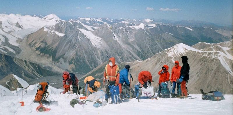
Climbing to summits of more than 6000 meters in Bayankol gorge.
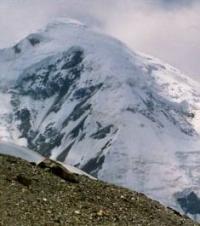
Peak Kazakhstan is located at an altitude of 5769 m. a. s. l., located in the main ridge of the Sarydzhaz ridge in the Narynkol district of the Almaty region. The top of Kazakhstan is located between the Bayankol peak, 5790 m. a. s. l. in the west, and Karlytau, 5550 m. a. s. l., in the east and slightly to the north.
Distance from peak Kazakhstan to peak Bayankol is 2.1 kilometers, to peak Karlytau is 1.2 kilometers. The jumpers between the peaks Bayankol and Kazakhstan, Kazakhstan and Karly Tau are inaccessible due to ice faults, the northeastern ridges leading from the peaks to the jumpers are also complex icefalls.
Short buttresses descend to the north from the peak of Kazakhstan. The first of them separates the upper reaches of the fourth branch of the glacier, and the second is located between the fourth and fifth branches of the Marble Wall glacier.
From the bridge between the peaks Kazakhstan and Bayankol, the northern ridge departs, delimiting the basins of the glaciers of the Mramornaya Wall and Bayankol.
On the northern slope of the Sarydzhaz ridge from Bayankol peak, the East Bayankol glacier descends with a length of 6.4 kilometers. To the south, along the western couloir from the peak of Kazakhstan, a glacier with a length of 4 kilometers descends, which at an altitude of 4329 m. a. s. l. connects with the North Inylchek glacier.
An ice-rocky ridge descends to the south from the summit. The top of the peak is ice-snowy. For 400 meters, the northern slope of the peak of Kazakhstan is rocky and then snow-ice. The tongue of the Eastern Bayankol glacier ends at an altitude of 3571 m. a. s. l., from here the sources of the Sarykoinou River begin.
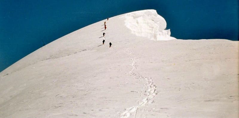
The difficulty category of the classic routes to Kazakhstan peak is rated at 4B, 5B. The first ascent to the top of Soviet Kazakhstan was carried out only in 1964 by members of the expedition of the Central Council of the Voluntary Sports Society "Burevestnik".
Geographic coordinates of peak Kazakhstan: N42 ° 16'55.79 "E80 ° 13'56.90"
Authority:
Boris Andreevich Studenin.
Kazakh Republican Council DSO "Spartak." Report on the traverse of the peaks Bayankol - Kazakhstan - Karly-tau - Marble wall. Summer, 1965. Alma-Ata. 1965 "
Alexander Petrov.
Photos by
Sergei Mikhalkov, Almaty city