


![]()
You are here
Peak Kyzyl-Asker.

Trip along river Aksu under peak Kyzyl-Asker.
"A series of six-thousanders opens with the westernmost of the peaks in this region - the grandiose Krasnoarmeyets peak, which we named so in 1934 because its outlines from afar really do resemble a soldier standing guard. At that time we tried to climb it. However, we managed to overcome only a small part of the first icefall, since the severe weather that broke out forced us to turn back."
"Central Tien-Shan". A. A. Letavet. 1937.
Ascension on peak Kyzyl-Asker.
Kyzyl-Asker Peak is 5842 meters above sea level, located on main ridge of western part of Kokshaal-Too Range, 28.3 kilometers to west and slightly south of Dankov Peak, 23.4 kilometers to south and slightly west of Kubyurgenty Pass in At-Bashinsky District of Naryn Region.
Kyzyl-Asker Peak is the second highest after Dankov Peak, 5982 meters above sea level, in the western part of the Kokshaal-Too Range. The Kyzyl-Asker Massif area is one of the main glaciation centers of Western Kokshaal-Too. Kyzyl-Asker Peak is located at the top of a spur that extends north from the main ridge of the Kokshaal-Too Range for 8.3 kilometers.
The spur ends at the southern shores of the Kyzyl-Asker East and West lakes. The rocky-ice spur, in the upper reaches of which the Kyzyl-Asker peak is located, divides the glacier of the same name into two branches: the Kyzyl-Asker East, 8.5 kilometers long, and the Kyzyl-Asker West, 8.9 kilometers long.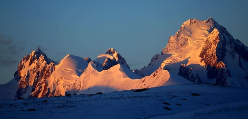
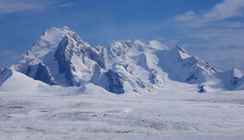
1.3 kilometers to the northwest is the Kyzyl-Asker East peak, 5,085 meters above sea level, located in the main ridge of the Kokshaal-Too ridge. 1.3 kilometers to the north and slightly to the east is the Kyzyl-Asker North peak, 5,413 meters above sea level, located in the main ridge of the Kokshaal-Too ridge, located in a mountain spur.
The peaks are composed of granite. To the south from the peak towards China, the Kechiksu glacier extends 6.8 kilometers. To the southwest, the peak ends in a rock-ice wall 3.8 kilometers long. The southeastern wall of the peak consists of monolithic granites.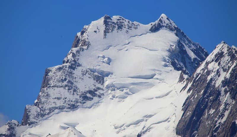
From the southern side, 7 rock-ice routes have been laid to the summit. The southeastern wall of the peak is made of strong, monolithic granites, with a difference in height of up to 1000 meters, the steepness of the slope up to 70 °. Currently, three different routes have been laid to the main wall: Odintsova, "War and Peace", "Spear" and "Ecuadorian", which passes along one of the eastern bastions.
History of conquest of Kyzyl-Asker peak in Western Kokshaal-Too ridge.
1934. August Letavet organizes an expedition to the Western Kokshaal-Too region consisting of four people, in addition to him and his wife, who participated in the previous expedition, the composition includes two young but experienced climbers, members of the tourist section of the Moscow House of Scientists - Mashkov and Maron (doctor).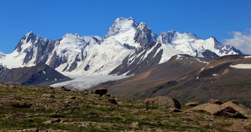
They make an attempt to climb the Kyzyl-Asker peak, but after two days of climbing the glacier, having fallen into bad weather, they realize that they cannot climb this peak on the move. The group refuses to continue the attempt and switches to exploring the area to the east of Kyzyl-Asker, wanting to reach the place where the Uzengi-Kuush river breaks through the Kokshaal-Too ridge.
1985. Climbing the northwestern wall, 6th category of difficulty. The first passage of the route as part of Kazbek Valiev, Yuri Moiseev, the city of Alma-Ata.
Geographical coordinates of peak Kyzyl-Asker: N41°01'25 E77°19'21
Authority and photos:
Alexander Petrov.