


![]()
You are here
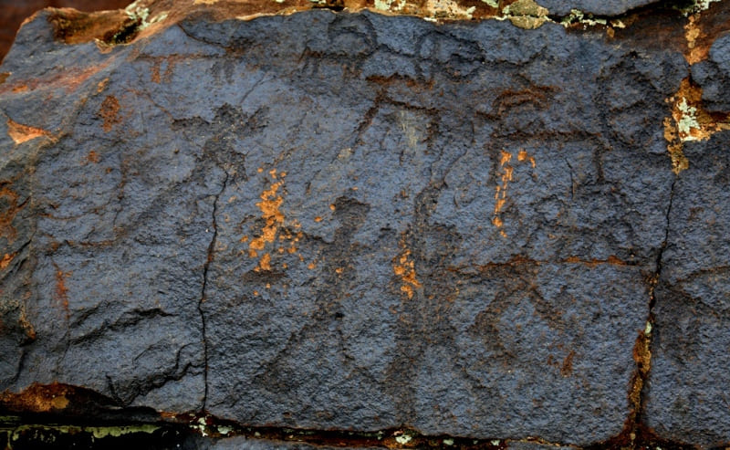
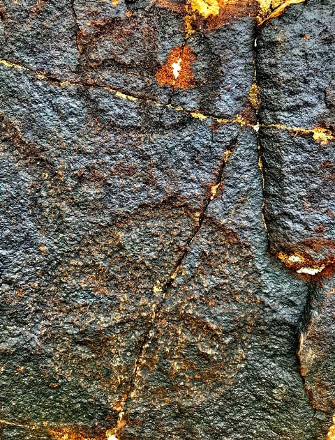
Petroglyphs of Boroldai.
Petroglyphs Bronze Age in mountains Karatau.
“The current state of the stones made such an impression on me that the signs on them have existed for at least a thousand years. The presented signs, in my opinion, do not belong to the Kalmyks, but to another people, which is the whole question”
Petr Ivanovich Komarov. 1904.
Petroglyph Tours of Boroldai.
Boraldai petroglyphs are located at an altitude of 500 m. a. s. l., located in western part of Boroldai tau ridge, which in turn is located in mountain system of Syrdarya Karatau ridge, 1.9 kilometers east of right bank of Boroldai River, 5.1 kilometers northeast of village of Terekty, 8.6 kilometers east and slightly south of village of Turakty, 17.1 kilometers northeast of village of Boroldai, on territory of the Baidibek district of Turkestan region.
The first report of cave paintings in the upper Boraldai River was in 1905 in the Turkestan Gazette. In 1904, these petroglyphs were examined by Pyotr Ivanovich Komarov. He learned about the "writing on the stones" from a local resident of Mold – Temir. P.I. Komarov examined the drawings together with Mr. F.S. Shpotin, who helped in copying drawings and signs.
Residents of neighboring villages believed that these drawings and letters were left by Kalmyks. Interestingly, Komarov immediately rejected this version. In a letter addressed to the Turkestan circle of lovers of archeology, he writes: “The current state of the stones has made such an impression on me that the signs on them have existed for at least a thousand years.
The given signs, in my opinion, do not belong to the Kalmyks, but to another people, which is the whole question.” Patina, formed under the influence of the sun, P.I. Komarov considered artificially made by man. He agreed with the message of local residents that the stones and rocks were smeared with a special compound that gave them a black color.
In 1904, Komarov and Shpotin examined the drawings of the main ridge of the sanctuary located on the hill between two streams flowing into the Boraldai River. In the 80s, the congestion of Boraldai petroglyphs was examined by M.K. Kadyrbaev and A.N. Maryashev.
They identified subjects of the Bronze Age, examined a number of cult subjects and their semantics. In 1986, Boraldai's petroglyphs were investigated by A.S. Mirzabaev. Based on the experience of previous studies of Karatau petroglyphs, he identified the main chronological framework and examined some issues of semantics of ancient drawings.
In 1995 and 1997, the petroglyphs were examined by employees of the Ordabasy historical and cultural reserve, the South Kazakhstan Museum of Local History and the archaeological expedition of South Kazakhstan State University named after M. Auezova.
In 2002, a report on the petroglyphs of the upper Boraldai River was published by A.S. Mirzabaev and D.S. Absemetova in the collection “Cultural Heritage of South Kazakhstan”. The message suggests the systematization of plots, examines Kazakh tamgas and their tribal affiliation.
The most complete examination and photofixation of petroglyphs in the upper Boraldai River was carried out by A.N. Grishchenko in 1989 - 2005 He discovered several new clusters of petroglyphs on the right bank of the river. In connection with the implementation of the State program “Cultural Heritage” in 2007, Boraldai petroglyphs were examined by a joint expedition of the Institute of Archeology of the Academy of Sciences of the Republic of Kazakhstan of the Republic of Kazakhstan and M.O. South Kazakhstan State University Auezov.
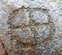
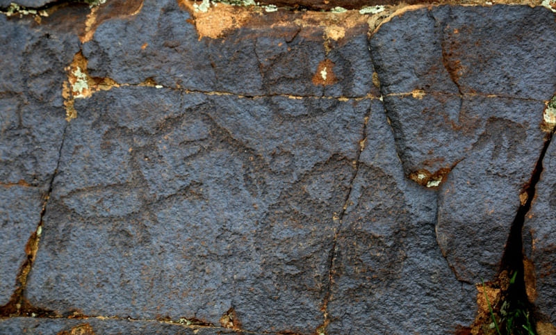
The result of recent expeditions was the publication of Boraldai's petroglyphs in a book in 2007. Petroglyphs are divided into two groups, one is located on the banks of the Boraldai River, the other is higher up the slope. The earliest drawings date back to the Bronze Age (two thousand years BC).
Much later, Kazakhstani archaeologists M.K. Kadyrbaev and A.K. Maryashev, analyzing the cave paintings of the Karatau of the Bronze Age, also touched the Boraldai monuments. In 1986, employees of the Kazprojectrestoration Institute discovered clusters of petroglyphs, where the total number of drawings approaches 300 drawings.
Their chronological framework is determined and an attempt is made to semantic analysis. In 1995, employees of the Ordabasy National Historical and Cultural Reserve and in 1997, employees of the South Kazakhstan Museum of History and Local Lore, identified another location of cave paintings.
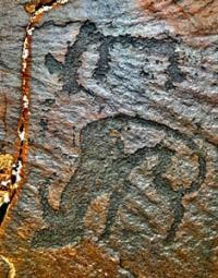
It is 1.5 km away. east of the village of Kapac (Baidibek district of the South Kazakhstan region), at the rock of the same name. Horsemen are shown, jumping for argali, deer, wolf, mountain goat, as well as hunters with bows in their hands.
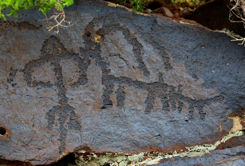
There are signs similar to the Orkhon inscriptions.
Petroglyphs are divided into two groups, one is located directly on the banks of the Boraldai River, the other is higher up the slope. The earliest drawings date back to the Bronze Age (two thousand years BC). Engravings are located on two hills located along the gorge.
These hills are flat tops of farewell rock covered with deluvial-proluvial deposits. The bulk of the drawings are grouped on the southern and southeastern slopes of the outcrops on stones with a relatively flat surface and strong patinization.
In engravings of Boroldai, 4 chronological layers and corresponding ethnocultural cycles should be distinguished:
1. The era of bronze (II millennium BC). The final stage stands out.
2. The Early Iron Age (I millennium BC) with the Scythian-Sakian “animal style” of the VIIth – Vth centuries BC. with its ornamentality and decorativeness.
3. The Turkic stratum is weakly developed and inexpressive - tamga-like goats, tamgas (VI – IX centuries).
4. Kazakh and Sufi cycles (ХV - XIX centuries). “Sufi” plots (epigraphy) should be attributed to the era of the Kazakh khanates and even to a later time in connection with the penetration of Islam into the Kazakh steppes. Kazakh folk drawings are realistic.
Boroldai's petroglyphs (Buryltai writings) are an integral part of the vast range of rock art in Central Asia, Kazakhstan and South Siberia, brought to life by the unity of the economic structure, level of spiritual development, the similarity of ideas and representations of the steppe tribes.
At the beginning of the XXI1st century, petroglyphs are threatened with destruction due to their easy accessibility.
Geographic coordinates of Boroldai rock paintings: N42°51'12 E69°49'54

Authority:
http://stgrpp.kz/index.php/en/monuments-of-history-and-culture-regional-park
Photos by:
Alexander Petrov.