


![]()
You are here
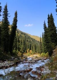
Prokhodnaya River.
In Tien-Shan Mountains Tours.
"You can't go on a boat without water."
Chinese proverb.
Sights of gorges in mountains of Trans-Ili Alatau.
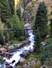
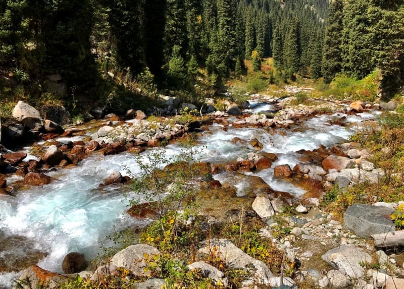
The Prokhodnaya River is a left tributary of the Bolshaya Almatinka River, located on the northern slope of the Zailiyskiy Alatau ridge in Bostandyk district of Almaty region. The sources of the river begin from the northern side of the Almaty pass, at an altitude of 3599.1 meters above sea level, the mouth of the river is at an altitude of 1422 meters above sea level.
The length of the river is 18.4 kilometers, the catchment area is 83.3 square kilometers. Average long-term discharge at the mouth is 1.69 cubic meters per second. The width of the river at the mouth is 5.0 - 6.5 meters, the depth is 0.20 - 0.80 meters.
In the upper reaches of the river, before the formation of the main channel, at an altitude of 3124 meters above sea level, the river receives 4 tributaries. On the eastern side, one of the tributaries is the Western Alagir River, 3.6 kilometers long.
The river originates from the western side of the Almaty-Alagir pass with a height of 3655 meters above sea level, the mouth of the river is located at an altitude of 3124 meters above sea level.
Geographic coordinates of the Western Alagir River: N42 ° 59'52.05 "E76 ° 56'07.85"
After 1.6 kilometers, the Western Alagir River receives a small tributary on the left - the Tuyik River, 2.7 kilometers long. The Tuyik River originates from the southern side of the Almaty-Alagir peak, 4225 meters above sea level, the mouth of the river is located at 3428 meters above sea level.
Geographic coordinates of the Tuyik River: N42 ° 59'31.26 "E76 ° 56'39.52"
After 2.3 kilometers from the beginning of the source, on the left, the Dikaya River flows into the Western Alagir River, 1.8 kilometers long. The sources of the Dikaya river are located on the southern side of the Dikiy pass and the glacier at an altitude of 4020.1 meters above sea level.
Geographic coordinates of the Dikaya River: N42 ° 59'16.91 "E76 ° 55'15.11"
The next unnamed tributary, which flows east of the Prokhodnaya River, parallel to it, with a length of 2.3 kilometers. This tributary originates from a glacier at an altitude of 4005.8 meters above sea level, its mouth is located at an altitude of 3185.4 meters above sea level.
Geographic coordinates of an unnamed tributary east of the Prokhodnaya River: N42 ° 59'24.63 "E76 ° 54'15.84"
Left tributaries of the Prokhodnaya River.
For 10.6 kilometers after the source, the Prokhodnaya river receives two insignificant nameless tributaries on the left.
Morenaya river.
10.6 kilometers after the source of the Prokhodnaya River, on the left, a small tributary flows into the river - the Morenaya River, 2.5 kilometers long. The river originates from underground streams of the ancient moraine, which is a continuation of the Kargalinsky Right glacier.
The lower part of the moraine is located between the peaks of Pyla in the south, 3790 meters above sea level and Vechernaya in the north, 3410 meters above sea level. The mouth of the Morenaia River is located north of the Terra glade, at an altitude of 2543 meters above sea level.
Geographic coordinates of the Morenaia River: N43 ° 02'25.90 "E76 ° 54'29.87"
Burkitta River.
Through 950 meters after the confluence of the Morenaia River, the Prokhodnaya River receives a tributary of Burkitta, 3 kilometers long. The river originates from the eastern side of Kargalinsky peak 3675 meters above sea level and glaciers on the slope of the eastern exposure of the Prokhodny gorge.
Geographic coordinates of the Burkitta River: N43 ° 03'01.45 "E76 ° 53'56.22"
Northern Burkitta River.
560 meters after the confluence of the Burkitta River, the Prokhodnaya River flows into the Burkitta Severnaya River, 2.5 kilometers long. The sources of the river begin from the northeastern side of Kargalinsky peak, 3674.9 meters above sea level.
Geographic coordinates of the Northern Burkitta River: N43 ° 03'26.09 "E76 ° 54'13.02"
Sakhnovka river.
1.5 kilometers after the confluence of the Severnaya Burkitta River, the waters of the Sakhnovka River, 2.6 kilometers long, flow into Prokhodnaya. The left tributary of the Sakhnovka begins from the eastern side of the watershed ridge between the rivers Kargalinka and Prokhodnaya. The northern tributary of the Sakhnovka originates from the eastern side of an unnamed peak 2932 meters above sea level. The mouth of the Sakhnovka into the Prokhodnaya River lies at an altitude of 2005 meters above sea level.
Geographic coordinates of the Sakhnovka River: N43 ° 04'08.11 "E76 ° 53'38.27"
Kaskabas river.
3.9 kilometers after the Sakhnovka River, on the left, Prokhodnaya receives the Kaskabas tributary, 3.9 kilometers long. The origins of Kaskabas begin in the northwestern part the Maybulak tract. The mouth of the Kaskabas is located at an altitude of 1527 meters above sea level.
Geographic coordinates of the Kaskabas River: N43 ° 06'00.89 "E76 ° 53'43.13"
Right tributaries of the Prokhodnaya River.
Karniznaya river.
After 8.6 kilometers from the headwaters of the Prokhodnaya River, the Karniznaya tributary, 2.7 kilometers long, flows into the river on the right. The tributary originates from the eastern side of the Almatynin Alagir ridge from a moraine, flowing lake located on the eastern side of the Almatynin Alagir ridge on a moraine, at an altitude of 3510 meters above sea level, in the northern part of the Karniznaya glacier.
The length of the lake from south to north is 98 meters, the greatest width in the southern part of the lake is 70 meters. The mouth of the Karniznaya River is located at an altitude of 2883 meters above sea level.
Geographic coordinates of the Karniznaya River: N43 ° 01'35.95 "E76 ° 56'15.78"
Zhosalykozen stream.
After 1.2 kilometers, on the right, a small, drying up stream Zhosalykozen, 1.8 kilometers long, flows into the river and starts from the Zhosalykozen pass with a height of 3336.8 meters above sea level. The mouth of the stream is located at an altitude of 2,722 meters above sea level.
Geographic coordinates of the Zhosalykozen stream: N43 ° 02'29.70 "E76 ° 55'49.55"
Bolshoi Iguzek stream.
2.6 kilometers after the Zhosalykozen stream, the Bolshoi Iguzek stream flows into the Prokhodnaya river, 2 kilometers long. The sources of the stream begin from the western slope of the Bolshoi Almatinsky peak, 3681.9 meters above sea level, the mouth of the stream is at an altitude of 2188 meters above sea level.
For 800 meters from the mouth and above, the stream has a wide channel formed by periodic catastrophic mudflows descending along the stream canyon. Mudflows are formed due to the high steepness of the western slope.
Geographic coordinates of the Bolshoi Iguzek stream: N43 ° 03'39.38 "E76 ° 54'52.19"
A nameless stream with a small waterfall, located 200 meters south of the bath in the Passage Gorge.
2 kilometers after the confluence of the Bolshoi Iguzek stream into the Prokhodnaya river, a 2.8-kilometer stream flows into the right. Not far from the mouth, just above the path on the stream, there is a small waterfall. The sources of the stream are located at an altitude of 2856 meters above sea level from the springs, in the upper reaches of the western slope of the Prokhodnoye gorge, the mouth of the stream is at an altitude of 1833 meters above sea level.
Geographic coordinates of an unnamed stream with a small waterfall located to the south, 200 meters from the bath in the Passage Gorge: N43 ° 04'54.29 "E76 ° 54'56.22"
Geographic coordinates of the Prohodnaya River: N43 ° 04'26.20 "E76 ° 54'21.71"


Authority and photos by
Alexander Petrov.