


![]()
You are here
Przhevalsky in mountains of Saur-Tarbagatay.


Tours in mountains of Saur-Tarbagatay.
"By the fifties of the last century, the entire sum of European information about the Chinese ridge of heaven was given by Ritter Asia, and clearly the maps of d'Anville in the later processing of Claprot. This knowledge, if not equal to zero, was insignificant..".
Traveler, geographer Grigory Efremovich Grumm-Grzhimailo.
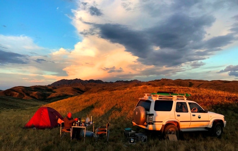
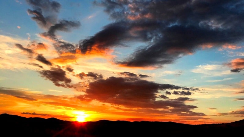
Familiarization tour of Saur-Tarbagatai mountains.
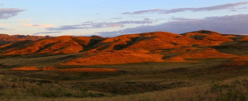
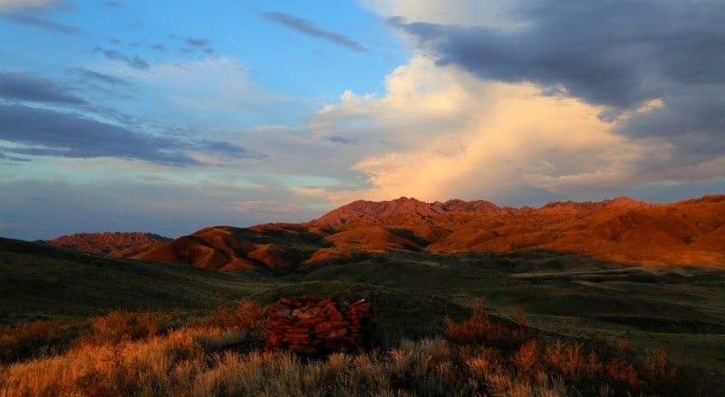
This is how Nikolay Przhevalsky describes the Saur Ridge on his second trip to Tibet in March 1879. “In the south, the Saur Ridge stands a high wall, reaching 12,300 feet of absolute height in the ever-snowing group of Mus-tau; Altai is visible in the north in the distance.
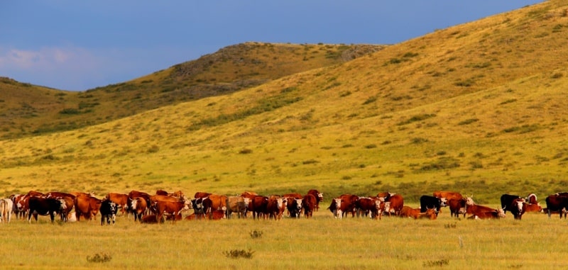
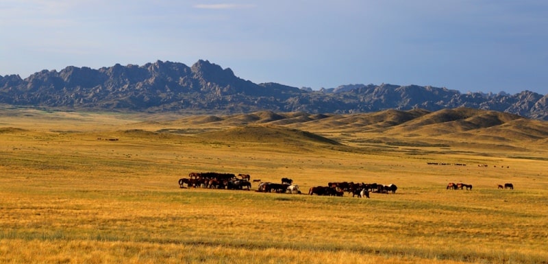
Between these ranges lies the vast valley of the Black Irtysh, abundant in the vicinity of the named river with undulating loose sands. These sands were overgrown with small birch, aspen and jingil (Halimodendron argenteum); in addition, Calligonum mongolicum, Tragopyrum and Ephedra are found here [Mongolian juzgun, chicken, conifer]; sand reed (Psamma arenaria) is also not uncommon; quite good grass grows in the hollows between the mounds, delivering fodder to the herds of nomadic here in the winter of the Kyrgyz.
Outside of the sands, the described plain has clay-solonetzic soil, in the best places covered with high cheshiy, or, in Mongolian, with holeyssun (Lasiagrostis splendens). Closer to the mountains, the terrain begins to rise gently, and at the same time, pebbles and gravel are the decomposition products of the Saura rocks.
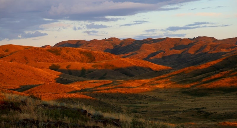
The latter ends abruptly and abruptly south; to the north, however, it has a long slope riddled with gorges and directly connects here with other smaller mountain groups, of which Kishkine-tau stands near Zaisan itself.
To the north-west of Saur, the low ridge Manrak branches off, and in the west, Saur merges with Tarbagatai. In the east, from the snow group of Mus-tau, the described ridge begins to drop rapidly and, with a turn to the northeast under the name Kara-adyr, ends with small elevations near the western shore of the lake. Ulyungur.
The southern slope of Saura is treeless. On the northern slope of these mountains, which, it should be noted, we were not able to visit, in the high belt you can see quite vast areas of forests from the valley, consisting, as they say, almost exclusively of Siberian larch.
Other tree species, such as aspen, birch, poplar, mountain ash, wild apple and shrubs - currants, honeysuckle, raspberries, boyars, bird cherry trees, wild rose, meadowsweet, etc., are hidden in the depths of the gorges, along the bottom of which, from the eternal snows of Mus -Tau, numerous streams run.
Combining, these streams form rivers - Kendyrlyk, Ulasts, Tumandy, etc., of which only the first flows into Lake. Zaysan; the rest disappear into the neighboring plain, forming in places swampy spills. The described ridge on the Zaisan Plain has the adverse effect that it obscures the rapidly warming and little snowy Dzungarian desert.
Therefore, winter on the northern side of Saura is harsher and more abundant in snow; spring comes later, especially near the mountains themselves, as, for example, in the village of Kendyrlyk and in Zaysan.”

Authority:
"The second trip to Tibet." Nikolay Przhevalsky.
Photos
Alexander Petrov.