You are here
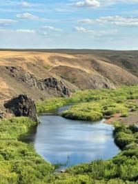
Siletinskoye Reservoir.

Rest in Kazakhstan.
“Erase random features. And you will see: The world is beautiful!”
Alexander Blok.
Reservoirs of Akmola region.
Siletinsky reservoir is located at an altitude of 221 meters above sea level, located on Selety River, 43.1 kilometers north of village of Turgai, 54 kilometers southeast of town of Stepnogorsk, in territory subordinate to ttown akimat of Stepnogorsk in northeast Akmola region.
In 1966, 204 kilometers from the mouth of the river into the bitterly salty Lake Silety-Teniz, the Silety reservoir was built to regulate the flow of the Silety River. The 4.5-kilometer-long embankment dam includes a 100-meter reinforced concrete part, the height of the embankment is 33 meters.
The length of the reservoir is 35 kilometers, the volume of water is 270,000,000 cubic meters. Serves for water supply to the city of Stepnogorsk and the Tselinny Mining and Chemical Combine. In the eastern part of the reservoir, on the shore there is the village of Seletinsky.
There are several camp sites and guest houses on the reservoir. 30 kilometers upstream of the river, the Bestobe (Siletinsky) canyon begins, 26 kilometers long.
Geographic coordinates of Seletinskoye reservoir: N52°07'31 E72°35'23
Authority and photos by:
Alexander Petrov.


