


![]()
You are here
Soils of Dzhngarskiy Alatau.
Climatic conditions of Dzhungarskiy Alatau.
“The land into which no labor is invested has no name.”
Turkmen proverb.
Subalpine soils of Dzhungarskiy Alatau.
The formation of soils in the Dzhungar (Zhetysu) Alatau is subject to certain physical and geographical patterns, depending mainly on climatic conditions, the chemical and mechanical composition of rocks, their moisture content, the altitude of the area above sea level, the exposure of the slopes and other reasons.
By redistributing precipitation, relief plays a decisive role in the formation of soil zones and belts, often determining their altitudinal boundaries. As a rule, in conditions of weakly dissected and plateau-like relief forms, the altitudinal boundaries of zones and belts rise.
In addition, there is a partial loss of individual belts, for example forest belts, which are most developed on dissected surfaces, including along the steep slopes of river valleys. The highest constancy of structure is found in the high-mountain meadow and meadow and steppe zones.
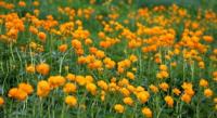
On the northern slopes, mountain-meadow alpine and subalpine soils predominate; on the southern slopes, high-mountain meadow and steppe soils predominate. In the subalpine zone, high-mountain dark-colored soils have become widespread.
In the high mountain zone, inversion phenomena may be observed locally when alpine soils descend into the subalpine zone. The predominant soil-forming rocks are coarse moraine, eluvial and eluvial-deluvial, mainly two-membered thin gravelly loams.
In the mountain forest, meadow and steppe zones, there is a wide variation in belts, their composition, altitudinal boundaries, as well as the structure of the soil cover. Forest belts are not represented everywhere.
They develop most in conditions of steep, mid-mountain terrain and along the valleys of large rivers. On leveled landforms, forests and their corresponding soils are replaced by mesophilic meadows with deeply podzolized and leached chernozems.
In this case, they rise to the subalpine zone, as, for example, in the interfluve of Orta-Tenteka and Inili (Karoy tract). The forest belt can fall out completely, as in the above example, or partially, when there is no belt of small-leaved and (or) fruit forests and the belt of coniferous forests remains (the Dzheldy-Karagai mountains, the basins of the Ulken and Kishi Baskana rivers).
The forest belt is most fully represented within the main ridge in the Jaman Koturtas mountains, on the slopes of the mountains, south of the village. Kokzhar. Coniferous forests and the dark-colored mountain-forest soils characteristic of them rarely form a continuous belt.
More often, in combination with them, mesophilic forest meadows with mountain forest-meadow soils are common on the northern slopes, and mountain meadow steppes with mountain meadow and steppe soils are common on the southern slopes.
The composition of the soils in the belt of mountain small-leaved forests, forest meadows and meadow steppes consists of mountain-forest dark gray soils located on the slopes of northern exposures, and mountain meadow-steppe soils that dominate the southern slopes.
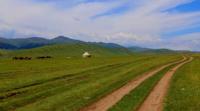
Often, mountain-forest dark gray soils form combinations with mountain-forest chernozem-like soils, which rise here from the underlying belt along the northern slopes, sometimes reaching the southern ones. The steppe zone is formed not only in conditions of dissected steep terrain, where the exposure combinations of mountain chernozems and mountain steppe soils, mountain dark chestnut and mountain light chestnut soils predominate, but also in conditions of leveled surfaces of intermountain valleys and leveled plateaus, where soils lie in uniform contours.
Currently, there is no detailed cartographic information on the soil cover in the park, and additional research is required to assess the state of the soil cover to compile a soil map and clarify the map of ecosystems in the park.
Authority:
“Management plan of the RSU “Zhongar-Alatau State National Natural Park” for 2022 - 2026.
file:///C:/Users/User/Downloads/%D0%9F%D0%BB%D0%B0%D0%BD%20%D1%83%D0%BF%
D1%80%D0%B0%D0%B2%D0%BB%D0%B5%D0%BD%D0%B8%D1%8F%20%D0%A0%D0%
93%D0%A3%20%D0%96%D0%BE%D0%BD%D0%B3%D0%B0%D1%80%20%D0%90%D0%
BB%D0%B0%D1%82%D0%B0%D1%83%D1%81%D0%BA%D0%BE%D0%B3%D0%BE%20%
D0%93%D0%9D%D0%9F%D0%9F%20%D0%BD%D0%B0%202022-2026%20%D0%B3%D0%B3.%20(1).pdf
Photos by:
Alexander Petrov.