


![]()
You are here
South-Alichur Ridge.
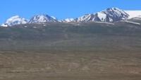
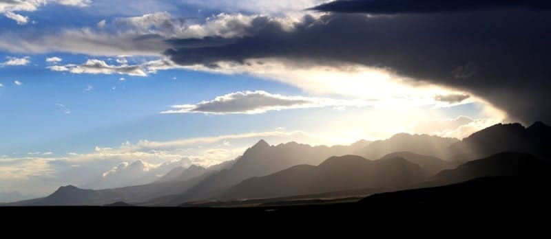
Photo walks across Tajikistan.
“The world is a book and those who do not travel read only one page”
Augustine of Hippo.
Thru-hikers in Tajikistan.
South Alichursky ridge is located in Southern Pamirs, on left bank of Pamir River, in southern part of Murgab region, in south of Gorno-Badakhshan Autonomous Region. In the east, the border of the ridge is the valley of the Istyk River on the right bank, where the burial ground and hot spring of Dzharty Gumbez are located.
In the west, the border of the ridge is the valley of the Javshangoz River, where it merges with the Kokbay River and the northern spurs of the Wakhan Range. In the middle part of the ridge, a powerful spur extends to the north into the interfluve of Bashgumbez and Shegembet.
The dominant height in this spur is an unnamed peak 558 meters above sea level. The peak is located in the upper reaches of the second tributary of the Shegembet River and 1.3 kilometers southeast of the Rei peak, 5505 meters above sea level.
Almost along the entire length of the ridge, the southern border of the ridge is the state border between the Republic of Tajikistan and Afghanistan. The length of the ridge is 192 kilometers. The ridge stretches from west to east. In the western part of the ridge, the dominant peak is Mount Kyzyldangi, 5704 meters above sea level.
In the eastern part of the ridge, the dominant peak is an unnamed mountain 1,5480 meters above sea level, which is located 1.5 kilometers east of the Kukdzhigit pass. The slopes of the ridge are covered with high-mountain desert vegetation, at an altitude of 4200 to 4500 meters above sea level - nival landscapes.
High mountainous terrain and desert vegetation predominate. The snow line in the north is at an altitude of 4900 to 5150 meters above sea level, in the south - at an altitude of 4900 to 5300 meters above sea level. The total glaciated area of the South Alichursky ridge is 68 square kilometers.
There are 256 glaciers in the ridge zone, the total area of which is 72 square kilometers. There are about 10 passes in the ridge and its spurs, through which roads or trails pass. The main access routes are from the north from the Pamir Highway, from the south from the Pamir River valley, where there is also a road.
The ridge is composed mainly of granites, gneisses and crystalline schists.
Geographic coordinates of beginning of South Alichursky ridge: N37°20'54 E72°34'29
Geographic coordinates of average position of South Alichursky ridge: N37°31'10 E73°09'52
Geographic coordinates of end of South Alichursky ridge: N37°33'35 E74°08'58


Authority:
Alexander Petrov.
"Glaciers." L.D. Dolgushin, G.B. Osipova. Series "Nature of the world." Moscow, the publishing house "Thought". 1989.
Photos by:
Alexander Petrov.