


![]()
You are here
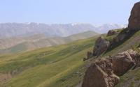
Terek Pass in Kokshaal-Too Range.
By cars from Turkmenistan to Kazakhstan.
"26 (September). The southern slope of the Terek Pass. We climb up the Terekta, in a southerly direction. The terrain is solonetzic. Mountains of clay and siliceous slate, cut by quartz veins. Many splinter slabs. The ascent to Terekty is gradual, but the descent is steep and covered with sharp stones. At its summit lies melted*… snow. The southern slope, where we are now standing, has noticeably warmed up, there is wormwood and chye. From the heights of Terekty to (the first Chinese picket) Islyk 60, to Kashgar 135 versts.
"Kashgar Diary. The Summit of the Zaukinsky Pass." Chokan Valikhanov. 1858.
“The Terekty Pass, according to the barometric measurement of Reintal, who passed through it to Kashgar, is at an altitude of 12,600 feet: I saw this pass snowless on October 13, and Reintal also found it snowless on October 16 of the following year, 1867, while under the Kok-kiya peaks, I believe, the October snow, judging by its height above the river, is a thousand feet lower than this snowless pass. The descent from the pass is almost imperceptible, and, strictly speaking, it exists only to the Aksai valley, somewhat deepened in the Aksai plateau, the flat tops of which, occupying more space than the deepened ravines between them, are almost at the same level with the Kyny pass, and even with Tas-asu, since the general slope of the plateau to the east and at the mouth of the Terekta, the riverbed itself is not lower than the Tas-asu pass.”
"Across the mountainous regions of Russian Turkestan." V. I. Lipsky. 1906.
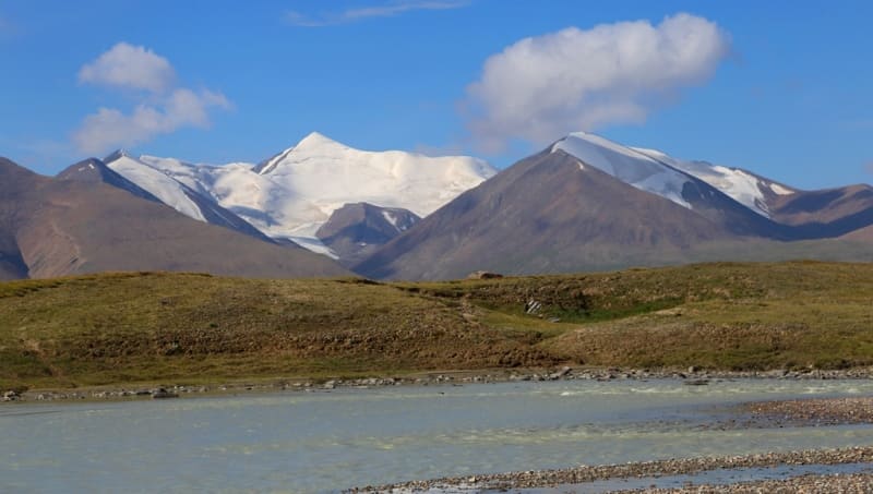
Passes in western part of Kokshaal-Too Range.
Trip from Naryn to valley of Western Aksai River.
Terek pass, 3909 meters above sea level, is located on main ridge of Kokshaal-Too range, 54 kilometers southeast of Lake Chatyr-Kol, 62 kilometers southwest of high-mountain lake Kel-Suu, in Atbashi district of Naryn region.
The Terek River, 64 kilometers long, originates from the northern slope of the pass. It is a right tributary of the Western Aksai River at 39 kilometers after its origin. This is one of the long rivers of the right tributaries of the Western Aksai. The river has numerous right and left tributaries.
The river's sources are on the southern side of the Terek Pass at an altitude of 3908 meters above sea level. The mouth of the river is at an altitude of 3308 meters above sea level. On the right side, the river has 5 intermittent tributaries, on the left, 22 large and small intermittent tributaries.
History of the Terek Pass.
The Terek Pass has been known since the second half of the XVIIIth century; one of the famous caravan routes passed through it. The route through the Terek Pass was the shortest for caravans traveling to China, to the city of Kashgar. In addition, the first large settlement before Kashgar was Artush, where merchants also traded.
On September 26, 1858, a caravan of merchants headed for Kashgar passed through the pass, with Shokan Ualikhanov in it. On the northern side of the pass, Ualikhanov was forced to bury his diary, which he had kept from the Karamola tract, in the village of Sarybgysha, near the Sarybulak picket.
On the eve of crossing the Chinese border (September 26), Sh. Ualikhanov, taking precautions, buried the diary in the ground, making the following entry: “I’m in a hurry. The diary is now being buried in the ground, and if God returns us alive and well, and the dampness doesn’t spoil us, we will show it to the world again.
I entrust you to Allah. Goodbye.” The diary was dug up almost six months later, on March 12, 1859, upon Sh. Ualikhanov’s return to his homeland. He wrote down in it new impressions that he had gained from his trip to Kashgar. Unfortunately, due to the author's illness, the second half of the diary was probably written under his dictation and therefore contains numerous corrections, additions, and postscripts made by Sh. Ualikhanov.
After walking about ten versts, I noticed a road running from the northeast, diagonally across the plateau, and crossing our path; this is the road from the Zaukinsky Pass to the Terektinsky Pass, through the Chakyr-kurum Pass near Taragay (upper Naryn); Ch. Ch. Ualikhanov entered Kashgar along this road.
In July 1906, botanist Vladimir Ippolitovich Lipsky visited the area around the pass for research purposes.
Geographic coordinates of Terek Pass: N40°18'35 E75°51'18

Authority and photographs:
Alexandra Petrov.