


![]()
You are here
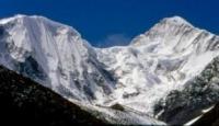
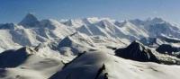
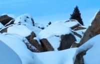
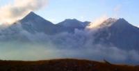
Tien-Shan mountains in Kazakhstan.

Tours to Tien-Shan mountains of Kazakhstan.
"My work on Asian geography led me ... to a thorough acquaintance with everything that was known about inner Asia. It attracted me, especially to itself, the most central of the Asian mountain ranges - the Tien Shan, which the European traveler had not yet set foot on and which was known only from scarce Chinese sources ... To penetrate into the depths of Asia on the snowy peaks of this unattainable ridge, which the great Humboldt, on the basis of the same meager Chinese information, considered volcanic, and bring him a few samples "from the ruins of the rocks of this ridge, and home - a rich collection of flora and fauna of a country newly discovered for science - that seemed to me the most tempting feat."
Semenov Tian-Shansky.
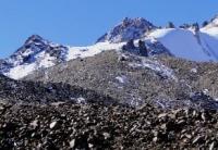
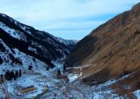
Traveling in the mountains of southern Kazakhstan.
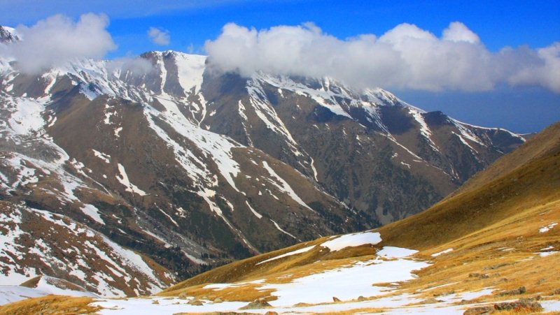
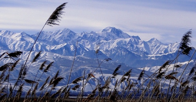
Tien-Shan is one of the largest mountain systems in Asia. Translated from Chinese Tien-Shan means "heavenly mountains." The territory of Kazakhstan includes almost the entire Northern Tien-Shan, parts of the Central and Western Tien-Shan.
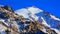
The central Tien-Shan within Kazakhstan begins from the powerful Khan-Tengri mountain junction 6995 meters above sea level, at the junction of the borders of China, Kazakhstan and Kyrgyzstan. Further extends to the west with a number of ranges.
The largest of them is Terskey Alatau. The border with Kyrgyzstan runs along its eastern branch. Ranges are included in the Northern Tien-Shan: Ketmen, Kungey Alatau, Zailiysky Alatau, Chu-Ili mountains and Kyrgyz Alatau.
The Talas Range and the ridges departing from it in the southeastern direction - Ugamsky and Korzhintau - enter the Western Tien-Shan. Karatau is located completely within Kazakhstan - the most extreme, heavily destroyed region of the Tien-Shan.
Relief, geological structure and minerals. Tien-Shan is located in the ancient geosynclinal belt. It is composed of metamorphosed schists, sandstones, gneisses, limestones and volcanic rocks of Precambrian and Lower Paleozoic deposits.
More late continental and lake deposits are concentrated on the mountain plains. They consist of clay, sand and moraine deposits. The main mountain systems: Zailiysky Alatau - the northernmost mountain range of the Tien-Shan, has a length of 350 km, a width of 30 - 40 km, an average height of 4000 meters above sea level.
The Zailiysky Alatau rises towards the Talgar, Chiliko-Kemin mountains (Talgar peak - 4973 meters above sea level, and eastward, to the tracts Dalashyk and Tore, it decreases markedly (3300 - 3400 meters above sea level).
The northern slopes of the mountains are especially distinctly cut by numerous rivers, which indicates the influence of the glaciation epoch on them.The Zailiysky Alatau is composed of ancient sedimentary and igneous rocks of the Lower Paleozoic - sandstones, porphyries, granites and gneisses.
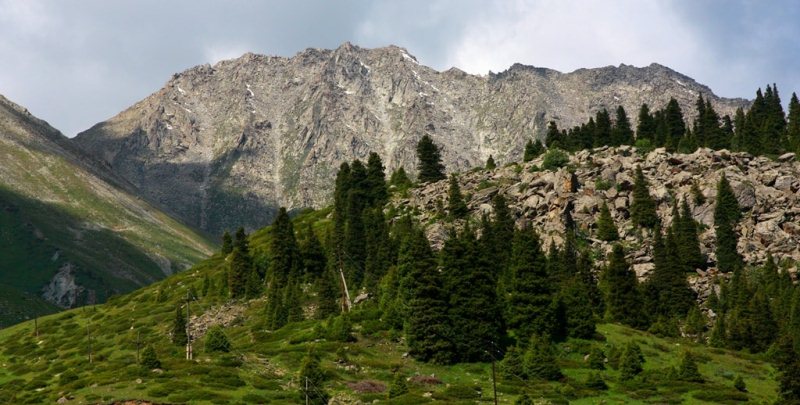
he mountain structure became blocky-folded. Alpine topography formed on the peaks. Sharp-pointed peaks alternate with intermountain plains. Some mountain sections have a stepped relief form. Ketmen is one of the mid-mountain ranges - located in the eastern part of the Tien-Shan, its length within Kazakhstan is 300 km, width - 50 km, height - 3500 meters above sea level.
It is formed from the Paleozoic effusive sedimentary rocks. In some places, granite appears on the surface of the relief. The slopes of Ketmen are divided by the rivers of the Ili basin. Kungei Alatau within Kazakhstan is included only in the northern slopes of its eastern part.
The average height of this mountain range is 3800 - 4200 meters above sea level. The eastern part of Kungei Alatau and Zailiysky Alatau are divided by the valleys of the Charyn, Chilik and the intermountain plain of Zhalanash.
The slopes of the Kungei of North Alatau are relatively gentle and strongly dissected, the peaks are aligned. Chu-Ili mountains are located in the north-west of Zailiysky Alatau. They consist of separate elevations that have undergone destruction, severe erosion (Dolankara, Kulzhabas, Kindiktas, Khantau, Alaigyr, etc.).
The average height of 1000 - 1200 meters above sea level. The highest point is Aitau, its height is 1800 meters above sea level. The Chu-Ili mountains were formed from Precambrian metamorphic rocks and thick layers of gneiss.
Their surfaces are composed of sedimentary-effusive rocks
Kyrgyz Alatau - a large mountain system, in the territory of Kazakhstan is located its northern slope of the western part. Its highest peak is the peak of West Alamedin 4875 meters above sea level. In the Kazakhstani part, the height of the mountains does not exceed 4500 meters above sea level.
To the west, they are declining. The northern slopes are settled and destroyed mountains. The surface of the ridge is composed of sandstones, limestones and granites of the Carboniferous period. The ridge has uneven, highly dissected surface.
On the border with Kyrgyzstan, this ridge has a type of alpine relief. The Western Tien-Shan within Kazakhstan begins to the south of the Kyrgyz Range, beyond the Talas Valley. The chain of Talas Alatau rises here (in the vicinity of the city of Taraz).
The Kazakhstani part of the Talas Alatau is the Zhabagly Mountains and the Sairam Ridge. The Zhabagly mountains are divided into two mountain ranges: they form the basin of the Aksu-Zhabagly rivers (the height of the northern ridge is 2600 - 2800 meters above sea level, the southern ridge is 3500 meters above sea level). They are also composed of sedimentary and igneous rocks of the Paleozoic. The slopes of the mountains are dissected, bear traces of ancient glaciation, differ in alpine type of relief.
The Pashtashkent mountains consist of several mountain ranges extending southwest of Talas Alatau. These include the Sairam Mountains (the highest point is Sairam peak of 4220 meters above sea level, Koksu 3468 meters above sea level, Ugam 3560 meters above sea level, Karzhantau 2839 meters above sea level, Kazykurt 1700 meters above sea level.
Their geological histories are similar All of them are composed of Paleozoic limestones.
The slopes of the mountains are steep, the relief is dissected. Karst phenomena are widespread. The Karatau ridge is located on the western outskirts of the Western Tien Shan. It extends in the north-western direction for 400 km. its height is 1800 meters above uro the highest point - Mynzhylky 2176 meters above sea level.
To the northwest it decreases and already at the confluence of the dry channels of the Sarysu and Chu rivers the mountain passes to the plateau. The geological structure and relief of Karatau is similar to the Chu-Iliysky It settles, collapses, and leveles.
The north-eastern and south-western mountain ranges of the Karatau ridge are separated by intermountain valleys. If its south-western ridge was formed from metamorphic rocks of the Proterozoic, then the north-eastern ridge - from sandstones and shales Paleozoic.
he valleys located between the two ridges are composed of red clays. Mesozoic and Cenozoic deposits of limestone, sandstone and clay are also widespread. The local relief was formed in a dry climate. There is no constant surface runoff.
The slopes are divided by large and small gorges and dry river beds. On the territory of Karatau, a large stock of mineral resources was found. They are used for the production of lead and zinc at the Shymkent lead-zinc plant and for supplying phosphorus raw materials to the chemical complexes of Taraz.
Ores are mined open pit. Karatau is a source of building materials - gypsum, cement, etc., which gives the state a big profit. The folded base of the southwestern and southern parts of the ridge formed in the Paleozoic era.
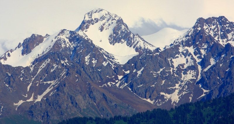
The main appearance of the Tien Shan relief was formed during mountain formation in the Neogene and Anthropogenic periods of the Cenozoic era. The proof of this is the earthquakes occurring in the Tien Shan.
The general view of the relief of the mountains varies. In the mountains, high peaks alternate, ridges with intermountain valleys, hilly plains, etc. The high-altitude zone of the mountains is formed in direct dependence on the geographic location and scheme of mountain ranges.
Climate, rivers and glaciers in Tien-Shan mountains.
The climate of the Kazakhstani part of the Tien-Shan mountain system is dry, unstable, formed in winter under the influence of polar, and in summer, tropical air masses. It is influenced by the arctic air masses and the Siberian anticyclone.
he height of the mountain ranges, the diversity of the relief affects the onset of heat and moisture. Therefore, in the fall and spring in the foothills of the Tien-Shan, frosts often occur. In the summer months, sultry winds - dry winds - often blow.
The dry continental climate of the plain in the mountains gives way to a moderately humid continental climate. Winter is long, from October to April-May, summer is much shorter. In Kungey and Terskey Ala-Too, snow sometimes falls in August and it becomes quite cold.
Even in May-June there are often frosts. The real summer comes only in July. The largest amount of rainfall is May. If during this period it rains at the foot of the mountain, then snow falls on its peaks. On the northern slopes of Zailiysky Alatau, even in the winter months, there are often warm days.
During the day the snow melts, at night the puddles are covered with ice. Such a sharp change in weather destructively affects the rock. The climate of the Western Tien Shan is influenced by the warm climatic conditions of the south of Kazakhstan.
Therefore, in the mountains of the Western Tien Shan, the snow line is higher than in the east. Here the average annual rainfall is more - 600 - 800 mm. On the slopes of the mountains, the average July temperature is + 20 ° + 25 ° С, at the foot of the glaciers -5 ° С.
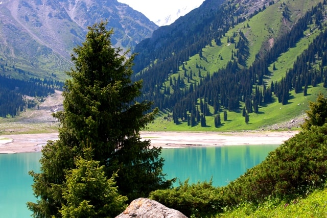
Many rivers flow along the spurs of the Tien Shan mountains, along the inter-mountain plains. The rivers Bolshaya and Malaya Almatinki, Talgar, Issyk, Chilik, Kaskelen have their origin from the northern slopes of the Trans-Ili Alatau, the Charyn River from the eastern slopes of the Tien Shan.
Many of them flow into the Ili River, the flow of which replenishes the water reserve of Lake Balkhash. The Chu River originates in the Kyrgyz Alazau and after crossing the Kyrgyz border flows through Kazakhstan.
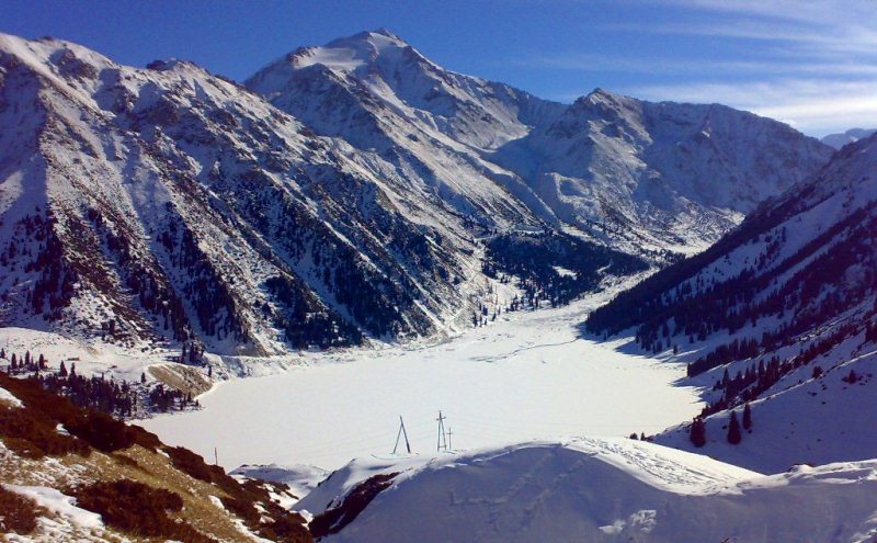
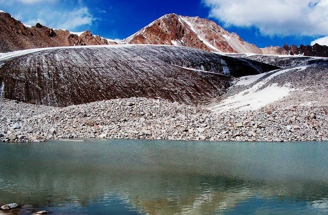
The rivers Arys, Boraldai, Bogen flow down from the southwestern slopes of Karatau. From the northwestern slopes there are some rivers that feed on melt snow waters in the spring and dry in the summer. In the spurs of the Tien Shan there are lakes located in depressions between the tops of the mountains.
These lakes originate from glaciers. Below, in the intermontane basins, small lakes form. The peaks of the Tien Shan mountains are covered with glaciers, their especially powerful reserves are concentrated in the Chiliko-Keminsky mountain junction.
In Zailiysky Alatau there are more than 380 glaciers that occupy mountain valleys with a total area of 478 square kilometers. They are located in the upper part of the basins, from where the rivers Chilik, Issyk, Talgar, Bolshaya and Malaya Almatinki, Aksai originate.
The largest glacier - Korzhenevskogo (length 12 km). In total, in the Kazakhstani part of the Tien Shan there are 1,009 glaciers with a total area of 857 square kilometers. The prolonged melting of glaciers and heavy rainfall on hot summer days increase the flow of meltwater to lakes and rivers.
This leads to the fact that the water leaves the coast and floods begin. They cause great harm to the household and pose a danger to people's lives. Flora and fauna of the Tien-Shan mountain system. The natural zones of the Tien-Shan mountain country vary in vertical zonation.
These belts formed in direct proportion to the orographic scheme of mountain ranges and geographical location. Due to the diversity of the natural environment and the characteristic features of each Tien-Shan mountain range, the same belts are not always located at the same height vertically: the same belts are higher in one ridge and lower in another.
In the Northern Tien-Shan there are four levels of high belts. If you count them from the very top, then they begin with glaciers, with an alpine relief, covered with eternal snows. And in other ridges, the belts begin from a height of 2600 - 2800 m, in the third - above 3300 m.
Here there are hilly hills surrounding bare rocks. Natural areas consist of subalpine and alpine meadows, alpine landscapes. In the mountains live leopards, mountain goats, Ular, mountain eagles. The following high-altitude belt is widespread in mountains of average height from 1500 - 1600 m and up to 3200 - 3300 m.
Small-leaved and coniferous forests mainly grow on the northern slopes of the mountains. The plains are covered with meadows; on the southern slopes, signs of steppe and meadow-steppe zones are observed.
Fir-forest belt.
1. Fir Shrenka.
2.Aspin.
3. Mountain ash Tien-Shan.
4. Honeysuckle.
5. Geranium straight.
6. Siberian larch.
7. Siberian fir. Forests are found only in gorges. From animals live bears, roe deer. The belt of low mountains is clearly traced in the Trans-Ili Alatau. Their height is 900 - 1100 meters above sea level. They resemble the small mountains of the central part of Kazakhstan.
Various types of plants grow on dark and dark chestnut soils of this territory: grassy, woody (pine), shrubby (meadowsweet). The lowest altitude zone covers the intermountain plains and the foothills of the mountains (they are located at an altitude of about 600 - 800 meters above sea level).
In these territories there are signs of desert, semi-desert, steppe zones. Here cereals, melons and horticultural crops are grown. Meadows are used as pasture for grazing. The altitudinal zones of the Western Tien-Shan are 100 to 200 meters higher than the Northern Tien-Shan.
They are affected by the aridity of the climate of Central Asia, less moisture. Types of soil and vegetation cover vary with altitudinal zonation.

Authority:
N.A. Gvozdetsky, Yu.N. Golubchikov. "Mountains", a series of "Nature of the world." Moscow, "Thought", 1987.
Photo
Alexander Petrov.