


![]()
You are here
Туркменистан.
Туркменистан страна в Центральной Азии.
«Любят родину не за то, что она велика, а за то, что своя»
Сенека Луций Анней.
Туркменистан на карте мира.
Туркменистан, расположен на юго-западе Центральной Азии, на западе омывается Каспийским морем. Протяженность с запада на восток – 1100 километров, с юга на север – 650 километров. Граничит на севере с Казахстаном, на северо-востоке – с Узбекистаном, на юго-юго-востоке – с Афганистаном и на юге – с Ираном.
Территория – 491,2 000 квадратных километров в том числе площадь пустыни – 375 000 квадратных километров. Население – 5 851 000 человек (2018 год).
Столица – Ашхабад (730 000 жителей). В стране 21 город, крупнейшие – Туркменбаши (бывший Красноводск), Туркменабат (бывший Чарджоу), Дашогуз (бывший Ташауз), Балканабат (бывший Небитдаг).
Береговая линия Каспийского моря на юге слабо изрезана, а на севере имеет извилистые очертания, образуя залив Кара-Богаз-Гол, Туркменбаши, Туркменский, полуострова Красноводский, Челекен, Дарджа.
У побережья расположен остров Огурчинский. На юге – горы Копетдаг (высота до 2942 метров над уровнем моря - гора Ризе) и северные предгорья Паропамиза - возвышенности Батхыз (до 1000 метров над уровнем моря) и Карабиль (до 980 метров над уровнем моря).
На крайнем юго-востоке протягивается отрог Гиссарского хребта – Кугитангтау (до 3139 метров над уровнем моря). К северо-западу от Копетдага располагаются два обособленных хребта – Малый Балхан (до 777 метров над уровнем моря) и Большой Балхан (до 1880 метров над уровнем моря).
На западе – Красноводское плато с крутыми обрывами Кюренингкюреси (до 306 метров над уровнем моря). На северо-западе заходят отроги Устюрта – плато Капланкыр, Челюнкыр, Костматдаг. Горы Копетдаг окаймляет предгорная равнина, на западе сливающаяся с Прикаспийской низменностью.
На север и северо-восток от предгорий равнины простирается песчаная пустыня Каракумы, занимающая низменную Туркменскую равнину. На севере и северо-востоке она ограничена Сарыкамышской котловиной и долиной Амударьи, на западе – сухим руслом Западного Узбоя.
В пределы Туркменистана входят неширокая полоса правобережья Амударьи – западная часть пустыни Кызылкум и пески Сундукли. Климат резко континентальный, засушливый. Средняя температура января - 4 °С (в долине Атрека + 4 °С), июля - + 28 °С.
Осадков от 80 мм на северо-востоке до 300 мм и более в горах. Постоянные ветры, частые пыльные бури. Главные реки: Амударья (на территории Туркменистана более 1000 километров здесь в нее не впадает ни один приток; значительная часть воды поступает в Каракумский канал – ныне Каракумрека, Атрек (единственная река, впадающая в Каспийское море), Теджен, Мургаб. Почвы преимущественно серо-бурые и сероземы.
Растительность в основном пустынная, в горах вертикальная поясность. В Туркменистане 8 заповедников, среди них: Бадхызский, Репетекский (с конца 1970-х годов биосферный), Хазарский (бывший Красноводский), Копетдагский и др. Туркменистан богат разнообразными полезными ископаемыми: нефтью (согласно правительственным оценкам, туркменская часть Каспийского м. содержит 3 млрд. тонн нефти, по другим данным прогнозные запасы нефти – 12 млрд. тонн); газом (запасы газовых месторождений оцениваются в 26 трлн. метров кубических); серой, калийными и каменными солями; цветными и редкоземельными металлами.
Добывается мирабилит (Кара-Богаз-Гол). Богатые ресурсы гелио - и ветровой энергии.
Первое государство возникло на территории современного Туркменистана в 250 г до н. э. Это была Парфия со столицей в городе Ниса (18 километров от Ашхабада). В период ее расцвета парфяне распространили свое влияние на обширные области от Месопотамии до Индии. После падения Парфии в III веке эти земли стали частью Хорасана владений иранской династии Сасанидов, империя которых была поглощена в VII в. Арабским халифатом.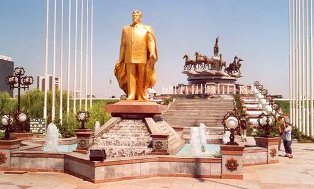
Туркменский народ сформировался к XI веку, в связи с миграцией огузских племен (сельджуков) и их смешением с местными иранцами. Сельджуки создали обширное государство, центром которого была территория Туркмении. В XII веке ее завоевали хорезмшахи, в XIII - монголы, в XIV Тамерлан.
До XVI века она была частью узбекской империи Тимуридов, затем Хивинского и Бухарского ханств. В 1869 г русские войска закрепились на восточном берегу Каспийского моря, основав форт Красноводск (нынешний город Туркменбаши).
Он стал центром Закаспийской области. В 1881 годутерритория была окончательно завоевана, в качестве опорного пункта был построен Асхабад (с 1927 город Ашхабад), ставший столицей.
В 1886 годуобласть вошла в состав Туркестанского края.
В этот период в Туркмении была проложена Среднеазиатская железная дорога, началась разработка нефтяных ресурсов, хотя основу экономики составляло хлопководство и скотоводство.
Революционные события 1917 г в Туркестане развивались практически синхронно с центром.
В ноябре-декабре 1917 года установлена Советская власть. 30 апреля 1918 г. на V съезде Советов Туркестанского края была образована Туркестанская АССР в составе РСФСР. 27 октября 1924 года из отдельных территорий, населенных туркменами, была образована Туркменская ССР.
22 августа 1990 г. Верховным Советом Туркменской ССР принята Декларация о государственном суверенитете республики. 26 октября 1991 г. в ходе всенародного референдума за государственную независимость республики проголосовало 94 % избирателей.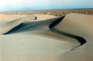
С ноября 1991 г. официальное название государства – Туркменистан. Согласно Конституции 1992 года Туркменистан состоит из следующих административно-территориальных образований: велаятов (областей) – их пять: Ахалский, Балканский, Дашховузский, Лебабский, Марыйский; этрапов (районов), шахеров, приравненных к этрапам, в которых образуются органы государственного управления, а также шахеров, поселков и оба, где учреждаются местные органы самоуправления.
Туркмены составляют 72 % населения, проживают также русские, узбеки, казахи, татары, украинцы, азербайджанцы, армяне и белуджи. Официальный язык – туркменский (огузская группа тюркской языковой семьи), графика – латиница.
Религия: широко распространен ислам суннитского толка. Денежная единица – манат. Имеет дипломатические отношения с Российской Федерацией (установлены 8 апреля 1992 г.). Входит в СНГ.
Национальный праздник – 27 октября - День независимости Туркменистан.
18 мая 1992 г. Верховный Совет принял новую Конституцию. Она провозглашает Туркменистан демократическим, правовым и светским государством. Президентская республика. Глава государства и исполнительной власти – президент, избирается путем всеобщих прямых выборов сроком на 5 лет.
Он является также верховным главнокомандующим вооруженными силами страны. 27 октября 1990 года первым президентом республики был избран Сапармурат Ниязов. 21 июня 1992 года после принятия Конституции состоялись внеочередные президентские выборы.
Президентом вновь был избран С. Ниязов. Высший представительный орган – Халк Маслахаты (Народный совет) Туркменистана. В его состав входят: президент, депутаты меджлиса, председатель Верховного суда, председатель Высшего хозяйственного суда, генеральный прокурор, члены Кабинета министров, главы администраций.
Халк Маслахаты рассматривает и принимает решения о целесообразности внесения поправок в Конституцию, проведения референдумов, о выработке основных направлений развития страны, ратификации и денонсации договоров о межгосударственных союзах и иных образованиях и по другим вопросам.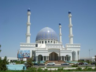
Законодательный орган – меджлис (парламент) состоит из 50 депутатов, избираемых по территориальным округам с примерно равным числом избирателей сроком на 5 лет. В настоящее время в Туркменистане официально зарегистрирована Демократическая партия Туркменистана (ДПТ).
Председатель политсовета ДПТ – С. Ниязов. В качестве основополагающего принципа внешней политики провозглашен постоянный нейтралитет.
В декабре 1995 года на 50-й сессии ГА ООН принята резолюция о признании статуса постоянного нейтралитета Туркменистан.
Республика - член ООН со 2 марта 1992 года, а также член ОЭС, ОИК, ОБСЕ, Движения неприсоединения, АзБР, ЭСКАТО, ЕБРР, ИБР и других международных организаций.
Стратегия экономического развития страны на переходный период определена программой “10 лет стабильности”. Ее главные цели и задачи – превращение Туркменистан в государство с развитой социально ориентированной рыночной экономикой, обеспечение реальной экономической независимости (в первую очередь, продовольственной).
В общем объеме производства продукция топливно-энергетической отрасли составляет 27,5 %, машиностроительной - 5,1, химической – 5,4, легкой промышленности – 41 %. Наиболее перспективная отрасль – топливно-энергетический комплекс.
К ведущим отраслям относится также легкая (в основном, хлопкоочистительная) промышленность. Нефтедобывающая промышленность связана с Небит-Дагскими месторождениями нефти, где она добывалась более 800 лет назад.
Позже были открыты месторождения Кундаг, Дагаджик и Алигул на Западном Челекене, Котурдепе, Барса-Гельмес, Окарем и Камышлыджа. С обретением независимости началась разведка Каспийского шельфа с привлечением иностранных компаний.
Нефтедобывающая промышленность позволила создать нефтеперерабатывающую. В 1943 году в Красноводск (ныне Туркменбашы) было эвакуировано оборудование Туапсинского НПЗ. На его базе был создан Красноводский НПЗ.
В конце 1990 г. началась его реконструкция. Здесь смонтирована установка миллисекундного каталитического крекинга, рассчитанная на переработку 1,8 млн. тонн нефти, и связанная с ней единой технологической схемой установка по производству бензина мощностью 900 000 тонн высококачественного топлива.
Сдана в эксплуатацию установка гидроочистки и каталитического реформинга, рассчитанная на 750 000 тонн бензина в год. Газодобывающая промышленность начала развиваться в середине 1960-х годов.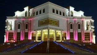
На балансе страны числятся 127 газовых месторождений, крупнейшими из которых являются Довлетабат-Донмез с запасами 1,3 трлн метров кубических и Яшлар с запасами 0,76 трлн метров кубических.
Здесь берут начало газопроводы Центральная Азия – Центральная Россия, Центральная Азия - Урал. С обретением независимости страны состоялось открытие первого экспортного газопровода Корпедже-Кут-Куи (Иран).
Он рассматривается как первый этап строительства супергазопровода Туркменистан – Иран -Турция – Европа. Кроме того, не снимается с повестки дня вопрос о прокладке Трансафганского газопровода от крупнейшего газового месторождения Туркменистана через Афганистан в Пакистан.
Обсуждается также вопрос о транспортировке газа в Китай и Японию. В стране действуют мощности по выпуску нефтеаппаратуры, центробежных насосов, химического оборудования и др. Химическая промышленность производит такие товары, как технический углерод, сера, йод, бром, минеральные удобрения, химические средства защиты растений, товары бытовой химии. Устойчиво развивается легкая промышленность.
Среди ее отраслей – хлопкоочистительная, первичная обработка шерсти, шелковичных коконов, текстильная, трикотажная, ковроткачество. За годы независимости построено 7 фабрик по выработке хлопчатобумажной пряжи, фабрика по производству джинсовой ткани, крупное предприятие по производству трикотажа.
Пищевая промышленность представлена маслобойной (производство растительного масла), мясной, плодо-консервной, табачной, винодельческой отраслями. Сельскохозяйственные угодья – 82 % общей земли (в основном, пастбища; пашня – 3 %).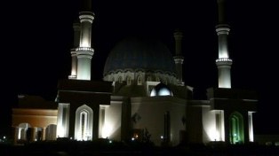
Основной тип земледелия – орошаемое. Благоприятные почвенно-климатические условия позволяют выращивать при орошении ценнейшие сорта тонковолокнистого хлопчатника. Страна производит около 1300 000 тонн хлопка-сырца.
Построено около 40 000 километров коллекторно-дренажной сети и другие объекты. Период независимости охарактеризовался резким увеличением производства зерна за счет частичного сокращения земель под хлопчатником, что позволило Туркменистану выйти на самообеспечение зерном.
Широко развито овощеводство, садоводство (яблоки, инжир, гранат, абрикосы, сливы и т.д.), виноградарство (приготовление изюма, кишмиша, вина), бахчеводство (дыни, ассортимент которых включает более 200 видов, арбузы).
На юго-западе страны, в субтропиках, произрастают хурма, зизифус (китайский финик). В полупустынных и пустынных районах – кочевое животноводство. Ведущая отрасль животноводства – овцеводство, в том числе каракульское.
Туркменистан в значительных объемах производит натуральный шелк, шерсть, лакрицу. Развита и типичная пустынная отрасль – верблюдоводство. В предгорных и горных районах имеет место пчеловодство.
В стране издавна разводят знаменитую ахалтекинскую и иомудскую породы лошадей. Рыболовство связано не только с Каспийском морем, но также с реками и каналами. Успешно акклиматизированы в речной системе Амударья – Мургаб – Теджен дальневосточные промысловые рыбы – белый амур, толстолобик и белый амурский лещ.
С их помощью решается и задача очистки каналов и водоемов от зарастания. Развитая транспортная система включает в себя железнодорожный, речной, морской, автомобильный и воздушный транспорт.
Особое значение в перевозках грузов имеет автомобильный транспорт. Протяженность автодорог общего пользования составляет 15 000 километров. Практически все города страны соединены шоссейными дорогами.
Формирование железнодорожной сети началось в конце XIX века, когда была построена Закаспийская железная дорога, соединившая Красноводск с Ташкентом. На сегодня длина железных дорог составляет 2350 километров.
В перспективе национальные железные дороги планируется связать с дорогами Турции, Ирана, Узбекистана, Кыргызстана, Казахстана и Китая в единую транспортную магистраль; она в свою очередь явится частью трансконтинентальной железнодорожной магистрали от китайского порта Ляньюньчен через Урумчи – Алма-Ату – Ташкент – Тегеран – Стамбул – Будапешт до Роттердама.
Уже построен один из участков этой дороги Мешхед (Иран) – Теджен (Туркменистан), протяженностью 800 километров, из них 132 километров – по Туркменистану.
Судоходство по реке Амударья, Каракум-реке (головная часть канала на протяжении 800 километров судоходна), Каспийскому морю.
Морской незамерзающий порт Туркменбаши. Полной модернизации подвергается и паромный терминал. Планируется открыть паромное сообщение между портами Туркменбаши и Оля, Астраханская область.
Начиная с 1998 года осуществляется реконструкция порта, практически первая со дня его основания более чем 100 лет назад. Порт занимает площадь 400 000 метров квадратных. Обустраивается терминал, производится строительство новых причалов.
Функционирует морской железнодорожный паром Туркменбаши - Баку. В республике имеется ряд курортов: Байрам-Али, Фирюза (климатические), Арчман, Моллакара (бальнеологические). На страны СНГ приходится более 51,6% внешнеторгового оборота Туркменистана.
Основными статьями экспорта (98,6 %) остаются природный газ и нефть, нефтепродукты, фосфориты, хлопок-волокно, электроэнергия, каракуль, ковры, сухофрукты. Основными торговыми партнерами являются Турция, Иран, Пакистан, Италия, Швейцария, США, Великобритания.
В эти страны в основном поставляется хлопок (более 80 % от всего экспорта).
Источник:
Энциклопедия Туркменистана.