


![]()
You are here
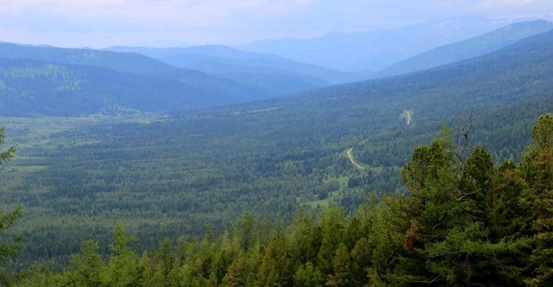
Uba river on Kazakh Altai.

A trip to Uba River from Poperechnoye village.
"A few miles before reaching the next station, Losikha, twenty miles from Vydrikha, a charming view suddenly opened up of the Uba valley, widening here into a basin, in the middle of which the majestic river meandered like a wide ribbon and a sprawling village sprawled, descending into the basin from the foot of a porphyry hill. On the opposite, right bank of the river, a rocky mountain rose, composed of fine-grained dark green diabase (grunstein). This mountain is the last of the Uba River's ridges, which then flows to the Irtysh across the steppe."
P. P. Semenov-Tyan-Shansky. "Journey to Tien-Shan." 1856-1857.
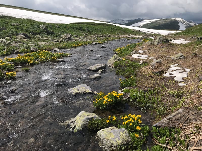
Rafting along mountain rivers of Kazakhstan Altai.
Uba River lies at an altitude of 238 to 723 m. a. s. l. It begins at confluence of Ak-Uba (Russian: Belaya Uba), which originates on northern slopes of Ivanovskiy Range, and Kara-Uba (Russian: Belaya Uba), which originates on western slopes of Koksu Range, flowing through Shemonaikhinsky and Glubokovsky districts of East Kazakhstan region.
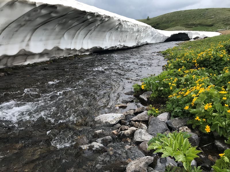
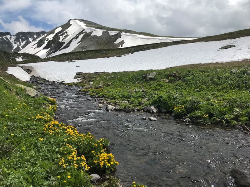
The Uba River's drop along its course is 483 meters. This river originates at the confluence of the Belaya and Chernaya Uba, rushing noisily from a high-mountain plateau at an altitude of 1,900 to 2,000 meters above sea level, located at the junction of several ridges.
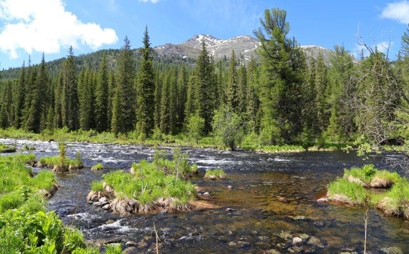
The Uba flows through forested mountains, through narrow crevices among rocky ledges. In places, debris is blocked by protruding stone boulders, reminiscent of elephant and crocodile backs. Along its course, the Uba receives a number of noisy taiga rivers flowing from the Tigiretsky and Uba mountain ranges.
It flows through Kazakhstan. The river is 278 kilometers long, with a basin area of 9,850 square kilometers. It is fed by a mixed system, but primarily snow. Floods occur from April to mid-July. The average discharge at 8 km from its mouth is 177 cubic meters per second.
The Uba, like other rivers in Rudny Altai - the Ulba, Narym, Kurchum, and Kalzhir - has clean, clear water thanks to natural filters - a rocky bed, sandy banks, and bottom. Its summer water temperature is lower than the Irtysh. This suggests that it is fed by melting snow and glaciers.
The upper reaches of the Uba are bounded from the northeast and west by the Tigiretsky, Koksuysky, and Uba mountain ranges. The high, flat-topped ridges are covered with alpine meadow and tundra vegetation, and where the ridges are composed of dense crystalline rock, bald mountains with vast fields of stone placers rise.
The average July temperature is 20-21 degrees Celsius. In the mountains, precipitation increases significantly, reaching 1,500-2,000 mm per year. Maximum precipitation occurs during the warm season. Three altitudinal landscape zones are distinguished in this region: mountain-steppe (up to 900 meters), mountain-forest from 1,800 to 1,900 meters, and high-altitude, predominantly mountain-meadow, above 1,900 meters.
Rafting on the river is typically carried out by connecting two rivers in the East Kazakhstan region – the Belaya Uba and Uba Rivers. The Belaya Uba River, after confluence with the Black Uba River, forms the Uba River, a major right tributary of the Irtysh River. In the area of the Lineiny Belok Ridge, the Chernaya Uba River flows in a narrow channel through marshy terrain.
Geographical coordinates of Uba River: N50°42'06 E82°46'31
Geographical coordinates of beginning of Uba River: N50°34'43 E83°39'02
Geographical coordinates of mouth of Uba River: N50°16'24 E81°40'54
Authority:
Adventure Planet, Alexander Petrov.
Photos by:
Alexander Petrov.