


![]()
You are here
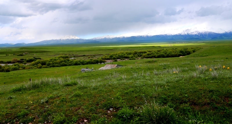
Valley Karkara in Kazakhstan.

Trip from Almaty to valley Karkara.
“Nature is wise. You can learn everywhere and from everything”
Leonardo da Vinci.
Trip from Almaty to valley Charkuduk in Kyrgyzstan.
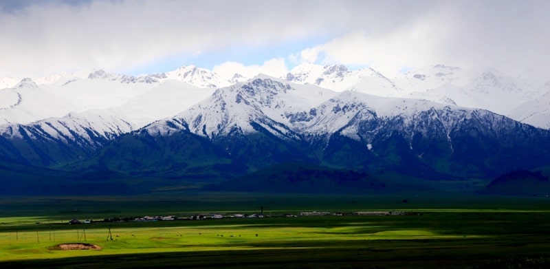
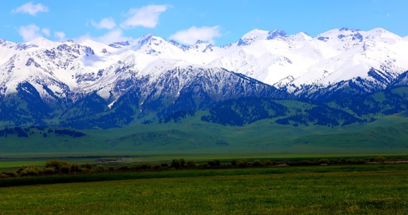
The area located between the settlement of Kegen the administrative center of Kegen district of Almaty region and the northern foothills of the Terskey Alatau is called Karkara. Throughout 31 kilometers from height of 1850 meters above sea level at which the settlement of Kegen is located and up to the height of 2032,3 meters above sea level at Terskey Alatau bottom Karkara natural boundary was stretched. Karkara natural boundary severe in the winter and picturesque in the summer.
From the northeast the natural boundary is limited to the mountains Shoaldyr with the dominating height of 2257,7 meters above sea level and the pass Shoaldyr 2065 meters high above sea level through which the highway from the settlement of Kegen on Narynkol runs.
About the West the natural boundary is propped up by the mountains Saryygyr and the western spurs Kungey Alatau. From the South are located Mount Terskey Alatau which in a northern part break up to certain ridges - the mountains Kopyl and Chikbay.
Through Karkara natural boundary from the North on the South the highway which connects Kyrgyzstan to Almaty runs. Through the natural boundary several small rivers and streams with boggy coast flow. In the western part of the natural boundary the river Irsu, in the central part of the natural boundary the river Karkara the river Zhelkarkara which is the most extended and deep, in the east flows.
The rivers of east and western exposition flow into Karkara.
In the Southern part of the natural boundary the village of Karkara which is a part of the Shirganak rural district is located. In ancient times across the territory of the natural boundary there passed the Great Silk Way, in this wide mountain valley long time there was a Karkara fair, known across all Central Asia.
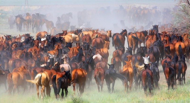
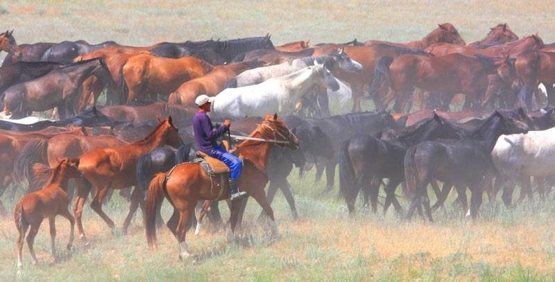
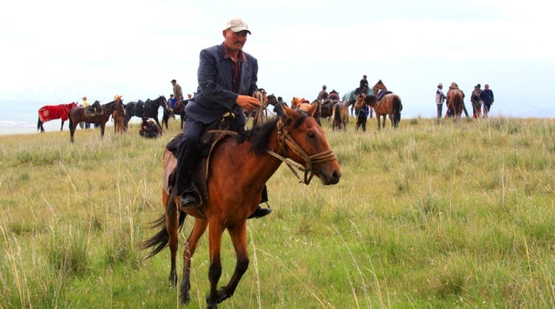
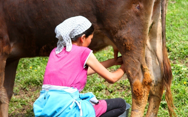
To Karkara valley every year in the summer cattle breeders from villages of Kegen district overtake a livestock. Since May and until the end of September graze the cattle here, milk cows, do baked milk, sour cream, Curt.
In the hot summer here fans of national drinks drink pure, mountain koumiss. Here too it is possible to undergo treatment pair, mare's milk (saumal). Vasily Vasilyevich Radlov is the Russian orientalist the turcologist, the ethnographer, the archeologist and the teacher of the German origin, one of pioneers of comparative historical studying of Turkic languages and the people so treated an origin of the name of the area and river Karkara:
"The name of the area and river are that because there lives a birdie whom call a karkara. Karkara - a kind of a heron, and also some girls dress feathers of this bird on the headdresses which are called "karkara" too (1893, t.1 page 190).
The ethnographer and the researcher of folklore, traditions and customs of Kazakhs M. Krasovsky wrote year in the geographical and statistical notes about the Kazakh steppe the following: "During removements Kazakhs load on camels chests with load which top turns out similar to roofs of their houses (yurts), and these chests they call "karkara".
And as road chests and outlines of some mountains are similar, mountains also are called Karkara". (Krasovsky M., 1988, p.1, page 108 - 109). Approximately, also the ethnographer Shokan Valikhanov held such opinion.
"Karkara - Kazakhs so call plumelets, the sultan on the head of two very young girls of the Kalmyks captured at the small river". (Valikhanov Ch., 1984, page).
Geographic coordinates of the Karkara area: N42 ° 48'17.34 "E79 ° 15'17.14"
Authority and photos by
Alexander Petrov.