


![]()
You are here
Valley of Susamyr.
Ski tours in Susamyr to valley.
“Nature abhors annihilation”
Marcus Tullius Cicero.
Tours to Susamyr valley.
Suusamyr Valley is located in Inner Tien-Shan, between Talas Ala-Too ranges in west, Kyrgyz Ala-Too in east and Suusamyr Too and Jumgal Too in south, valley is located in Chui and Talas regions.
The absolute height of the valley bottom is located at an altitude of 2000 - 3200 m. a. s. l. The length of the Susamyr valley is 150 kilometers, the greatest width, within the bottom is 24 kilometers. The Susamyr valley is one of the largest in the Inner Tien-Shan.
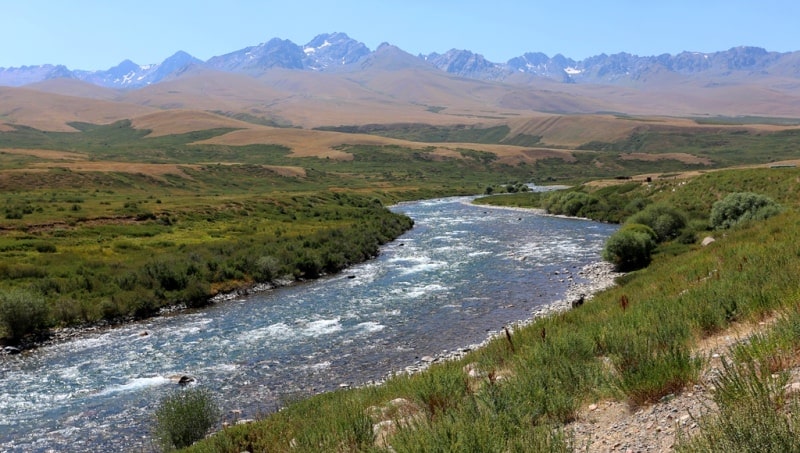
The Susamyr valley has the shape of a triangle strongly elongated from northeast to west, the longest side of which faces north. To the west and east, the depression noticeably narrows and rises. A significant part of its bottom is occupied by the valleys of the Suusamyr and Western Karakol rivers.
The western part of the Susamyr valley is called Duban-Kechuu. The upper reaches of the Suusamyr River are located here. The bottom of this part of the depression lies at an altitude of 2300 - 2600 m. a. s. l. It is a wavy valley bounded from the north by a rather steep rocky slope of the Talas Ala-Too, and from the south by a relatively gentle soddy slope of the Suusamyr ridge.
The western part of the depression is separated from the central one by the rather high domed mountains of Korumdu and Aigyr-Jal. The height of the bottom of the central part of the valley is 2000 - 2400 m. a. s. l. The depression is a wavy plain, composed mainly of deposits of merged fan lobes.
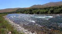
In some places it is dissected by long, but gentle and low spurs of the Suusamyr ridge. Sometimes here there are separate outliers with a relative height of up to 500 - 700 meters in the form of ridges and rounded plateau-like surfaces. In the lowest part of the depression, the Suusamyr and Western Karakol rivers form a vast swampy floodplain and break into dozens of shallow branches.
The Western Karakol River has a narrow and deep valley. Its width nowhere exceeds 2 km. Sometimes cliffs of high pebble terraces approach the river. The valley is composed mainly of sandstones, conglomerates, clays, limestones, pebbles and other rocks. It has a synclinal structure.
The climate is sharply continental. The average temperature in January is from - 20 C to - 21 C, in July - from 1-3 to 14 C. Precipitation is 350 - 370 mm per year (in dry weather 255 mm, in rainy weather up to 500 mm per year). In winter, the air temperature drops to -40C, sometimes to -45C.
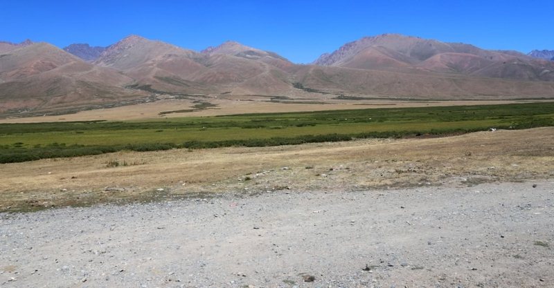
The main rivers are Suusamyr and Western Karakol. Typical fescue-wormwood dry steppe (2000 - 2200 m), meadow-grass steppes (2500 - 2600 m. a. s. l.), subalpine forb meadows (3000 - 3100 m. a. s. l.), alpine meadows (3500 - 3700 m) and glacial-nival (3500 - 3700 m. a. s. l.) landscapes.
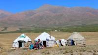
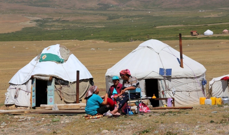
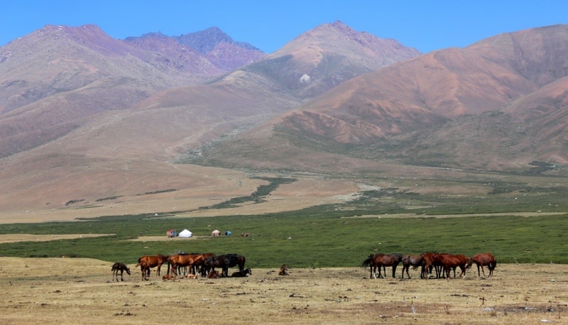
There are tugai forests along the banks of the Suusamyr and Western Karakol rivers. There is an alpine pasture here. Highways Bishkek - Osh, Kara-Balta - Min-Kush pass through the Susamyr valley. The main wealth of the Susamyr Valley is its wonderful subalpine and alpine meadows and meadow-steppes, located along the terraces of rivers and silons of mountains, mostly flat.
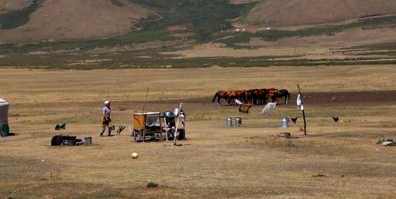
Rocky outcrops are found only high in the mountains. The Susamyr Valley is famous as one of the best jailoo in Kyrgyzstan. The area suitable for grazing is over 300 000 hectares. Inhabitants of the Chui and Talas valleys bring hundreds of thousands of cattle here.
Until recently, the Susamyr pastures were used only in summer. Since 1950, they began to develop for winter grazing. The construction of residential buildings and heat-insulated premises for livestock began. The Susamyr MZhS (machine and animal breeding station) helps collective farms to procure safety stocks of forage from natural hayfields, ensures the processing of crops of grain and fodder crops and forage grasses.
Permanent settlements of Achik and Tunuk appeared in the valley, in which there are schools, clubs, medical and other institutions.
Geographic coordinates of the Suusamyr valley: N42°10'36 E73°21'34


Authority:
Issyk-Kul. Naryn "encyclopedia, Frunze, 1991." Kyrgyzstan ", publishing house" Mysl ", Moscow, 1977.
“Discovery Travel” Magazine. www.centralasia.travel
Photos by:
Alexander Petrov.