


![]()
You are here
Zarafshan River.
Popular hikes in Uzbekistan.
“The real voyage of discovery consists not in seeking new landscapes, but in having new eyes”
Marcel Proust.
Hiking in Ghissar mountains.
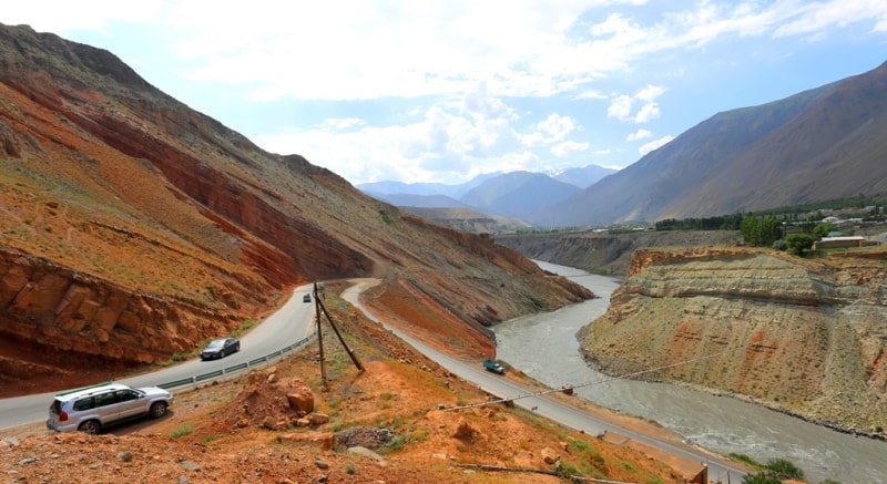
The Zarafshan River is located in the headwaters of the Match ridge, in Uzbekistan and Tajikistan. The length of the river is 877 kilometers, the basin area is 17.7 thousand square kilometers. The average water flow in the Zarafshan River is 162 cubic meters per second.
The Zarafshan River originates from the Zeravshan glacier in the mountain junction between the Turkestan and Zeravshan ranges. The river is fed mainly by glaciers and snow. Therefore, the largest runoff in it occurs in the summer (July, August), in the cold season Zarafshan carries little water.
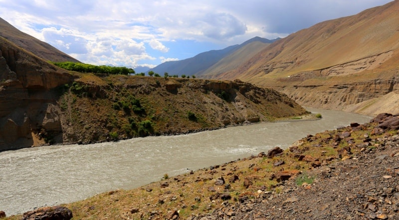
In summer, the water in the river is cloudy, gray-steel, in winter it is clean and transparent. Within Tajikistan, Zeravshan receives three large tributaries - the Fandarya, Kshtutdarya and Magiandarya flowing from the Gissar Range, and more than 100 small rivers.
The Zeravshan River flows in a deep gorge, then in a spacious one, with rows of wide terraces, then in a very narrow one. In the valley, landslides and landslides are frequent, as a result of which temporary dammed lakes are formed.
A huge landslide-landslide occurred on April 24, 1964 (the seventh in 900 years) near the district center of Lini. About 50 million cubic meters of stones fell from the Darpvorz Mountains into the valley, blocking the path of the river.
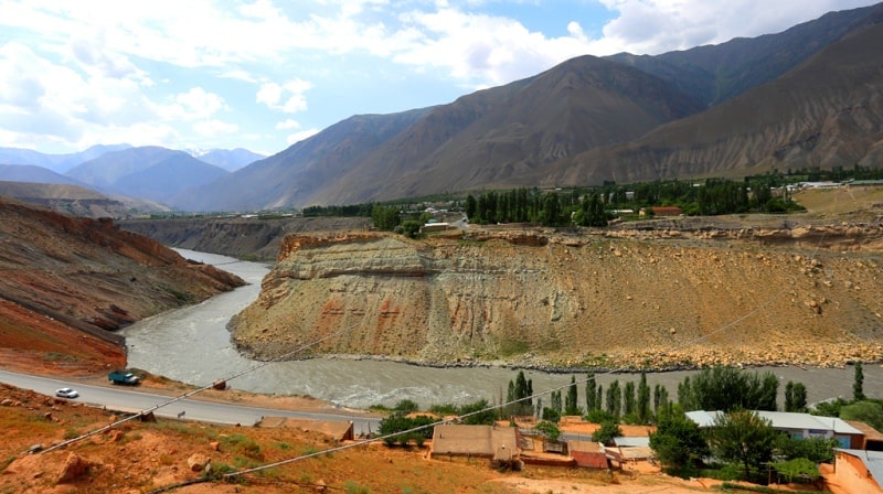
There was a lake, the level of which was rising rapidly. The threat of a catastrophic breakthrough of the formed dam hung. Only urgently taken measures prevented the inevitable disaster. Below Penjikent Zeravshan comes out of the mountains, its channel is divided into river branches, forming islands rich in natural and especially cultural vegetation.
Near Samarkand, the channel of Zeravshan is divided into two river branches - Akdarya and Karadarya. At the village of Khatyrchi, the river, compressed by the outcrops of bedrock, again flows in one channel. The lower reaches of Zeravshan are fed by the waters of the Amu Darya along the Amu-Bukhara canal.
Zeravshan used to run into the Amu Darya, now it is losing its waters in the Kyzylkum desert, forming two deltas - Karakul and Bukhara. On the river are the Kattakurgan and Kuyumazar reservoirs.
Authority:
http://www.cawater-info.net/bk/water_land_resources_use/docs/rivers.html
Photos by
Alexander Petrov.