You are here
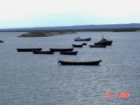
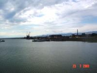
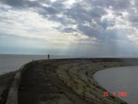
Zaysan Lake.


Tours to Zaisan Lake.
"Sunset. Like snakes, the waves bend
Already without angry scallops,
But they do not run to touch
Invincible shores"
Nikolai Gumilev. "On the sea".
Travel to lakes of East Kazakhstan region.
Zaysan is the largest lake in the north-east of Kazakhstan. It was not without reason that back in the XVIIIth century, the Siberian historian Tatishchev wrote: “Zaysan Kalmyks for greatness are named by the lake general.” Then the lake was called Nor-Zaysan, and the word zaysan means prince - the head of the clan.
Its name is associated both with the Mongolian word "saikhan" (beautiful, beautiful), and with the Oyrot "reserve" (fish). The combination of the custom common among the Mongols to assign names containing praise with the Oyrot word gave birth to the legend of an incredible amount of fish in the lake, which in the distant past saved the local peoples from starvation.
The Mongols and Kalmyks did not eat fish; hunger forced them to catch it. Then the names Nor-Zaysan, Zaysan-Hop and Zaasingnor appeared - “a beautiful fish lake”. Zaysan lake in the east of Kazakhstan, in an open high and flat valley between mountain ranges: from the north-east of Altai, from the north-west - Kolbinsk and from the south of Tarbagatai.
The Chinese border runs 60 km from the eastern shore of the lake; the Black Irtysh River flows and flows into the Zaysan from the Chinese side. The lake is located at an altitude of 420 m, its length is 105 km, and its width is 22-48 km, the maximum depth is 15 m.
Zaysan is between 47 ° 60 'and 48 ° 30' s. w. and between 83 ° and 85 ° in. The ancient Zaysan Lake is located at the bottom of the huge Zaysan Depression, enclosed between the mountains of Southern Altai, Saura and Tarbagatai. Zaysan is a fresh lake.
The absolute height of the basin basin is 386 m. The basin area is 1.8 thousand km2, the depth is up to 10 m. The lake is flowing, the rivers flow into it: Cherny Irtysh, Kokpekty, Zharma, Kendirlik and others, and one river flows out - the Irtysh. In connection with the creation of the Bukhtarma hydroelectric station, the water area of the lake increased to 5.5 thousand km2.
According to legend, once on its shores and in the lake dinosaurs were found. Zaysan Lake is a kind of paradox of nature. Essentially, it is widely spilled over the flat Irtysh valley. Irtysh Cherny flows into the lake, flowing from China, and flows the Irtysh Bely, often referred to simply as the Irtysh.
According to climatic conditions, the Zaysan Valley is a desert or semi-desert, hot in summer, severe, with snowstorms and frost in winter. And this is despite the fact that the lake is surrounded by mountains on three sides: in the north it is high Altai with moist taiga vegetation (mountains up to 4500m high), in the east - Saur mountains (Tarbagatai spur) with larch forests and peaks up to 3900m high. In the south, the lake is bordered by a low, treeless Monrak ridge with mountains up to 2500m high.
Between these mountains, breaking out of the gorge of the Chinese mountains, the mighty Irtysh spills widely and freely 200 km in length and 150 km in width. Its shores are mostly flat and low-lying, and in only a few places, serving as a kind of lighthouses, do lonely hills, burnt, calcined by heat and sun, rise.
In the north these are Chikilmes and Karabiryuk mountains, in the east - Ashutas mountains. (Ashutas in translation means a bitter, salty stone, as it contains ancient charred plant debris and has a sulphurous smell).
The shores are mostly deserted and because of the rise in water level by several meters, the Bukhtarma reservoir has not yet everywhere formed vegetation, even in the form of reeds and reeds. Only in the east, where the Irtysh flows into the lake, called Cherny here (the water is more muddy, because it did not have time to settle in the pond), its lowland delta has lushly overgrown not only impenetrable thicket of reeds, but in places (on islands) groves of poplar and shrubs.
Here, among the yellow egg capsules and white water lilies, the expanse and the kingdom of waterfowl: cormorants, pelicans, herons, geese, ducks and other smaller birds, formerly called game. Roe deer and wild boars are also found here, and once a tiger also inhabited.
At first glance, the Zaysan Basin is not a very welcoming and picturesque place, but, nevertheless, among this plain, often dissected by ravines, there are now and then lakes, or hilly hills, composed of multi-colored clays - a kind of unreal, almost fantastic - real moon mountains composed of unearthly rocks.
Among the tourists, such aeolian mountains are especially famous in the tracts of Kiin-Kerish and at Cape Barhot on the northern shore of Zaysan. Silence, interrupted only by piercing screams of swifts, the sound of swiftly flying sajas and bulldurks, and the quiet voices of the desert heaters, reigns on the abandoned Kiin-Kerish desert.
The nests of falcons, mighty mounds are seen on clay cliffs. Nowhere is a trace of a person and at first glance it seems that they are not here. Amazed by the landscape, tourists come here even from abroad. But how smart is nature: it is worth going through one shower and no traces of man have ever happened!
They quickly wash out, and the clay shines again with pristine purity and pristine. Zaysan depression is famous for its rare and even endemic animals (they are not found anywhere else on earth). Such are the ocellated foot-and-mouth disease, the three-toed fat-tailed jerboa (almost the champion among mammalian midgets), the rarest yellow pest, the Roborovsky hamster, the Zaisan round-headed. Marmots, badgers, falcons, falcons, bustards and bustards still live here.
And more recently, in past centuries, herds of saigas, kulans, wild horses of Przhevalsky were worn on the open spaces of the Zaisan Valley (we recall that it was from the town of Zaysan Przhevalsky that the first instance of the skin of this rare horse was presented to history).
And in 1876, members of the expedition of the famous German naturalist A. Bram on the northern coast of Zaysan more than once met herds of kulans, they even managed to catch a kulans. More than 20 species of fish live in the waters of the lake: sturgeon, sterlet, nelma, taimen, common carp, ide, tench, pike, perch, etc.
There is a fish farm for the extraction of caviar. The name Zaisan itself means “noble” - so according to legend, the tribes dubbed the lake, who first went to the reservoir and found there an abundance of fish that saved them from starvation.
Previously, Lake Zaysan was called the "lake of bells", apparently for the melodic noise of the waves, similar to the humming of wires, not ceasing from almost constantly blowing winds. The history of the study and development of Zaysan is closely connected with the names of Russian researchers: N. N. Przhevalsky, V. V. Sapozhnikov, A. N. Sedelnikov and others. A special place in the study of the lake is given to the works of G. N. Potanin, who visited the expedition to Zaysan in 1863.
Zaysan is a lake of tectonic origin, formed as a result of filling graben with water. Grabens are formed in the faults of the earth's crust, so the shores of the lake are steep and steep. In the past, Zaisan was much larger: traces of the surf strip, lying much higher than the current water edge, indicate this.
As for his age, there is no unity of opinion; it is suggested that Zaysan arose in the Cretaceous period - at least 60 million years ago. If so, then this is almost one of the oldest inland water bodies, preserved to this day.
Most of the bottom is covered with a layer of silt brought by rivers flowing into the lake from the slopes of the mountains. There are separate sandy and rocky areas, mainly with small pebbles. The water area of Zaysan is a large part of the Bukhtarma reservoir, formed in 1960.
The Chinese border runs 60 km east of it. According to a common version, the first Russian to see Zaysan was the tsar's envoy to China, Fyodor Baikov (circa 1612 - 1663 - 1664). Tsar Alexei Mikhailovich, dissatisfied with the promotion of the Chinese in the Amur region, already mastered by the Russians, decided to settle the matter peacefully (nothing came of it). In 1654, Baikov and his people left Tobolsk and proceeded along the Irtysh to Zaysan itself, which he referred to in the Kalmyk manner of Kyzylbash.
Subsequently, the shores of the lake were explored by Nikolai Przhevalsky and especially Grigory Potanin (1835 - 1920) in 1863. The history of the study and development of the lake began at the beginning of the 18th century and is closely connected with the names of Russian travelers.
Of particular importance in his examination are the works of G. N. Potanin, as part of an expedition who visited 3aysan in 1863. The history of the study and development of Zaysan is closely connected with the names of Russian researchers: N. N. Przhevalsky, V. V. Sapozhnikov, A. N. Sedelnikova et al.
Since 1966, when the regulation of water flow in the Bukhtarma reservoir began, the water level in Zaysan increased by 7 m, and the surface area doubled. Not so long ago, ichthyologists found crabs in the lake that fell into it along the Black Irtysh from China.
In the XIX century. Irtysh Cossacks built special karbasy boats for catching only sturgeon fish. There were so many fish that children were not allowed to tackle: a strong and large fish could easily turn the boat over and entangle them in nets.
They say that especially large pikes were used in winter instead of milestones on lake ice. The gradual disappearance of zander in Zaysan is explained by the fact that lucrative orders for juvenile zander come from Europe: it has more protein.
Allowed to catch fish should be at least 38 cm, but now fishermen take any trifle. Trying to save fish in Zaysan, they released a hybrid - karposazan.
Authority:
"Zhetysu is the Land of tourism”. A Tourist Guide-book. Almaty. 2003. 68 p. and the material for this page is taken from the printed edition.
Photos
Alexander Petrov.


