


![]()
You are here
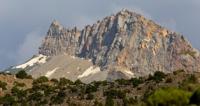
Zerafshan Range.

Trekkings in Uzbekistan.
“Though we travel the world over to find the beautiful, we must carry it with us, or we find it not”
Ralph Waldo Emerson.
Uzbekistan and Central Asia Climbing.
Zeravshan Range is located in the Gissar-Alay mountain system. The western part of the ridge is located on the territory of Samarkand and Kashkadarya regions of the Republic of Uzbekistan. The central and western parts of the Zeravshan Range are located on the territory of the Sughd region.
The westernmost spurs of the ridge are located on the territory of the Batkent region of the Kyrgyz Republic. The ridge is located to the south of the Turkestan ridge, starting at the fork with the Alai ridge in the Igla mountain range, 5301 meters high above sea level.
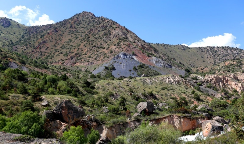
The length of the ridge is 300 kilometers. The Zeravshan ridge is composed mainly of clayey shales and limestones, which have undergone metamorphization in places with the formation of marbles. The eastern part of the range is dominated by alpine relief.
About 50 peaks exceed more than 4000 meters above sea level, about 10 peaks - over 5000 meters above sea level. The highest point is Chimtarga Peak, 5489 meters above sea level. To the north of the Mirali peak in the Zeravshan ridge, peaks stand out: Intermediate 4810 meters above sea level and Adamtash.
Further, the ridge goes down a lot, forming a series of passes. To the south of Energia peak, the Zeravshan ridge is a very winding line with the peaks of Kaenok, Zindon, Rocky Wall, Moscow, 5193 meters above sea level, Sugar Loaf, 4987 meters above sea level, Pushnovat, 4831 meters above sea level.
From the Dukdon pass, the ridge turns sharply to the west, forming a continuous ice barrier of the Dukdon massif with peaks up to 5000 meters above sea level. In the western part, where the ridge is divided by the deep gorges of the Fandarya, Kshtutdarya and Magiandarya rivers, the mid-mountain relief with karst forms prevails (including the abyss-cave Kievskaya).
Fanу Mountains are the central part of the Zeravshan Range. The northern slope is relatively steep, with the length of the valleys from the side of the Zeravshan River 10 - 20 kilometers, the height difference is 2200 - 3500 meters above sea level.
he southern slope at the western and eastern extremities is more gentle, dissected by extended and branched valleys 20 - 50 kilometers long (up to 5 kilometers in the central part) with a height difference of 2500 - 3600 meters above sea level.
The lower part of the slopes of the ridge is covered predominantly with mountain steppe and woody and shrubby vegetation (poplar, maple, juniper, walnut, birch, wild rose, wild cherry, etc.), giving way to subalpine and alpine meadows.
Above 3500 - 4900 meters above sea level - nival zone. The height of the snow line on the northern slopes of the ridge reaches 3400 - 4400 meters above sea level, on the southern slopes - 3600 - 4600 meters above sea level.
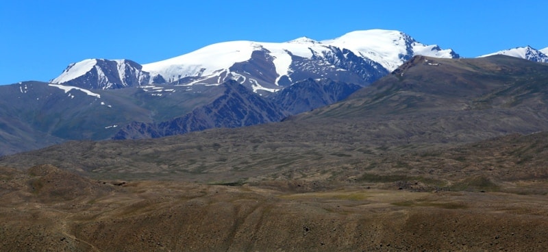
Glaciers of Zeravshan Range.
The total glaciation area of the Zeravshan Range is about 307 square kilometers. In past eras, the area was subjected to glaciation. The ice shell covered the entire basin of the modern Fandarya River. At present, there are numerous traces of a powerful ice cover in the form of moraines, glacial lakes and numerous short glaciers, cirque and valley.
On steep slopes, hanging ice is held, which collapses from time to time. The steps of the terminal and bottom moraines are clearly visible in the gorges of Karakul, Arga to Chapdary. The entire region of the Alaudin lakes is a continuous bottom moraine.
Glaciers and moraines owe their origin to the lakes Iskanderkul, Karakul, the chain of Kulikalon and Alaudin lakes. Only Lake Bolshoye Allo is of dammed origin. Modern glaciers are retreating, their tongues are often covered with cloaks of fresh gravel.
Most of the glaciers are located on the northern and shaded slopes. Glaciers are fed mainly by avalanches and ice mass discharges from above. The steep fall of glaciers leads to the formation of cracks, icefalls, steep steps.
In summer, the surface of the glaciers is covered with calgospores. The Yellow Glacier begins with a large icefall from the slopes of the Great Hansa. Glaciers Yuzhny, Alaudin, Surkhob represent a steep ice cascade.
The melt water of glaciers and snow fields gives rise to rivers. The Iskandarya-Karakul system has the highest full-flowing water. The Voru river carries a lot of water. Malovoden Pasrud. mountain glaciers The circuses of the Mutnye Lakes have an underground runoff, only in the area of the Alaudinskiye Lakes does water come to the surface.
Zeravshan range is very rich in water. Numerous lakes, rivers, streams and brooks come across at every step; on sunny days, streams run along glaciers and cascade and waterfalls fall from rocks. There is a large waterfall on the Iskanderdarya River, below Lake Iskanderkul.
Climate of Zeravshan Range.
The climate of the Zeravshan Range is continental. Precipitation falls 200 - 250 mm. The main amount of precipitation falls on the second half of winter and spring. From July to September, dry, warm weather usually sets in.
Appearing small cumulus clouds leave their mark in the form of snow pellets only in the upper zone of the mountains. The law of vertical zonality and the prevailing wind direction divide the area into a number of climatic zones.
Western and southwestern winds carrying moisture leave it in the upper reaches of the Sarymat, Karakul and Archa-Maidan. On the Arga, Alaudin lakes and Kulikalon, precipitation is less, and the lower reaches of the Pasrud, Fandarya and Iskanderdarya belong to the arid zone.
Vegetation of Zeravshan Range.
Vegetation zones are also subject to vertical zoning. In the lower river valleys, where the population is concentrated, the winter is mild and very short. There are many orchards here. Agriculture is possible only irrigated.
At an altitude of 1800 - 2600 meters above sea level, there is still warm loto and snowy winters. Birch, poplar, willow grow here. Many shrubs: dogrose, barberry, currant. From a height of about 2200 meters above sea level, juniper forests appear.
At an altitude of over 3200 meters above sea level, a positive temperature can only be observed in summer. The woody vegetation disappears, the slopes are covered with meadows, which are replaced higher by gravelly screes and rock outcrops.
In the uppermost zone, in some places on the warming, small flowers pressed against the rocks are found. In winter, frosts reach 20 - 25 °. The most favorable season to visit in the mountains is from May to October. In winter and spring, there is an increased avalanche danger.
In the Zeravshan Range there are over 130 passes with heights from 3000 to 4800 meters above sea level. The easiest ways of crossing through the passes of the Zeravshan Range pass through the passes of Khodjaymusa, Takali, Pakshif, Rost, Ravosang, Mushdif, Darh, Kulikon and others.
The main approaches are from the north, from the Ferghana Valley, through the Shahristan pass (by road), from the south, from the valleys of the Vakhsh and Surkhob rivers through the Anzob pass (by road) or along the valleys of the Dubursa (Sorbog) and Yarkhich rivers.
History of exploration of Zeravshan Range.
1936
Sibirtsev's geodetic detachment climbed Chimtarga and installed a bamboo pole on top.
1937
Climbing by Moscow tourists A. S. Mukhin and V. F. Gusev to the top of Bolshaya Hanza, Rain gauge, Kirkshaitan.
1939
Moscow tourists Mukhin, Gusev, Romanov, Chernyshev and Arsenyev. The group conquers the peak of Moscow, finds a new way to Chimtarga from the Zindon gorge and makes an ascent to Malaya Hanza.
1940
Expedition of the Moscow House of Scientists led by VV Nemytsky. As part of his group, numbering 18 people, there were climbers who had already visited the mountains of Central Asia more than once. Among them: A. S. Mukhin, V. F. Gusev, A. I. Ivanov, V. S. Naumenko and others. The central and eastern parts of the highlands of the Zeravshan knot remained unexplored. Arriving in the mountains, the expedition was divided into four groups.
The first of them - A. Mukhin, V. Gusev and. V. Naumenko - by a difficult route penetrated the upper reaches of the Raygorodsky and Utren glaciers. Here they examined two mountain groups, conventionally named by them "A" (to the west of these glaciers) and "B" (to the east).
Climbers found that group "B", where on a ten-verst map there is a peak reaching 6500 meters above sea level, is actually lower and slightly more than 5000 m. The peaks of group "A" reach 5800 meters above sea level. These mountains have very sharp, sharp outlines.
The second group - A. Ivanov, L. Perlin and N. Fedorov - went to the Kshemysh glacier, found a difficult pass to the Ak-terek valley and went down there, to the place of the base camp - a conditional gathering point for all groups.
A group led by V.V. Nemytsky explored the northern slope of the eastern part of the Turkestan Range. After all the groups gathered at the base camp and summed up the materials obtained in the first reconnaissance campaigns, they again dispersed in different directions.
Group A.S. Mukhina descended through the Matcha pass to the Zeravshan glacier and from there crossed to the Bely glacier. Here the climbers scouted the approaches to the peaks of Belaya and Ledyanaya. The group then visited the Mir-Amin 2nd glacier and two of its members climbed Matcha Peak (4600 meters above sea level). This ascent made it possible to understand the location of the ridges of the node.
Meanwhile, the second group, led by A.I. Ivanov, made an ascent to one of the peaks of group "B" with a height of about 4800 meters above sea level. From this point, the climbers also made the necessary observations to compare them with the data of their comrades.
Finally, the group of V.S. Naumenko, the third, made an unsuccessful attempt to climb the beautiful snowy peak of the Alai Range, rising in the upper reaches of the Sary-tash. However, the deadline set by the group was not enough, and she had to return.
The most difficult route of the third stage of the expedition was the ascent of Mukhin, Gusev and Popov to the "Peak 5800" in the Akterek ridge. Climbing required the use of rather complex techniques: the icy and rocky slopes of the peak were very steep.
Another ascent, in the upper reaches of the Ailanysh glacier, was made by Ivanov's group. He and his companions climbed to the top of 4400 meters above sea level, located not far from the top of the Needle. The work of the expedition provided a lot of valuable materials for refining the map of the site and describing the glaciation of the area.
1950
The Tashkent group led by B. Karpov conquers the peak of Tashkent.
1953
A group led by Martynov climbs the peaks of Sugar Loaf and Moscow.
1961
Mount Arg conquered.
1962
Groups of Mashkov and Lyapin climb the peaks of Moskva and Sugar Loaf.
1963
Alpine camp "Varzob" began to conduct systematic trips to the Fann Mountains of educational departments.
Geographic coordinates of Zeravshan Range: N39°14'13.04" E68°36'30.93"
Authority:
Alexander Petrov.
"Glaciers". L.D. Dolgushin, G.B. Osipov. Series "Nature of the world". Moscow, publishing house "Thought". 1989.
Zatulovsky D.M. "On the glaciers and peaks of Central Asia." OGIZ, State publishing house of geographical literature. 1948.
N. Paganuzzi, V. Sedelnikov "Kazakhstani in the Fann Mountains". Defeated peaks 1965 - 1967.
Photos by
Alexander Petrov.