


![]()
You are here
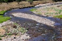
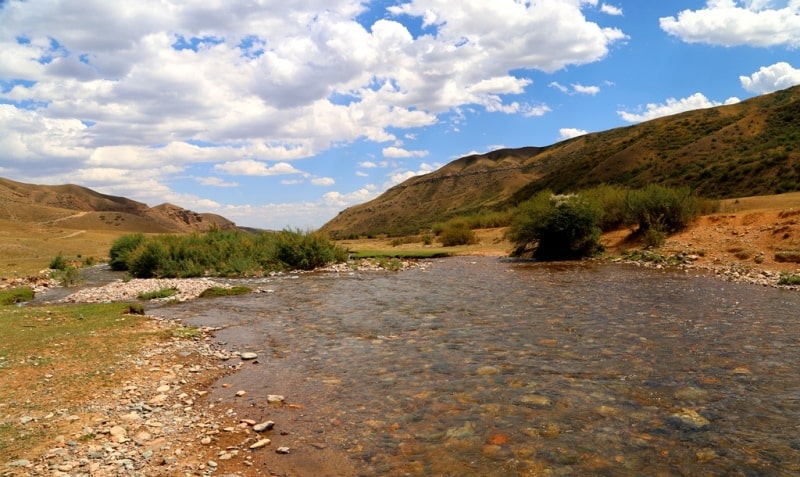
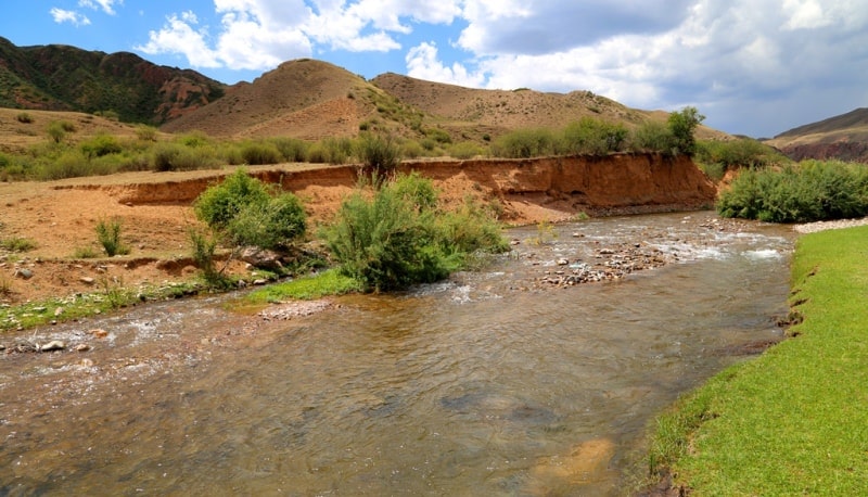
Zhinishke river.
Trip to Tien-Shan mountains.
"In all areas of nature ... a certain pattern dominates, independent of the existence of thinking humanity."
Max Planck.
Fishing on Zhinishke river.
The Zhinishke River (kaz. Zhinishke) belongs to the basin of the Ili River, located in the eastern part of the Kungey Alatau ridge between its northern slope and the southern slope of the Sarytau ridge in the Kegen district of the Almaty region.
The Zhenishke River originates in the western part of the Sarytau ridge at the junction with the eastern end of the Zailiyskiy Alatau ridge. The main channel of the river is formed from three tributaries, the northernmost one originates from the eastern slope of an unnamed peak 3550.9 meters above sea level, the southern tributary from the eastern slopes of an unnamed peak 3292.5 meters above sea level. Directly at the source of the river in the western direction is the Amanzhol pass with a height of 3649.1 meters above sea level.
The first left tributary, which the river receives - Zhinishkebulak, with a length of 7 kilometers, begins from the eastern slope of an unnamed peak 3550.9 meters above sea level. After 2 kilometers on the left, the Sarlysay tributary flows into the river, with a length of 7 kilometers it begins to flow from the southeastern slope of the Sarytau ridge at an altitude of 3453.1 meters above sea level.
The next left tributary, 2 kilometers later, is Mayinsai with a length of 7.5 kilometers, which Zhinishke receives. Two nameless tributaries flow from the Sholadyrkyrka tract located on the southeastern slope of Sarytau.
At an altitude of 2092 meters above sea level, the river on the left receives a tributary Kurbulak, 13 kilometers long, originating from the southern slopes of the Karasha pass, 3258.3 meters above sea level. In turn, in the middle reaches, the Kurbulak receives a small northern tributary, the Shymbulak, 4.5 kilometers long.
The next left tributary through 6.5 kilometers is the Karaarsha, the mouth of the river is located in the southeastern part of the Akkyrka valley, the length of the Karaarsha 12.5 kilometers originates from under the Karaarsha pass.
After 1.5 kilometers below, at the Zhinishke, a new tributary - Koksay, 10 kilometers long, originates from springs at an altitude of 3220 meters above sea level. At an altitude of 1775.4 meters above sea level, the river receives on the left another tributary of the Kurysai, 10 kilometers long, originating from springs.
The Kurysay, in turn, receives a left tributary, the Sulisay, with a length of 5.6 kilometers from the northern slopes of the Kyzylauz pass, 3007 meters above sea level. 3 kilometers upstream of the Koksai River on the right bank, there is an ancient burial ground Taban, a road from the Kyzylauz pass is laid here.
Through 1.4 kilometers below the river receives a dry tributary Akbakan with a length of 9.5 kilometers. 1.5 kilometers below Akbakan, on the left side, the Zhinishke receives the Kyzylauz tributary with a length of 9 kilometers and originating at an altitude of 2528.9 meters above sea level.
The next left, drying tributary Zhambas, 8 kilometers long, at an altitude of 1900 meters above sea level, the stream crosses the road leading to the Kyzylauz pass. Soon, after 4.5 kilometers from the left, the Kindiksay tributary, 12 kilometers long, flows into the river; the stream originates from the springs of the southern slopes of Mount Sarytau, 3230.1 meters above sea level.
After the tributary Kindiksay, the Zhinishke river has no left tributary to the mouth of the Shilik river. The first tributary of Akkiya, 11 kilometers long, receives the Zhinishke on the right after the formation of the channel. In turn, Akkiya receives 6 small tributaries into its main channel on the right, one of them is called the Kairakty 4.5 kilometers long, which originates from the eastern part of the Atzhorganzhot valley at an altitude of 3209 meters above sea level.
Further on the right, there are two small, nameless tributaries, the third under the name Taldybulak with a length of 4 kilometers originates in the northern part of the Shabyn valley. In the environs of the valley is dominated by an unnamed peak 3181.8 meters above sea level, one of the highest on the watershed plateau located between the rivers Zhinishke and Shilik.
At an altitude of 2092 meters above sea level, the Zhinishke receives the next, right unnamed tributary. Only after 4 kilometers the river receives the next right tributary Tuyme with a length of 6 kilometers. The ancient Tyzybek burial ground is located 1.2 kilometers upstream of the Tuyme River on the left bank.
The next right tributary, Shetensay, with a length of 3.5 kilometers, is located on the eastern border of the Taban-Karagai valley. 1 kilometer below the village of Zhinishke, the river receives the 16 kilometers long right tributary of the Biesuimes, this is the longest tributary of the Zhinishke river.
The Biesuimes River originates at an altitude of 2,476.2 meters above sea level in the northern part of the Ashykdala valley. Through 1.2 kilometers lower on the right, the Kurkoba spring tributary, with a length of 14.5 kilometers.
Soon, on the right, the Kyrkabulak tributary with a length of 8.5 kilometers flows into the waters of the Zhinishke, originating from the Akbastau spring on the northern slopes of the Sholak ridge. This is followed by 5 nameless, drying up right tributaries.
The length of the Zhinishke river is 63 kilometers, most of the river is located in a narrow channel, only in front of the village of Zhinishke the river flows for a short time over a relatively flat area. The source of the river is located at an altitude of 3550.9 meters above sea level.
The mouth of the Zhinishke is located at an altitude of 1198 meters above sea level, the river is the left tributary of the full-flowing Shilik. The difference in height on the river from the source to the mouth is 2353 meters.
The river is formed by tributaries with spring filling, there are no glaciers in the river basin. Spring and rain floods are observed on the river. The river is home to trout and osman, and the river is very popular with anglers.
Geographic coordinates of the Zhinishke River: N43 ° 09'00.41 "E78 ° 12'49.76"


Authority and photos by
Alexander Petrov.