


![]()
You are here
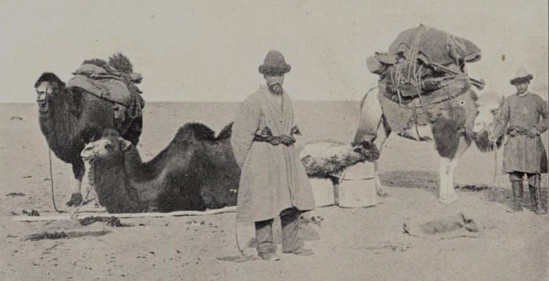
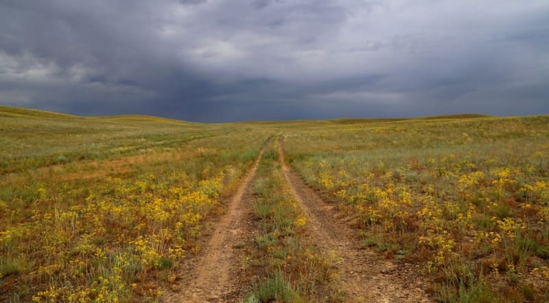
Zhusandala steppe.

Flora of steppes of Kazakhstan.
"It's good to ride you from one end to another
On a dashing horse,
To argue with the fast wind in a run,
With a stream - in its joy,
In songs - with steppe birds,
To admire the clear distance,
To rest near a well
In a clearing that is dressed,
Like a saddle cloth, with a cunning pattern
Of fragrant flowers..."
"Tale of Kozy Korpesh and Bayan Suu". Georgy Tveritin.
Steppes of Almaty region.
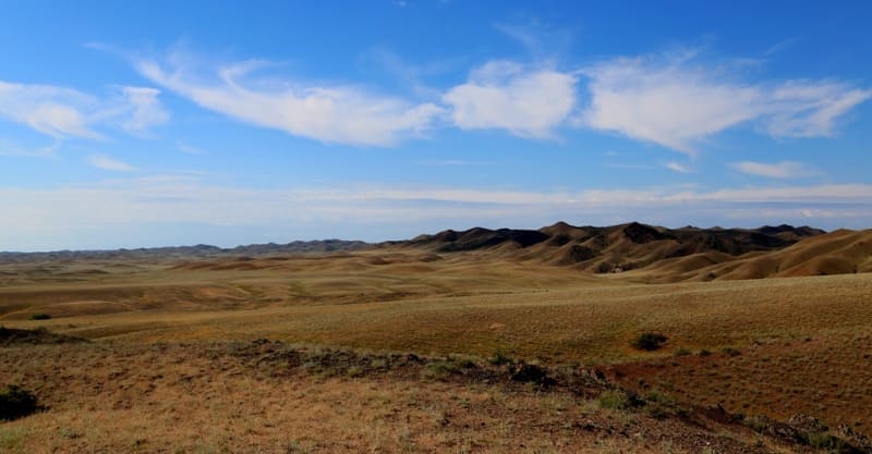
Zhusandala steppe is located at an altitude of 415 m. a. s. l. in northwestern part and 785 m. a. s. l. in southeastern part, located between Zheltau mountains in north, Taukum desert in east, the Zhambyl, Khantau, Mayzharylgan mountains and Anyrakai mountains in south on territory of Kordai region in western part of Zhambyl region and Zhambyl region in north-west of Almaty region.
The Zhusandaly steppe stretches from the southeast to the northwest for 164 kilometers, the maximum width in the northwestern part reaches 42 kilometers. To the north of the areas of the low-hill and low-mountain relief of the Anyrakai Mountains, the Zhusandalinskaya denudation plain (peneplain) extends.
Occupying a vast territory in the east of the Betpak-Dala desert, it is represented by high, medium, low and undulating relief. Low and medium rugged plains are located at absolute levels from 300 - 400 m. a. s. l., and sections of high plains at an altitude of 420 - 430 m. a. s. l.
The denudation plain was formed on the effusive-sedimentary rocks of the Paleozoic as a result of prolonged denudation over millions of years; the time of its formation until the Late Cretaceous. The plain is characterized by weak dissection and in the past was the habitat of numerous herds of saiga and goitered gazelles, which are now preserved only in the valley of the Chu River.
For pastoral nomads, this plain is of great value as a vast area of winter pastures. It is passable in any direction, but movement along it is limited due to the lack of drinking water. The most ancient accumulative plains are preserved in the northern part of the region.
This is the early Quaternary alluvial Akdala plain. Its surface lies at absolute elevations of 450 - 525 m. a. s. l. and is slightly inclined to the southwest. The ideally flat surface of the plain is disturbed by small saucer-shaped depressions and shallow dry valleys.
The plain is composed of sands and loams with Lower Quaternary pebbles, which determines the time of its formation. The sloping deluvial-proluvial Middle Quaternary-Holocene plain is located at the foothills of the low-mountain and low-hill terrain.
It is composed of deluvial-proluvial loamy-rubblestone deposits of alluvial plumes and is intersected by a system of dens up to 3-5 meters deep, originating in the mountains. The soils in the Zhusandal steppe are gray-brown, in some places sedimentary-takyr-like, gray-brown, underdeveloped, gravel, takyr-like and takyrs, floodplain meadow, floodplain forest-meadow, sands.
Geographic coordinates of Zhusandala steppe: N44°23'43 E74°31'19
Authority:
"Anyrakay Triangle Historical-Geographical Area and Chronicle of the Great Battle". I.V. Erofeeva, B.Zh. Aubekerov, A.E. Rogozhinsky, B.N. Kaldybekov, B.T. Zhanaev, L.L. Kuznetsova, R.D. Sala, S.A. Nigmatova, J.M.P. Deom. Almaty, 2008. "Dyke Press".
Photos by:
Alexander Petrov.