You are here
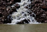
Lake Akkoldekol head of Buzunbai River.

Familiarization tour Central Asia.
"Time destroys false opinions, and the judgments of nature confirms"
Mark Cicero.
Sights of Terskey Alatau mountains.
Stained, fresh, flowing lake Akkoldekol is the source of the Buzunbai River, located in the upper reaches of the Buzunbai gorge at an altitude of 33995 meters above sea level, located on the northern slope of the Terskey Alatau ridge between the Kopyl mountains in the west and the northern spurs of the Meridional ridge in the east in the Narynkol region.
The beginning of the Buzunbai gorge is considered to be the Akkoldekol lake, from where the sources of the river of the same name begin. The perimeter of Lake Akkoldekol is 718 meters, the area is 37965 square meters.
The length of the lake, from south-east to north-west, is 247 meters, the maximum width is 282 meters, taking into account a small bay on the eastern side of the lake. Lake Akkoldekkol lies in the south and slightly west of Lake Karakol at a distance of 6.5 kilometers.
The lake is fed by streams flowing from three glaciers located to the south of the lake. One of the eastern streams is formed under the moraine of the eastern glacier, the length of which is 930 meters, the distance from the glacier to the lake is 1.2 kilometers.
The central and western glaciers have one common moraine from under which the most full-flowing stream that fills the lake flows out. The eastern side of the lake is swampy and consists of small lakes up to 50 meters connected by channels with the main lake.
The sources of the Buzunbai River are located in the eastern part of Akkoldekkol Lake.
Geographic coordinates of Lake Akkoldekol: N42 ° 27'46.43 "E79 ° 54'24.92"
Authority and photos by
Alexander Petrov.


