


![]()
You are here
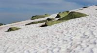
Ailanysh North Glacier.
Glaciers in Jety-Oguz Gorge.
“One evening I was sitting in a deep gorge on the bank of a fast stream. Nearby, through the dense greenery of pyramidal poplars, the walls of the houses of a small village were visible. The noise of a strong mountain river was incessantly in the air. And when the sun sank behind the high ridge of the mountain range, for a moment, patches of sparkling snow flashed in its farewell rays. The wind died down, the rustling of the leaves ceased, and it became clearly audible how the river carried large stones along the bottom, grinding them against each other.”
“Years of Searching in Asia.” E.M. Murzaev. 1973.
Walk to Ailanysh North Glacier from Jety-Oguz Gorge.
Upper boundary of Ailanysh North Glacier is located at an altitude of 5126 meters above sea level, end of glacier is at an altitude of 2941 meters above sea level, located in upper reaches of Ailanysh Gorge, on northern slope of Terskey Ala-Too ridge in Jety-Oguz district of Issyk-Kul region.
The area of the glacier is 3.82 square kilometers, the perimeter of the glacier reaches 10.36 kilometers. The length of the glacier is 4.2 kilometers. The end of the glacier is located at an altitude of 2941 meters above sea level. The Ailanysh River, 9 kilometers long, which is a right tributary of the Jety-Oguz River, originates from the glacier.
At the upper boundary, the eastern part of the glacier in the Oguz-Bashi spur, is the Karakol peak, 5168 meters above sea level, the highest peak of the Terskey Ala-Too ridge.
Geographical coordinates of Ailanysh Severny glacier: N42°10'26 E78°26'10
Authority and photos by:
Alexander Petrov.