


![]()
You are here
Ittish Glacier.
Glaciers in Djuku Gorge.
“Rest of the way goes along the surface of the glacier itself and seems, despite the steepness of the climb, easier than moving along the moraine. From the top of the pass, the path turns sharply to the eastern edge of the glacier and again crosses over snow bridges to the coastal moraine. This crossing is extremely difficult and dangerous.”
L.K. Davydov “Petrov Glacier”, 1925.
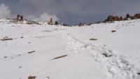
Walk along Ittish Gorge on northern slope of Terskey Ala-Too Range.
Ittysh Glacier is located at an altitude of 4808.1 to 3947 meters above sea level, is located on northern slope of Terskey Ala-Too ridge, in upper reaches of river of same name, which is right tributary of Juku River, borders on main ridge of Terskey Ala-Too ridge with Popov glacier in Jety-Oguz district of Issyk-Kul region.
Ittysh Glacier is one of the large glaciers of the northern slope of the Terskey Ala-Too ridge, this is one of the most picturesque and significant glaciers, which descends from a height of almost 5000 meters, is an important source of fresh water and part of a unique mountain ecosystem.
The Ittysh Glacier is located on the northern slope in the central part of the Terskey Ala-Too ridge, near the peaks reaching a height of about 5000 meters. It is part of the Juku River basin, which is fed by its meltwater and flows into Pokrovsky Bay, located on the southern shore of Lake Issyk-Kul.
The glacier stretches for a distance of 3.7 kilometers, forming a powerful ice flow that descends into the valley, its greatest width in the central part reaches 1.6 kilometers. The area of the glacier is 5.76 square kilometers, the perimeter is 14 kilometers.
The upper boundary of the glacier is located at an altitude of 4808.1 (Ittysh peak) meters above sea level. To the north of the Ittysh glacier, a serpentine glacier 1.5 kilometers long separates along a deep and narrow gorge. From the glacier to the east and further to the north there is a moraine 1.5 kilometers long and up to 800 meters wide, at the end of the moraine there is a small glacial lake.
In the southwest, behind the main ridge on the southern side of the Terskey Ala-Too Range, lies the Popov Glacier, 5.3 kilometers long. The Ittish River, 5.2 kilometers long and a right tributary of the Dzhuku River, originates from the eastern part of the glacier.
The tongue of the glacier begins at an altitude of about 3947 meters. The Ittish Glacier is surrounded by majestic mountain peaks covered with eternal snow. In summer, its meltwater feeds rivers and lakes, creating picturesque waterfalls and streams.
Around the glacier, you can see typical high-mountain vegetation - oppressed grass and lichens. The Ittish Glacier plays an important role in the water balance of the region, providing water to rivers and a lake, which are used for irrigation and water supply.
Like many other glaciers, Ittish is sensitive to climate change. Its condition helps scientists study the processes of global warming. The glacier attracts tourists and climbers who want to enjoy the beauty of the highlands and test themselves in hiking along glacial routes.
The Ittish Glacier, like many other glaciers in the world, is gradually shrinking due to climate change. This can lead to a decrease in water resources and a change in the region's ecosystem. To preserve the glacier, it is important to monitor its condition and take measures to reduce anthropogenic impact.
The Ittish Glacier is not only a natural wonder, but also an important element of the Terskey Ala-Too ecosystem. Its beauty and power remind us of the fragility of mountain landscapes and the need to take care of nature. A visit to the glacier leaves an unforgettable impression and allows you to feel the grandeur of the Tien-Shan Mountains.
Geographic coordinates of Ittish Glacier: N42°00'50 E77°57'14
Authority and photos by:
Alexander Petrov.