You are here
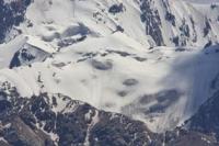
Toguz-Bulak Glacier.

Glaciers on northern slope of Terskey Ala-Too ridge.
“The northern slope of the ridge is long and dissected by deep gorges of numerous rivers. The southern, shorter one, gently descends to the syrts. On the Terskey-Ala-Too ridge within the Inner Tien Shan there are 1,375 glaciers with a total area of 1,123.7 square kilometers, of which 757 glaciers with an area of 544.2 square kilometers are on the northern slope.”
Walk in Toguz-Bulak gorge from Tossor gorge.
Toguz-Bulak Glacier is located on northern slope of Terskey Ala-Too ridge, in upper reaches of gorge of same name, which is left branch of main Tossor gorge, in Ton district of Issyk-Kul region. The Toguz-Bulak River, 20.5 kilometers long, originates from the northern part of the glacier and is a left tributary of the Tossor River.
The length of the Toguz-Bulak glacier is 3.8 kilometers, the average width is 1.3 kilometers, the width at the top is 2.8 kilometers. In the upper part, over a distance of 800 meters, the glacier is divided into two parts by a meridional spur. Below the spur, the surface of the glacier is a single surface.
The area of the glacier is 6.06 square kilometers, the perimeter of the glacier reaches 10.44 kilometers. The upper boundary of the glacier is located at an altitude of 4334 and 4457 meters above sea level, the end of the glacier is at an altitude of 3863 meters above sea level.
From the tongue of the glacier, the moraine stretches for 2 kilometers and in the lower, western part it borders on the moraine of the small Toguz-Bulak West glacier. In the east, the Toguz-Bulak glacier borders on the cirque of the Chetendy glacier, from which the river of the same name originates, which is the right tributary of the Toguz-Bulak River. In the west, the glacier borders on the vast Korumdu glacier.
Geographical coordinates of Toguz-Bulak glacier: N41 ° 57'27 E77 ° 15'45
Toguz-Bulak West glacier is 1.4 kilometers long and is located in a side, western gorge separated from the main gorge by a rocky spur 2 kilometers long. The area of the glacier is 0.61 square kilometers, the perimeter of the glacier reaches 3.56 kilometers.
The upper boundary of the glacier is located at an altitude of 4375 meters above sea level, the end of the glacier is at an altitude of 3891 meters above sea level.
Geographic coordinates of Toguz-Bulak West glacier: N41°59'05 E77°14'45
Authority and photos by:
Alexander Petrov.


