You are here
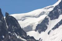
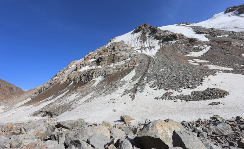
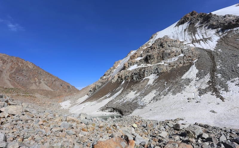
Glaciers in Tossor Gorge.

Jen-Shan Alpine Region.
“Having climbed out of the glacier again onto its left moraine, I went down to the valley, which I reached at 2 o’clock in the afternoon, at an air temperature of +12.5° C. Here I engaged in the highly interesting collection of Tien Shan alpine plants from the pastures of Marco Polo sheep (Ovis polli) and reached the bivouac of my caravan by evening, where the air temperature at 7 o’clock in the evening was +7° C."
P. P. Semenov-Tian-Shansky. “Journey to Tien-Shan.” 1856 - 1857.
Jeep trip to Tossor Gorge.
Tossor glacier group is located on northern slope of Terskey Ala-Too ridge, in upper reaches of gorge of same name, on northern slope of Tossor pass, in Ton and Jety-Oguz districts of Issyk-Kul region.
In the upper reaches of the Tossor River there are several small glaciers, the sources of which form the river of the same name with a length of 28.5 kilometers.
Tossor Central glacier group.
280 meters west of the Tossor pass there are glaciers that alternate one after another. In the cirque formed by the eastern and western spurs, on the northern slope, which departs from the main ridge of the Terskey Ala-Too ridge, there are 5 small glaciers.
The greatest length of one of them reaches 997 meters, the total width of the glaciers is 1377 meters. The total area of glaciers is 1.19 square kilometers, the perimeter of the glaciers reaches 5.64 kilometers. The length of the moraine is 1.1 kilometers, the area of the moraine is 0.47 square kilometers, the perimeter reaches 3.05 kilometers.
In the lower part of the glaciers, on the moraine there are two flowing lakes, one of them is clearly visible from the road that leads to the Tossor pass.
Geographical coordinates of Tossor Central glacier group: N41 ° 56'38 E77 ° 21'28
Tossor West Glacier.
To the west of the Tossor Central glacier group is the Tossor West glacier. The glacier is located on the northern slope of the Terskey Ala-Too ridge. The length of the glacier is 755 meters, the greatest width in the upper part is 630 meters. The area of the glacier is 0.29 square kilometers, the perimeter of the glaciers reaches 2.94 kilometers.
The length of the moraine is 1.1 kilometers, the area of the moraine is 0.26 square kilometers, the perimeter reaches 3.25 kilometers. At the bottom of the glaciers, on the moraine, there is a flowing lake, from here begins the source of the stream, which flows into the Tossor River on the left side.
Geographical coordinates of Tossor West glacier: N41 ° 57'03 E77 ° 20'25
Tossor East glacier.
In the south-eastern part of the Tossor pass is the Tossor East glacier, from the glacier flows the Tossor East River, 1.3 kilometers long, which is the right tributary of the river of the same name. The length of the glacier is 880 meters, the area is 0.34 square kilometers, the perimeter of the glacier reaches 2.29 kilometers.
The glacier is located on the northern slope of the Terskey Ala-Too ridge. The upper boundary of the glacier is located at an altitude of 4169 meters above sea level, the end of the glacier is at an altitude of 3889 meters above sea level. In the northern part of the glacier there is a flowing, moraine lake Tossor East with a length of 231 meters, the greatest width in the central part is 110 meters.
The lake is located at an altitude of 3889 meters above sea level. The area of the lake is 0.02 square kilometers, the length of the coastline reaches 0.57 kilometers.
Geographical coordinates of Tossor East glacier: N41 ° 57'26 E77 ° 22'25
Tossor North River.
After 4 kilometers from the beginning of the sources, the Tossor River receives a second tributary on the right, the Tossor North, 2.6 kilometers long, which flows out of a small glacier of the same name with a length of 1100 meters, the area of the glacier is 0.94 square kilometers, the perimeter of the glacier reaches 4.1 kilometers.
The river is located on the northern slope of the Terskey Ala-Too ridge. The glacier consists of two parts separated by a meridional ridge length. 550 meters. The upper boundary of the glacier is located at an altitude of 4334 and 4254 meters above sea level, the end of the glacier is at an altitude of 3854 meters above sea level.
In the northern part of the eastern glacier there is a small flowing moraine lake 137 meters long, the greatest width in the central part is 85 meters. The lake is located at an altitude of 3859 meters above sea level. The area of the lake is 0.01 square kilometers, the length of the coastline reaches 0.46 kilometers.
Geographical coordinates of Tossor North glacier: N41 ° 58'07 E77 ° 23'26


Authority and photos by:
Alexander Petrov.


