You are here
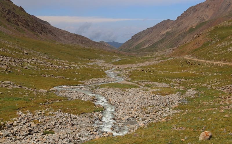
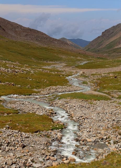
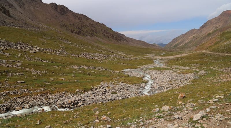
Tossor River.

Rivers on northern slope of Terskey Ala-Too ridge.
“Filled with the waters of melting snow, they at this time spill out very widely, or form fast streams, enclosed in narrow banks; then crossings over them become very dangerous, but after the flood waters have receded, the mass of water remaining in the present channel begins to decrease daily and produces a chain of lakes, connected to one another by means of weak channels, and sometimes completely separated from one another. Small rivers mostly dry up by autumn.”
Levshin A. I. “Description of the Kirghiz-Cossack or Kirghiz-Kaisak mountains and steppes.” 1832.
Trip from Tossor gorge to Uchemchek River valley.
Sources of Tossor River are located to west and northeast of pass of same name at an altitude of 4308 and 4292 meters above sea level, mouth of river is at an altitude of 1609 meters above sea level, located on northern slope of Terskey Ala-Too ridge, on territory of Ton and Jety-Oguz districts of Issyk-Kul region.
The sources of the river begin at an altitude of 3864 and 3782 meters above sea level, on the northern slope of the Terskey Ala-Too ridge with two small glaciers located northwest of the Tossor pass and one glacier, which is located at an altitude of 3865 meters above sea level and is located northeast of the pass of the same name.
The length of the river from the sources to the lake plain is 28.5 kilometers. For 1.3 kilometers the river flows along the moraine and then flows along the swampy depression formed by two meridional ridges of spurs, departing from the main ridge of Terskey Ala-Too.
After the very last, right tributary Kodol the Tossor River no longer has obvious, full-flowing tributaries. After the left tributary Togu-Bulak the valley of the Tossor River passes from the highland and alpine zone to the flat-foothill semi-desert with light chestnut soils and wormwood-cereal steppe with shrubs.
The river flows into the small Tossor Bay on the southern coast of Lake Issyk-Kul. The catchment area is 152 square kilometers. The Tossor River has 6 right and one left tributaries, the largest of which are the Toguz-Bulak and Teek-Su rivers. The main source of nutrition is melted snow and glacial waters. The flood begins in May and ends in September. The average annual water flow is 3.07 meters per second. The Tossor River flows through the gorge of the same name, cutting through the northern slope of the Terskey Ala-Too ridge in the meridional direction.
The river stretches from the centerline of the Terskey Ala-Too ridge to a narrow lakeside plain on the southern shore of Issyk-Kul. The height of the bottom of the gorge above sea level is from 1800 to - 3415 meters above sea level.
Geographic coordinates of Tossor River: N42 ° 02'12 E77 ° 22'04
Right tributaries of Tossor River.
East Tossor River.
After 2.8 kilometers from the beginning of the sources, the Tossor River receives the first tributary Tossor East from the right, 1.3 kilometers long, which flows from a small glacier of the same name, 880 meters long, the area of the glacier is 0.34 square kilometers, the perimeter of the glacier reaches 2.29 kilometers.
The river is located on the northern slope of the Terskey Ala-Too ridge. The upper boundary of the glacier is located at an altitude of 4169 meters above sea level, the end of the glacier is at an altitude of 3889 meters above sea level. In the northern part of the glacier there is a flowing, moraine lake Tossor East, 231 meters long, the greatest width in the central part is 110 meters.
The lake is located at an altitude of 3889 meters above sea level. The area of the lake is 0.02 square kilometers, the length of the coastline reaches 0.57 kilometers.
Geographical coordinates of Tossor East River: N41°58'08 E77°22'03
Tossor North River.
After 4 kilometers from the beginning of the sources, the Tossor River receives a second tributary on the right, the Tossor North 2.6 kilometers long, which flows from a small glacier of the same name with a length of 1100 meters, the area of the glacier is 0.94 square kilometers, the perimeter of the glacier reaches 4.1 kilometers.
The river is located on the northern slope of the Terskey Ala-Too ridge. The glacier consists of two parts divided by a meridional ridge length. 550 meters. The upper boundary of the glacier is located at an altitude of 4334 and 4254 meters above sea level, the end of the glacier is at an altitude of 3854 meters above sea level.
In the northern part of the eastern glacier there is a small flowing, moraine lake with a length of 137 meters, the greatest width in the central part is 85 meters. The lake is located at an altitude of 3859 meters above sea level. The area of the lake is 0.01 square kilometers, the length of the coastline reaches 0.46 kilometers.
Geographic coordinates of Tossor River Noarth: N41°58'39 E77°22'35
Teek-Su River.
After 16.7 kilometers from the beginning of the sources, the Tossor River receives a third tributary Teek-Su on the right, 3.8 kilometers long. The main channel of Teek-Su is formed at an altitude of 2381 meters above sea level from two tributaries of the Sary-Tor and a small unnamed tributary 2.5 kilometers long, which flows down the western slope of the Sary-Tor gorge.
Geographical coordinates of Teek-Su River: N42°04'27 E77°23'00
Sary-Tor River.
The Sary-Tor River is 13 kilometers long, originates from 5 small glaciers of the same name, the total area of the glaciers is 1.6 square kilometers, the perimeter of the glaciers reaches 12.72 kilometers. The river is located on the northern slope of the Terskey Ala-Too ridge.
The upper boundary of the glacier is located at an altitude of 4289 and 4379 (Perevalny peak) meters above sea level, the end of the glacier is at an altitude of 3890 and 3696 meters above sea level.
Geographic coordinates of Sary-Tor River: N42 ° 02'15 E77 ° 23'45
Bugumuyuz Stream.
At 2.1 kilometers from the beginning of the Teek-Su River sources, the low-flow tributary Bugumuyuz flows from the right, 6.3 kilometers long. The sources of the stream are in the forest zone, on the western slope of the Sary-Tor gorge. In the hot summer months there may be no water in the stream.
Geographic coordinates of Bugumuyuz River: N42 ° 04'40 E77 ° 24'32
Kodol Stream.
After 21.9 kilometers from the beginning of the sources, the Tossor River receives the fourth tributary Kodol from the right, 6.7 kilometers long. The sources of the stream are in the forest zone, on the western slope of the Tossor gorge. In the hot summer months there may be no water in the stream.
Geographic coordinates of Kodol stream: N42 ° 06'43 E77 ° 24'16
Left tributaries of Tossor River.
Toguz-Bulak River.
After 18 kilometers from the beginning of the sources, the Tossor River receives the first tributary Toguz-Bulak from the left, 20.5 kilometers long. The river originates from the glacier of the same name located on the northern slope of the Terskey Ala-Too ridge. 3.8 kilometers long, average width 1.3 kilometers, width in the upper part 2.8 kilometers.
The river is located on the northern slope of the Terskey Ala-Too ridge. The glacier consists of two parts separated by a meridional ridge. The length is 550 meters. The area of the glacier is 6.06 square kilometers, the perimeter of the glacier reaches 10.44 kilometers.
The upper boundary of the glacier is located at an altitude of 4334 and 4457 meters above sea level, the end of the glacier is at an altitude of 3863 meters above sea level. From the tongue of the glacier, the moraine extends for 2 kilometers and in the lower, western part borders on the moraine of the small.
Geographic coordinates of Toguz-Bulak river: N42°03'57 E77°17'12
Toguz-Bulak West glacier.
In the east, the Toguz-Bulak glacier borders on the cirque of the Chetendy glacier, from which the river of the same name originates, which is a right tributary of the Toguz-Bulak River. In the west, the glacier borders on the vast Korumdu glacier.
The Toguz-Bulak West Glacier is 1.4 kilometers long and is located in a side, western gorge separated from the main gorge by a 2-kilometer-long rocky spur. The area of the glacier is 0.61 square kilometers, the perimeter of the glacier reaches 3.56 kilometers. The upper boundary of the glacier is located at an altitude of 4,375 meters above sea level, the end of the glacier is at an altitude of 3891 meters above sea level.
Geographic coordinates of Toguz-Bulak West glacier: N41°59'05 E77°14'45
Chetendy River.
After 16 kilometers from the beginning of the sources, the Chetendy tributary flows into the Toguz-Bulak River on the right, 13.6 kilometers long. The river is formed at an altitude of 3587 meters above sea level at the end of a powerful moraine.
The river receives its sources from the Chetendy West glacier and the Chetendy East group of glaciers, which are located in a vast cirque. The Chetendy West glacier and the Chetendy East group of glaciers are separated from each other by a meridional spur 2.3 kilometers long, which extends north from the main ridge of the Terskey Ala-Too ridge.
Geographic coordinates of Chetendy River: N42°03'38 E77°19'36
Chetendy West Glacier.
The length of the glacier is 2 kilometers, the area is 1.52 square kilometers, the perimeter of the glacier reaches 5.53 kilometers. The glacier is located on the northern slope of the Terskey Ala-Too ridge. The upper boundary of the glacier is located at an altitude of 4423 and 4334 meters above sea level, the end of the glacier is at an altitude of 3754 meters above sea level.
From the tongue of the glacier, the moraine extends for 1.3 kilometers with a width in the middle part of 580 meters, in the eastern part, the moraine of the Chetendy West glacier is supported by the moraine of the Chetendy East glacier. On the vast moraine of the glacier there are two temporary, small moraine lakes. T
o the northwest of the Chetendy Zapadny glacier there is a small glacier 630 meters long located on the eastern slope of the gorge, the area of the glacier is 0.12 square kilometers, the perimeter of the glacier reaches 1.57 kilometers.
Geographic coordinates of Chetendy West Glacier: N41 ° 57'18 E77 ° 17'21
Toguz-Bulak glacier.
On the vast moraine of the glacier, there are two temporary, small moraine lakes. To the northwest of the Chetendy West glacier, there is a small glacier 630 meters long located on the eastern slope of the gorge, the area of the glacier is 0.12 square kilometers, the perimeter of the glacier reaches 1.57 kilometers.
Chetendy East Glacier Group.
The length of the glaciers is from 1.3 to 1.5 kilometers, the total area of the glacier group is 2.86 square kilometers, the perimeter of the glacier reaches 13.26 kilometers. The glacier is located on the northern slope of the Terskey Ala-Too ridge.
The upper boundary of the glacier is located at an altitude of 4423 and 4334 meters above sea level, the end of the glacier is at an altitude of 3754 meters above sea level. From the tongue of the glacier, the moraine extends for 1.3 kilometers with a width in the middle part of 580 meters, in the eastern part, the moraine of the Chetendy West glacier is supported by the moraine of the Chetendy East glacier.
In the east, the Chetendy West glacier borders on the cirque of the Chetendy East glacier, from which one of the tributaries of the Chetendy River flows. In the west, the glacier borders on the cirque of the Toguz-Bulak glacier. On the vast moraine in its eastern part there are three moraine lakes.
The middle, flowing lake is 445 meters long and 307 meters wide. The area of the lake is 0.03 square kilometers, the length of the coastline reaches 0.78 kilometers. There are also small moraine lakes near the tongues of the two extreme (eastern) glaciers.
Geographical coordinates of Chetendy East glacier group: N41°58'09 E77°19'55
Chetendy East Glacier.
The length of the glacier is 1850 meters, the greatest width in the middle part reaches 590 meters, the area is 1.25 square kilometers, the perimeter of the glacier reaches 4.5 kilometers. The glacier is located on the northern slope of the Terskey Ala-Too ridge.
The upper boundary of the glacier is located at an altitude of 4582 meters above sea level, the end of the glacier is at an altitude of 3935 meters above sea level. From the tongue of the glacier, the moraine extends for 715 meters with a width of 580 meters in the middle part, in the eastern part the moraine of the Chetendy West glacier is supported by the moraine of the Chetendy East glacier.
In the east, the Chetendy East glacier borders on the cirque of the Tossor glacier, from which one of the tributaries of the river of the same name flows. In the west, the glacier borders on the cirque of the Toguz-Bulak glacier. On the vast moraine of the glacier there are two temporary, small moraine lakes. One of them is the largest, 200 meters long.
Geographic coordinates of Chetendy East glacier: N41°58'09 E77°19'55
Zindan River.
1.8 kilometers after the confluence of the Chetenda tributary with Toguz-Bulak, the Zindan stream flows from the right, 9 kilometers long. The sources of the stream are at an altitude of 3513 meters above sea level. The bed of the stream is located between the gorges of Tossor in the east and Chetenda in the west. In the summer months, the stream dries up, since it is replenished only by spring, melt and precipitation.
Geographical coordinates of Zindan River: N42°03'21 E77°20'39


Authority and photos by:
Alexander Petrov.


